Gridlocked Cities
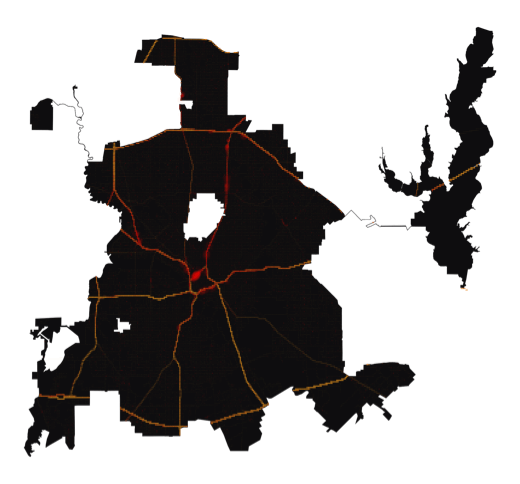
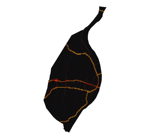
Traffic congestion affects almost every driver with an urban commute in America, but precisely where and when is it at its worst? Using 7.7 million aggregated data reports, Geotab has visualized the detailed patterns across major U.S. cities throughout the day.
Explore
Boston
Massachusetts
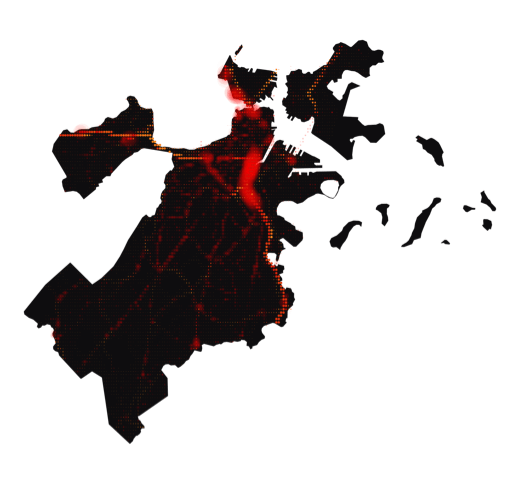
Worst Speed Drop
40% at 4-5pm
New York
New York
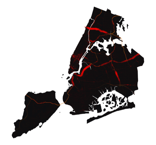
Worst Speed Drop
38% at 5-6pm
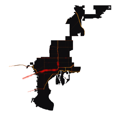
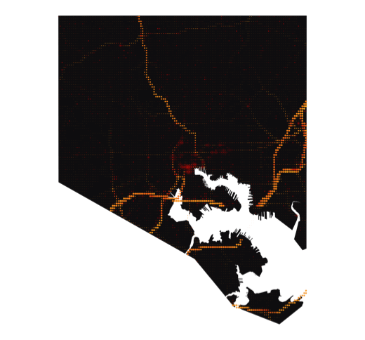
Miami
Florida
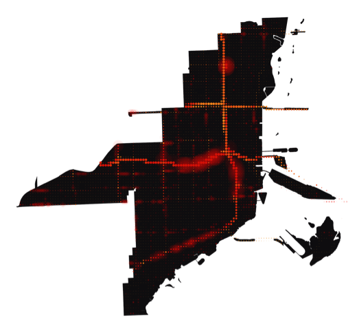
Worst Speed Drop
37% at 5-6pm
Washington D.C.
-
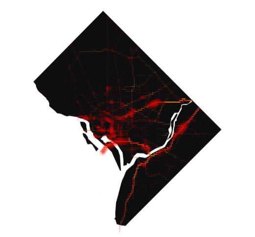
Worst Speed Drop
35% at 5-6pm
San Francisco
California
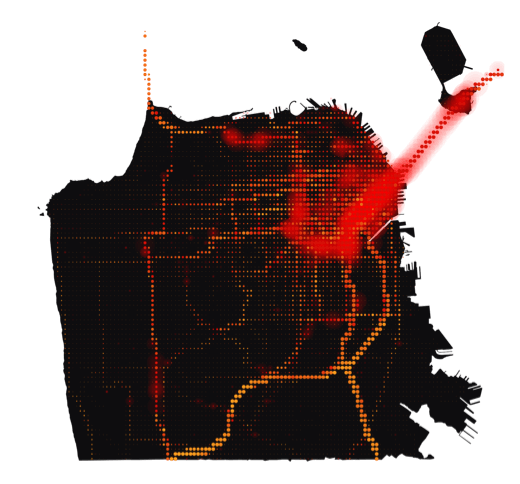
Worst Speed Drop
34% at 5-6pm
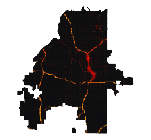
Chicago
Illinois
Worst Speed Drop
33% at 4-5pm
Los Angeles
California
Worst Speed Drop
32% at 5-6pm
Seattle
Washington
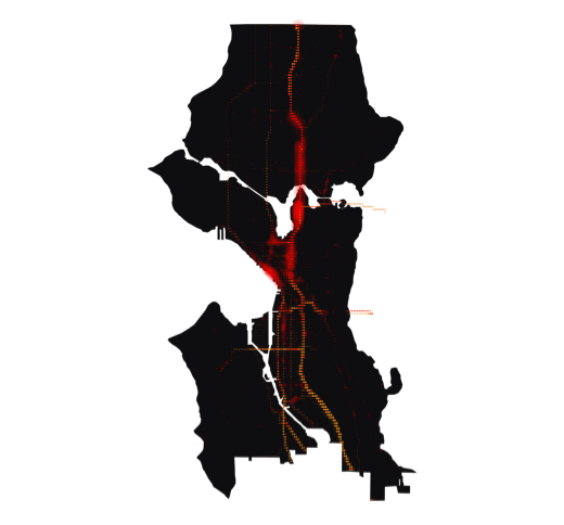
Worst Speed Drop
31% at 4-5pm
Denver
Colorado
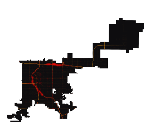
Worst Speed Drop
29% at 4-5pm
Philadelphia
Pennsylvania
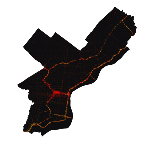
Worst Speed Drop
27% at 5-6pm
Minneapolis
Minnesota
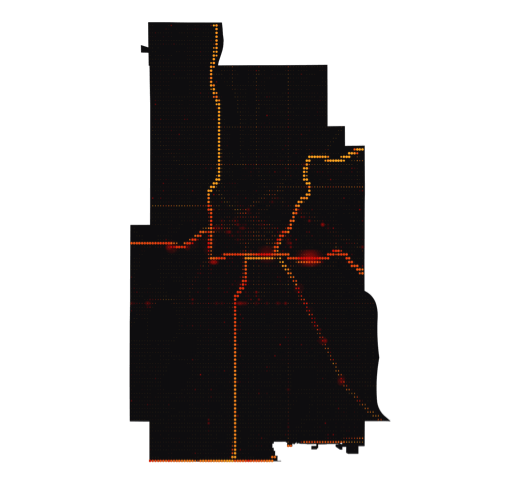
Worst Speed Drop
26% at 5-6pm
Tampa
Florida
Worst Speed Drop
25% at 5-6pm
Houston
Texas
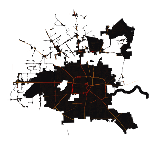
Worst Speed Drop
24% at 5-6pm
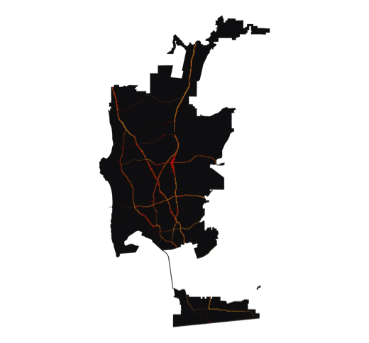
Atlanta
Georgia
Worst Speed Drop
23% at 5-6pm
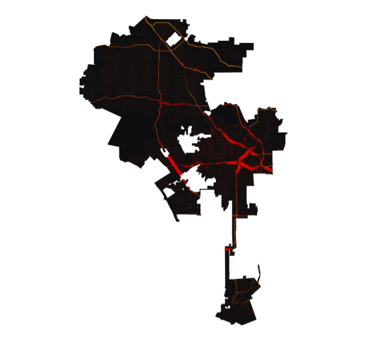
San Diego
California
Worst Speed Drop
23% at 5-6pm
Baltimore
Maryland
Worst Speed Drop
22% at 8-9am
Detroit
Michigan
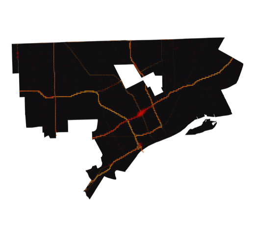
Worst Speed Drop
21% at 5-6pm
Phoenix
Arizona
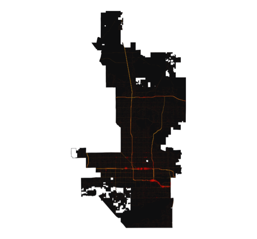
Worst Speed Drop
21% at 4-5pm
Dallas
Texas
Worst Speed Drop
20% at 5-6pm
St. Louis
Missouri
Worst Speed Drop
16% at 4-5pm
0%
50%+
Speed Drop
City
State
Downtown
Brookwood
Interchange
(I-75/I-85)
Interchange
(I-75/I-85)
Lennox Square
shopping mall
shopping mall
Westside
Reservoir
Park
Reservoir
Park
Downtown
Baltimore
Harbor
Tunnel
Harbor
Tunnel
Northern Parkway/
I-83 Interchange
I-83 Interchange
Gwynn Falls/
Leakin Park
Leakin Park
O'Neill Tunnel
Massachusetts
Turnpike
Turnpike
Morrissey Boulevard
Downtown
O'Hare
Airport
Airport
Downtown
I-90
Chicago-Kansas City
Expressway
Expressway
I-30 Bridge
over Lake
Ray Hubbard
over Lake
Ray Hubbard
Downtown
US Route 75
Texas
Stadium
Stadium
Denver
International Airport
International Airport
Downtown
I-70
Valley
Highway
Highway
Downtown
Belle Isle
I-75/I-94 intersection
Fisher Freeway
Downtown
I-610
I-10
George Bush
Intercontinental Airport
Intercontinental Airport
Downtown
Los Angeles
International Airport
International Airport
San Pedro
Hollywood
Sign
Sign
I-110
Downtown
I-195
(Julia Tuttle
Causeway)
(Julia Tuttle
Causeway)
South Dixie Highway
(US Route 1)
(US Route 1)
Dolphin
Expressway
Expressway
Downtown
Lowry Hill
Tunnel (I-94)
Tunnel (I-94)
University
Avenue
Avenue
I-394
Times Square
I-95
JFK Airport
Queensboro
Bridge
Bridge
Brooklyn Bridge
Center City
Philadelphia
International Airport
International Airport
I-76/I-676
Interchange
Interchange
Delaware
Expressway
Expressway
Downtown
Phoenix
Sky Harbor
International
Airport
Sky Harbor
International
Airport
Black Canyon
Freeway (I-17)
Freeway (I-17)
Loop 101
Downtown
Escondido Freeway
(I-15)
(I-15)
Jacob Dekema
Freeway (I-805)
Freeway (I-805)
San Diego
International
Airport
International
Airport
Golden Gate Bridge
Oakland
Bay
Bridge
Bay
Bridge
Financial District
US Route 101
Civic Center
Downtown
Space Needle
I-5
Industrial District
Downtown
I-64
Forest
Park
Park
Mark Twain
Expressway
(I-70)
Expressway
(I-70)
Hillsborough Avenue
Downtown
Howard
Frankland
Bridge
(I-275)
Frankland
Bridge
(I-275)
Tampa
International
Airport
International
Airport
14th Street
Bridges
Bridges
The White House
DC Route
295
295
Downtown
New York
Avenue
Avenue
Drag the slider or use the play button to move through the day and zoom in to see more detail
Roads
City
Landmarks
5-6pm
31%
34mph