The rhythm behind the runway: Aerotrans connects smart fleet with Geotab
Aerotrans, ground transport provider for the Garuda Indonesia Group, partnered with Geotab to gain real-time visibility across its 700+ vehicle fleet. Since adopting Geotab in September 2024, the company has seen significant improvements in safety, driver behaviour, and fuel efficiency .
Published: Apr 29, 2026
Updated: Apr 29, 2026
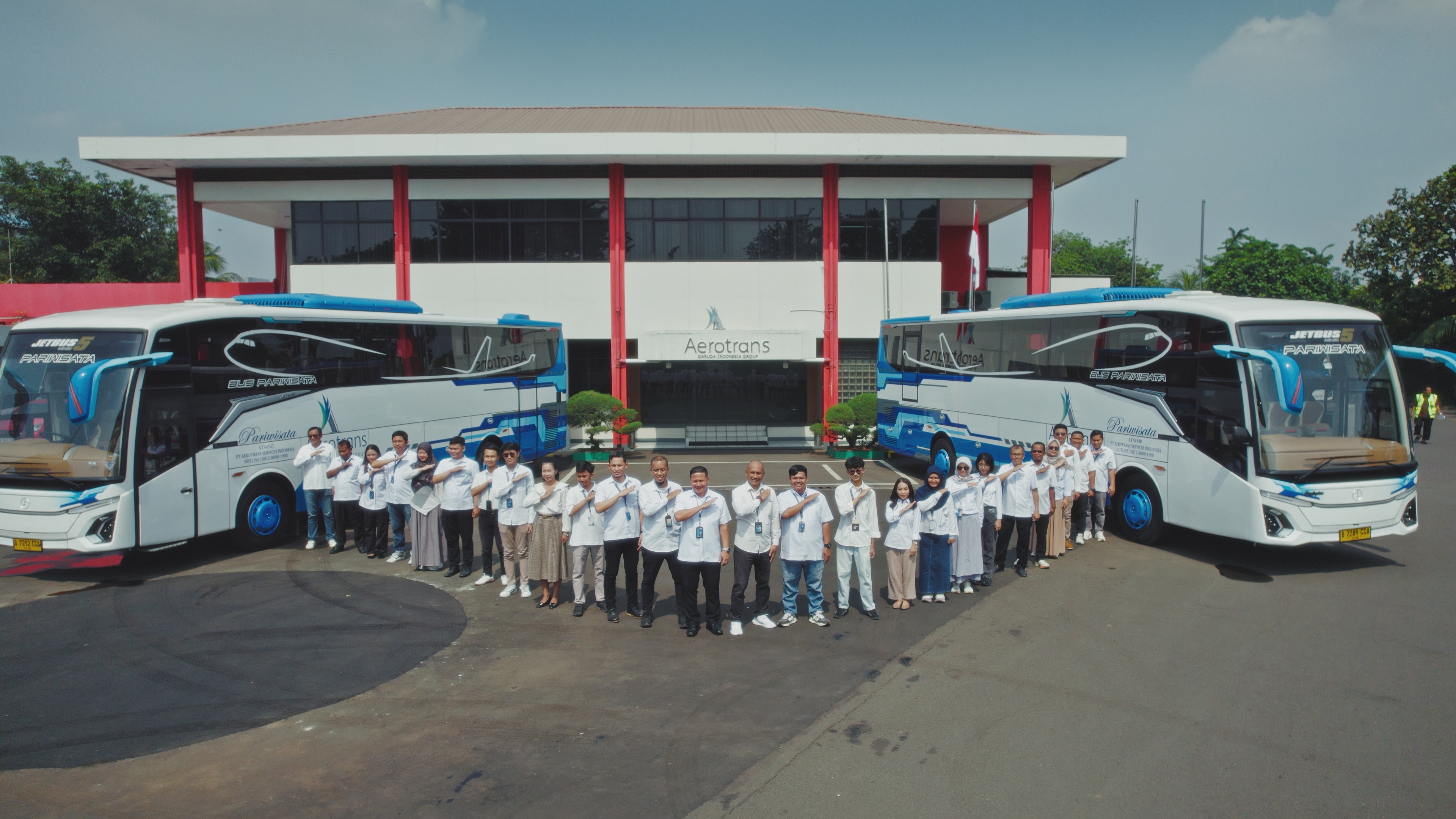
As the ground transport provider for the Garuda Indonesia Group, Aerotrans plays a critical role in supporting the nation’s aviation operations, moving flight crews and logistics teams across the country to keep airlines running on time. With a fleet of over 700 vehicles and more than 1,200 trips every month, Aerotrans operates with precision as a core value. The company has more than 250 connected vehicles. Each one averages 23 trips per day and covers 290 kilometers over 460 minutes of daily driving.
To maintain on-time performance, vehicle readiness, and achieve a reduction in incidents, Aerotrans partnered with Geotab, a global leader in connected fleet solutions. The goal: elevate its operational performance through smart telematics and real-time data.
"We were looking for a solution that could scale alongside our business and operations, and provide real-time insights. Geotab offered a platform that aligns with our values - particularly in terms of precision and safety. For Aerotrans, Geotab is not just a product, but a true partner. This collaboration supports our digital transformation goals and enables us to deliver better service to Garuda Indonesia Group and all our customers," - Kadek Bayu Temaja, Director, Aerotrans
The challenge: From limited visibility to real-time control
Before adopting Geotab, Aerotrans had limited visibility into its fleet performance. Incidents were difficult to trace, and the team had limited data to understand where and why vehicles faced challenges on the road. The company sought to have early warnings and driver behaviour data to ensure safety and efficiency across dispersed operations.
With Geotab's solution in providing notification for drivers and the monitoring team in charge, engine damage or braking incidents could be tracked easily.
"Before Geotab, our visibility of the fleet was very limited. Now, we can monitor our vehicles in real time. Since adopting the system, we have also seen a significant improvement in safety performance,” - Hermawan, Chief of Transport Operation Control Center, Aerotrans
The Geotab solution: Safely transporting crew members
After implementing Geotab’s platform in September 2024, Aerotrans has witnessed a positive shift in operational control and insight across its fleet operations, including key hubs such as Jakarta and Bali. Features used include:
- Crew address mapping to optimise routing and reduce delays
- Fleet productivity dashboards
- Maintenance alerts for engine and battery health
- Driver behaviour, such as harsh braking and speeding
- Notifications for immediate driver feedback
- Fuel usage analysis
Aerotrans also discovered new benefits. For example, uploading crew addresses enabled the team to improve pickup timing by tracking actual residence locations, a feature which was not available in their previous system.
"Geofencing is a strong feature within Geotab. This allows us to track vehicles approaching key operational zones such as airport areas in Denpasar or Soekarno-Hatta, giving us real-time visibility of their exact positions,” - Hermawan, Chief of Transport Operation Control Center, Aerotrans
Impact: Safer and more efficient
Since adopting Geotab, Aerotrans has seen marked improvements across safety, efficiency and fleet readiness:
- Achieved an 89% safety ranking, outperforming comparable fleets in the region
- 61% improvement in predicted collision rate per kilometer, a key milestone in their safety strategy
- 57% reduction in harsh braking events and 66% fewer acceleration spikes, pointing to improved driver behaviour as a result of real-time driver alerts
- 22% reduction in idling duration, contributing to fuel savings and operational efficiency
Looking ahead: More integration
Aerotrans plans to integrate Geotab more deeply with its internal fleet management system. Their goal is seamless system support from Geotab in the next evolution of their operational tech stack. By combining Geotab’s real-time insights with their dispatch systems, the company aims to:
- Use geofencing to locate the nearest available vehicle
- Improve dispatch accuracy and response time
- Build a more unified digital ecosystem for its operations
Additionally, while Geotab has primarily been used for crew transportation, it is also being tested on tourist buses to explore further utility.
“We will continue working closely with Geotab to further integrate and develop the system within Aerotrans. We are currently setting up a system we call TMS - Transport Management System - which will be used for operations across Indonesia, especially for crew shuttle services,” - Hermawan, Chief of Transport Operation Control Center, Aerotrans
Ready to drive your own digital transformation and achieve results like Aerotrans? Request a Geotab demo today and see how our data-driven insights can elevate your fleet.
Client profile
Client name:
Aerotrans
Industry:
Transportation & Logistics
Fleet size:
700
Client profile
Client name:
Aerotrans
Industry:
Transportation & Logistics
Fleet size:
700
Other stories

Milk & More: Sustainable home delivery for the modern age
September 6, 2023
4 minute read
Shaziman Transport improves performance, saves money and reduces environmental footprint with data
February 17, 2023
6 minute read

Enterprise uncovers the potential of fleet electrification
October 26, 2021
5 minute read