Beyond GPS: How All in One Video Telematics Are Reshaping Fleet Safety in Indonesia
See how Geotab’s Google Cloud-powered fleet intelligence and AI video help Aerotrans and TRAVL identify road risks, coach drivers and improve safety in Indonesia.

By Geotab Team
Oct 28, 2026
Key Insights
- Fleet safety is shifting beyond GPS tracking and after-the-fact reporting toward earlier risk identification through connected vehicle, driver and video data.
- Aerotrans, with more than 250 Geotab-connected vehicles, reports 57% fewer harsh-braking events, 66% fewer aggressive acceleration events and 22% less idling.
- TRAVL uses fleet data, video context and in-cab alerts to identify selected driving risks, guide driver coaching and support a more comfortable passenger experience.
- Built on Google Cloud, Geotab’s ecosystem includes Geotab Ace, which lets fleet teams ask questions about safety, vehicle health and utilisation in everyday language.
Indonesia recorded 158,508 traffic accidents in 2025, in which a total of 24,296 people lost their lives. Indonesia’s National Transportation Safety Committee (KNKT) continued to identify human factors—including fatigue, negligence and non-compliance with safety procedures—as a dominant contributor to these transport accidents.The figures highlight that road safety remains a major challenge, including for businesses that operate vehicles and transport people every day.
As fleet operations become increasingly complex, safety can no longer rely solely on responding after an incident occurs. Fleet operators increasingly need the ability to identify risky behaviour earlier, understand what is happening on the road, and give drivers and operational teams information that can support faster action.
That is the shift Geotab, a global leader in connected operations, video telematics and AI-powered insights, is seeking to enable through connected fleet intelligence. By bringing vehicle data, location, driver behaviour, diagnostics and video context into a single connected ecosystem, fleets can gain a clearer picture not only of where vehicles are, but how they are being operated and where potential risks are emerging.
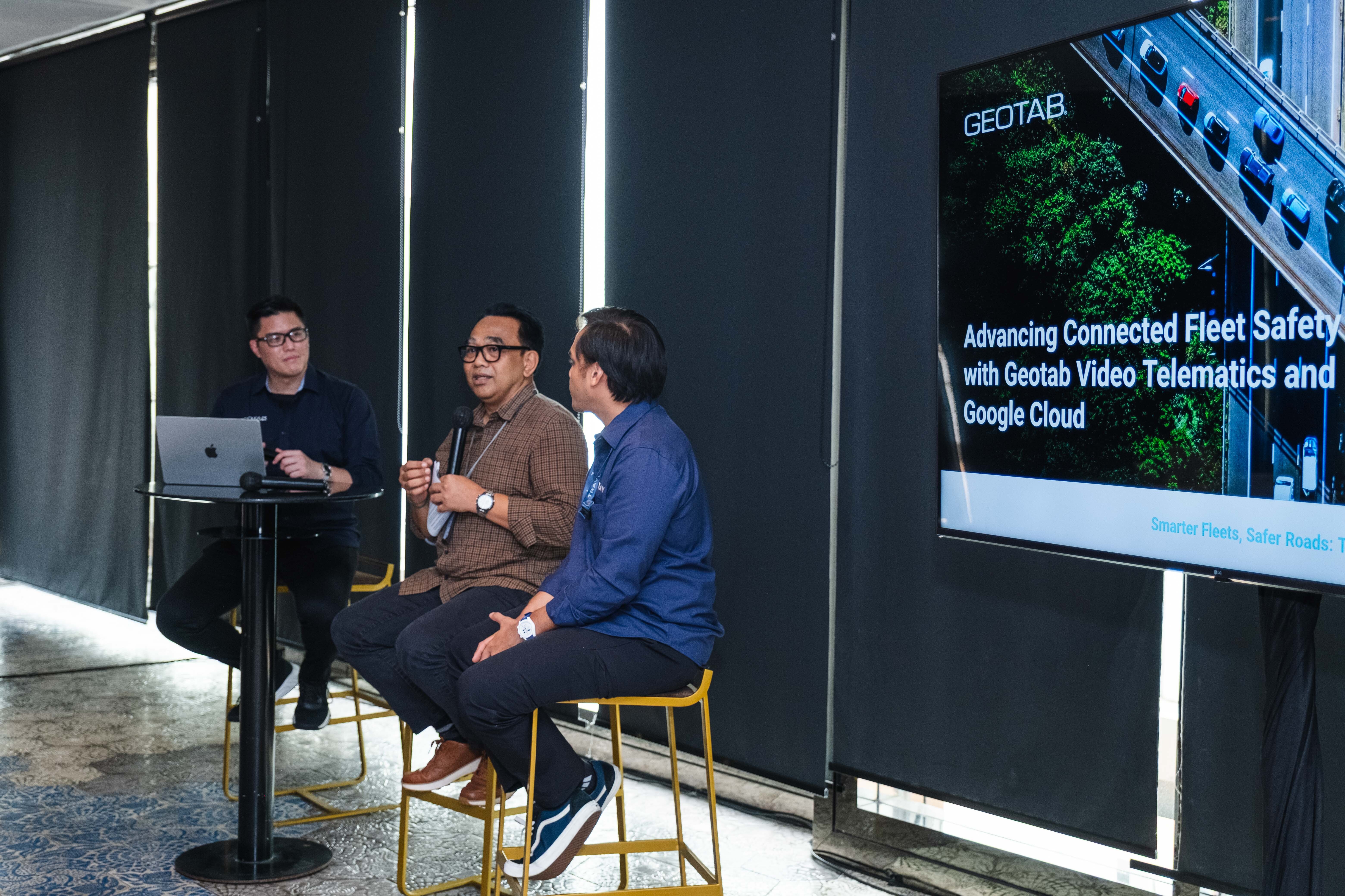
Indonesian mobility operators are already beginning to put this approach into practice. Aerotrans, which supports ground transportation for Garuda Indonesia Group, has used connected fleet insights to strengthen safety and operational control across its operations. Meanwhile, intercity shuttle operator TRAVL is using fleet data and video intelligence to gain deeper visibility into driver behaviour and strengthen the passenger experience.
“GPS gave fleets the ability to see where their vehicles were. The next evolution is understanding what is happening around the vehicle, how it is being driven and what action should be taken,” said Alvin Santoso, Business Development Manager, Geotab Indonesia. “For Indonesia, where road conditions, fleet operations and mobility needs can vary considerably, the value of connected intelligence is its ability to turn enormous amounts of data into information that operators and drivers can actually act on,” he added.
Scaling fleet intelligence with Google Cloud
Geotab’s connected ecosystem includes MyGeotab, its fleet-management platform that brings vehicle and driver information into a single environment; the GO9 telematics device, which captures vehicle and driving data including GPS location, g-force events, as well as engine and battery health data; and GO Focus Plus, which adds AI-powered video context and in-cab alerts for selected risks such as fatigue, distraction, and unsafe tailgating.
Behind these solutions is a massive global footprint. Processing over 100 billion data points daily across roughly 6 million connected vehicles and assets, Geotab does not just deliver data—it connects relevant information to drive action.
Built on Google Cloud, Geotab leverages advanced data intelligence and AI to transform fleet management from reactive troubleshooting to proactive prevention, anticipating problems before they occur. A key example is Geotab Ace, an AI assistant integrated into MyGeotab and powered by Google’s Gemini models. By enabling fleet teams to ask everyday-language questions about driver safety, vehicle health, and utilization, Geotab Ace delivers instant insights without complex queries or manual report scanning.
For added flexibility, Geotab solutions are also available on Google Cloud Marketplace, streamlining procurement for enterprise customers.
“Our view is that connected intelligence should ultimately make the complexity of managing a fleet simpler for the customer,” Alvin said. “Whether an operator is transporting airline crews, carrying intercity passengers or managing a large commercial fleet, the question should not be how much data it can collect. The question is whether that data helps someone make a safer and better decision,” he added.
Local operators turn data into safety actions
For Aerotrans, fleet intelligence supports a particularly time-sensitive operation.
As a ground transport provider for Garuda Indonesia Group, Aerotrans moves flight crews and logistics teams as part of wider aviation operations. Its overall fleet has more than 250 vehicles connected through Geotab.
Before adopting Geotab, Aerotrans had limited visibility into fleet performance and fewer tools to understand why certain road events occurred. Since implementing Geotab in 2024, the company has used capabilities including real-time vehicle monitoring, driver-behaviour insights, maintenance alerts, fuel analysis, and geofencing across its operations.
The company has since achieved an 89% fleet safety ranking outperforming comparable fleets in the region, recorded a 57% reduction in harsh-braking events, seen 66% fewer aggressive acceleration events; and reduced idling duration by 22%, thereby supporting fuel and operational efficiency.
The company has also used geofencing and location intelligence around operational areas including Soekarno-Hatta and Denpasar airports, giving its team greater real-time visibility of vehicles approaching key locations.
“We were looking for a solution that could scale alongside our business and operations, and provide real-time insights. Geotab offered a platform that aligns with our values - particularly in terms of precision and safety” said Kadek Bayu Temaja, Director, Aerotrans
Aerotrans is now exploring deeper integration between Geotab and its own Transport Management System, with the longer-term aim of using connected data to further support vehicle allocation, dispatch accuracy and response times.
On the other hand, is PT Maya Gapura Intan (MGI, who has been operating for over two decades in the Indonesian transport industry). In December 2025, MGI launched TRAVL, an inter-city shuttle service. For TRAVL, fleet intelligence is being applied to a different challenge: ensuring that safety is also reflected in the passenger experience.
Operating around 40 vehicles with approximately 100 daily departures across Jakarta, Tangerang and Bandung, the company uses fleet data and video context to gain greater visibility into risky driving behaviours like distraction, fatigue, and tailgating and provide a more objective basis for driver coaching. TRAVL began using Geotab and the MyGeotab platform in late 2025, before testing GO Focus Plus and moving into broader deployment in August 2026.
Its operations team can now review relevant data and video footage related to selected road events and operational reviews, while in-cab alerts can provide drivers with immediate feedback when selected risky behaviours are detected.
“Comfort is closely connected to the way the vehicle is driven. Our passengers should not have to feel that the driver is rushing or driving too aggressively. Technology helps us reinforce the standards we expect and gives us better information to have those conversations with our drivers.” said Syukron Fadillah Alkautsar, Head of Business Unit, TRAVL
Beyond GPS: Connecting vehicle data, video, and AI
The experiences of Aerotrans and TRAVL reflect a broader evolution in fleet technology. Vehicle location remains important, but fleet operators increasingly need to connect location data with information on driver behaviour, vehicle condition and road events in order to understand risk more comprehensively, ideally within a single, connected platform.
At the centre of Geotab’s ecosystem is MyGeotab, a web-based fleet management platform that brings vehicle, driver, and operational information into a single environment.
The Geotab GO9 telematics device captures vehicle information including GPS location, movement and g-force events, as well as engine and battery health data. This information can then be analysed through MyGeotab to help operators identify patterns across safety, utilisation, maintenance and fleet performance.
GO Focus Plus adds video context and AI-based detection. The dual-facing camera can identify selected risks including fatigue, distraction and unsafe following distance, while in-cab voice alerts can prompt drivers to adjust certain behaviours in real time. Authorised fleet teams can subsequently review video together with telematics data to better understand what occurred.
For Geotab, the experiences of Aerotrans and TRAVL show that connected fleet intelligence can be applied across different mobility needs, from supporting the reliability of aviation-related transportation to improving safety and comfort on intercity passenger journeys. As fleet operations in Indonesia become increasingly connected, the opportunity is therefore not simply to monitor more vehicles, but to use the information generated by those vehicles to identify risk sooner and support safer decisions before an incident occurs.
The Geotab Team write about company news.
Related posts
What Is ADAS? A Guide to Driver Assistance Systems for Philippine Fleets
October 21, 2026
5 minute read
What Is a GPS Jammer? Detection and Protection in the Philippines
October 20, 2026
5 minute read
What the Geotab and TAPA Webinar Reveals About Fleet Safety Management
October 2, 2026
2 minute read

How to maximise vehicle utilisation with a fleet management system in Southeast Asia
October 1, 2026
3 minute read
How Driver Safety Scorecards and AI Video Telematics Are Improving Fleet Safety in Southeast Asia
September 28, 2026
5 minute read