Picnic improves fleet efficiency with Geotab’s high-resolution solution
Learn how Picnic used Geotab’s high-fidelity fleet data to enhance its delivery operations and ensure compliance with its precise 20-minute delivery windows.
Published: Sep 17, 2026
Updated: Sep 2, 2026
Success Highlights
Learn how Picnic used Geotab’s high-fidelity fleet data to enhance its delivery operations and ensure compliance with its precise 20-minute delivery windows.
Challenge: Sourcing High-Fidelity Data for a “lakeless” data warehouse
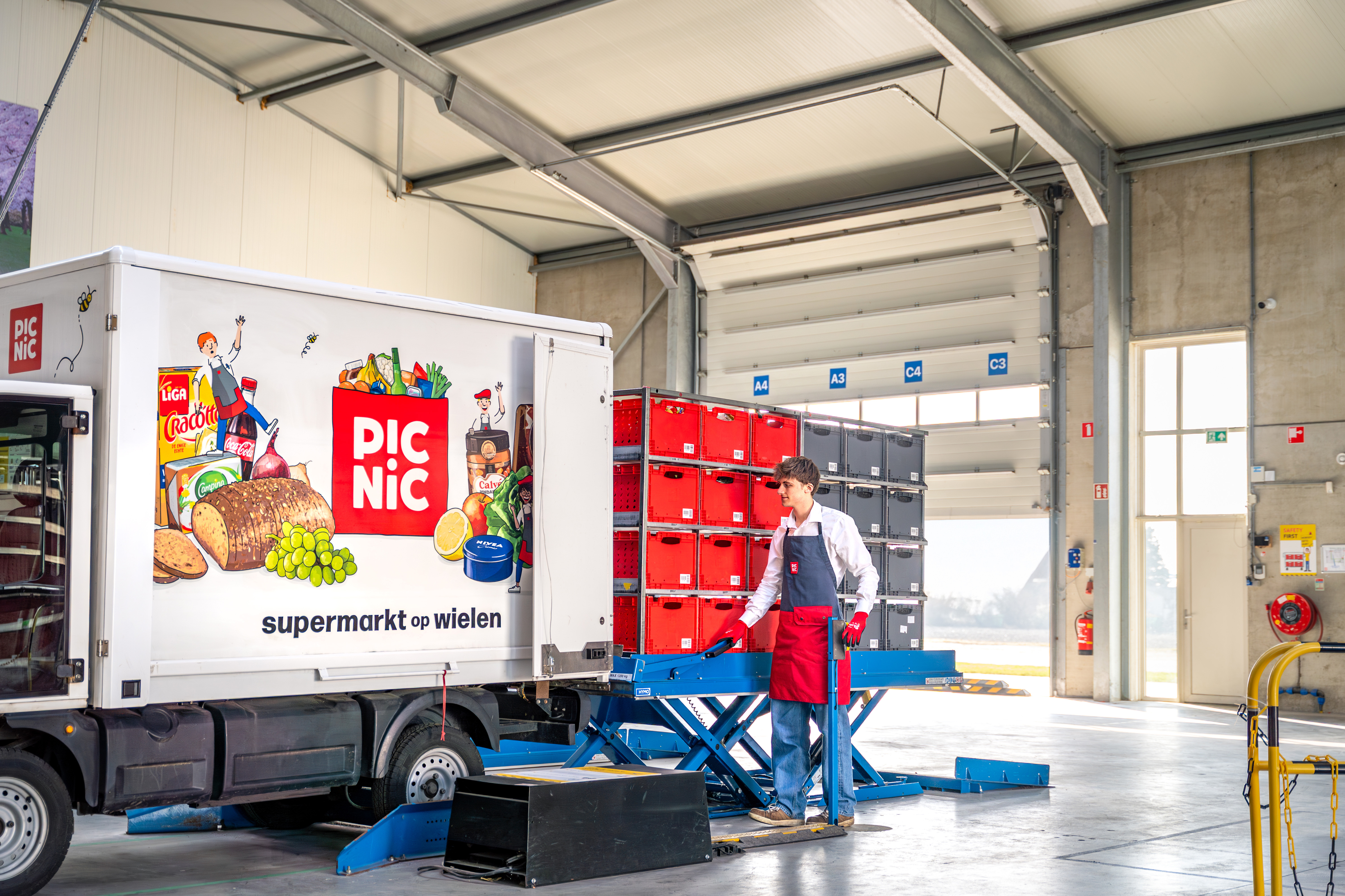
Picnic is the fastest-growing online supermarket in Europe, delivering to thousands of customers every day, across the Netherlands, Germany and France. The company prides itself on its sustainability performance and strives to minimise food waste. Customer service is also a priority, with 95% of Picnic’s orders arriving within its 20-minute delivery windows. At its core, Picnic is a data-driven tech company that uses this expertise to solve the logistical challenges of efficiently moving items from one place to another, providing a superior online grocery shopping experience.
The company needed a telematics solution for its fleet of 5,000 electric delivery vehicles that would meet its technical and operational requirements, help it optimise fleet operations and reduce costs, and improve safety and well-being for its 20k drivers (runners).
Picnic's operations are built on a sophisticated, "lakeless" data warehouse. This means that although it captures large amounts of data, it only works with it in real-time and does not create databases or “lakes”. The challenge was to find a telematics partner able to feed high-quality, structured data directly into Picnic’s advanced analytics platform. This meant capturing high-resolution EV-specific metrics such as live battery state of charge (SOC), charging status, energy use and fault codes, alongside live GPS data, with near-perfect data availability (>99.99%). It also required an open API capable of handling intensive, real-time data requests with high integrity.
Solution: Meeting exacting requirements to support a data-first culture
Picnic selected Geotab, the global leader in connected transportation, for its ability to deliver a robust, open platform that directly aligned with Picnic's data-driven philosophy. The solution uses Geotab's powerful Software Development Kit (SDK) and APIs to provide a continuous stream of raw high-fidelity data, which Picnic integrates, models, and utilises within its own "lakeless" data warehouse architecture. This allows them to treat vehicle data as another clean, reliable source, aligning with Picnic’s preference for structured, queryable data.
Instead of being a rigid, closed-off system, Geotab provides the tools for Picnic's teams to own their data workflows. This resonates with Picnic's culture of democratizing tools and empowering analysts to build their own models and automations. The telematics data then becomes another high-quality asset for their teams to innovate with.
“We chose Geotab because they can provide the data we needed in the way we wanted it.” – Bas Boschman, Fleet Development Project Manager, Picnic
Optimising Picnic’s vehicle-to-trip model
Picnic’s deliveries are completed by specialised, very lightweight EVs that operate on unique embedded systems. Since the data coming from the EVs was not standardised, Geotab’s solutions engineering team had to initially translate it to receive the relevant EV signals. From the point at which the first telematics devices were ordered, it took just three months for them to be installed in all 3,300 vehicles, showing Geotab’s ability to scale at a significant speed.
Managing these vehicles and ensuring that they have sufficient charge to complete their routes was a major challenge for the Picnic operations team. It is critical to their 20-minute delivery window customer service promise that they optimise vehicle uptime and that the right vehicle is assigned to each route.
Picnic uses its in-house software to assign a vehicle and driver to each route based on the vehicle’s state of charge and the calculated mileage and charge required to complete each preplanned route. Geotab’s high-integrity EV-specific data points, specifically state of charge (SOC) and charging status, together with its open API, were critical to ensure that this vehicle-to-trip (VTT) algorithm worked optimally. Since the vehicle-to-trip assignment occurs first thing in the morning, there was no room for error, and there was a high reliance on Geotab’s data integrity and availability. An improvement in the efficiency of the delivery process was visible from the first day after the VTT started to use Geotab’s telematics data.
Partnering for success
Geotab has taken on an advisory role in the partnership, helping the Picnic data team to optimise their API calls into the Geotab system, and advising them how to get hold of the right data and to implement it optimally. The Geotab Solutions Engineering team were able to support the signals in the right quality and quantity to ensure Picnic had no logistical problems, which immediately resulted in an improvement in the quality of service they were providing to their customers.
Modelling the effect of colder temperatures
The Picnic team wanted to model the effect of temperature on the operational range of their EVs. Colder ambient temperatures can significantly reduce the range of an EV, so this can be a major challenge for grocery delivery operations that utilise electric vehicles. The challenge can be further aggravated by the fact that demand can peak over the holiday period, when temperatures have already started to drop.
Geotab’s high-fidelity state of charge signals were provided to their modelling system via the API to help the data team gain a greater understanding of this variable so that they could alter routes accordingly in the winter months.
Impact: Supporting customer success
By integrating Geotab's high-quality data stream, Picnic can further enhance its operational models, leading to significant benefits:
- Optimised EV fleet operations and customer service performance: Access to real-time state of charge (SoC) and charging status across the entire fleet has allowed Picnic to optimise its in-house vehicle-to-trip algorithm, reduce the risk of stranded vehicles, and significantly improve the quality of service it provides to its customers.
- Supporting sustainable operations: By feeding this precise telematics data into its machine learning models, Picnic can further refine its "just-in-time" supply chain, streamlining routes, reducing food waste and improving stock management.
- Ensuring future-proof scalability: As Picnic continues its rapid international expansion and fleet growth, the Geotab platform provides a consistent, high-quality data stream across all markets. This supports Picnic's strategy of maintaining a unified codebase and data structure across different countries, ensuring long-term agility and efficiency.
- Reduction in fleet size: Picnic has reduced its overall fleet by 13% while increasing deliveries, thanks to the data provided by Geotab. This has reduced capital expenditure (CapEx) and the lifecycle carbon emissions of the fleet, as well as the number of vehicles on the roads, making it better for the neighbourhoods they service.
Next Steps: Enhancing safety and sustainability
While Picnic currently handles all of Geotab’s vehicle data in its bespoke systems, the safety team is also excited to use the MyGeotab fleet management platform’s Safety and Sustainability centres to enhance these two areas of their operations:
Safety:
The detailed accelerometer and GPS data collected by the Geotab GO9 telematics device will enable Picnic to implement sophisticated driver safety programs. The high-resolution incident data will provide them with invaluable, objective insights for post-incident reconstruction and analysis.
Sustainability:
Picnic wants to better understand how vehicle SOC is impacted by driver behaviour so that they can create monitoring and training programmes to enhance driver efficiency, maximising range and reducing the demands on depot charging infrastructure, while reducing Scope 2 emissions associated with the consumption of electricity. Picnic is also looking to model long-term battery state-of-health (SOH) and its effect on range, so that it can improve fleet utilisation and thereby improve the sustainability of its operation.
From the Fleet Manager
"Data is the engine of Picnic’s business success. We needed a telematics partner that understood our data-first philosophy and could provide us with a high-integrity and high-availability data stream. Geotab's open platform gives our engineering and analytics teams the direct access and tools they need to integrate vehicle data seamlessly into our own systems. This allows us to innovate faster and enhance our EV delivery logistics to further improve the hyper-efficient delivery experience our customers love." – Bas Boschman, Fleet Development Project Manager, Picnic
Client profile

Client name:
Picnic
Industry:
Online Groceries
Fleet size:
5000
Client profile
Client name:
Picnic
Industry:
Online Groceries
Fleet size:
5000
Other stories
EPNAK case study: Geotab, the key to a high-performing and responsible fleet
July 17, 2026
3 minute read

How Canarias.com manages 1200 vehicles on Europe's most in-demand island
June 8, 2026
3 minute read
-960x540.png)
Autolinee Federico: Geotab Telematics slashes fuel costs by 20% and supercharges safety
March 20, 2026
3 minute read
Motormax & Geotab: Driving Safety, Efficiency and Compliance for Burton Roofing Merchants
February 5, 2026
5 minute read