
Public sector fleet management solutions
Join the many public sector fleets that leverage Geotab’s solutions to provide critical intelligence to streamline regulatory compliance, reduce total cost of ownership, improve public and employee safety, and minimise greenhouse gas emissions.
Solutions for the public sector

Key features
Trusted and secure solution
Geotab has been named as a supplier on the RM1643 Vehicle Telematics Crown Commercial Service’s (CCS) framework. As a Lot 2 supplier, we can provide telematics software solutions to the public sector.
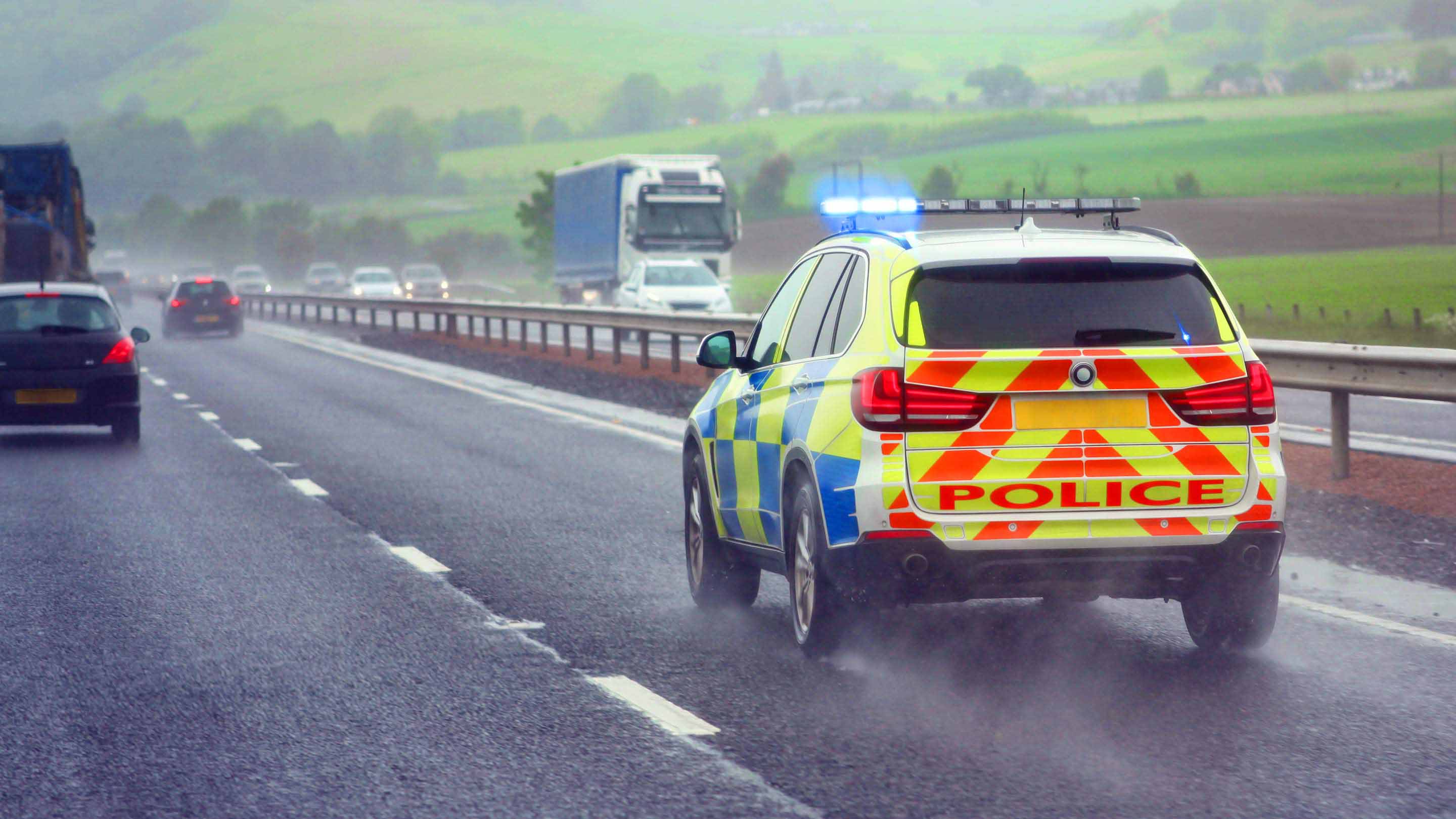
Road safety initiatives
Pave the way towards a fatality and serious-injury free future using telematics data for real-time road safety event information.
Accomplish fleet sustainability goals
Improve fleet operations and reduce harmful environmental impacts by reducing fossil fuel usage, improving vehicle utilisation and reducing operating costs.

The Geotab advantage
- Industry leading data security
- Hybrid and electric vehicle (EV) compatibility for easy management and analysis
- One universal device and platform for all vehicle makes and models, including EVs
- Automated reporting for regulatory compliance and billing
- Active tracking for emergency service vehicles
- Accident detection with real-time notifications
- Roadside Assistance
- CO2 emission calculations and reporting + EV suitability and ROI analysis
- Route optimisation tools for reduced mileage and fuel consumption
- Idling & fuel consumption trend reports
- Proactive fleet maintenance software focused on predictive engine and EV battery health
- Smart City insights and road safety analytics
Trusted leader preferred by all levels of government

Geotab chosen to provide telematics data for Madrid City Council’s new electric vehicle fleet
Geotab GO devices have been installed in Madrid City’s new EVs to capture environmental performance data, optimise the logistics deployment of the fleet, and compare the consumption and emissions of EVs with that of combustion vehicles.

Geotab selected as sole telematics provider by the State of California
As part of the State’s goal to promote a reliable, environmentally responsible and cost-effective fleet, Geotab’s award-winning technology will be available to all state, municipal and county fleets.

Geotab named as a supplier on the Vehicle Telematics Crown Commercial Services Framework
As a Lot 2 supplier, Geotab can provide telematics software solutions to the public sector and third sector.
Commonly asked questions
What is public sector fleet management?
Public sector fleet management is a specific subset of telematics management that is designed for fleets of all sizes. Public sector fleet management solutions are designed for emergency services, utilities, smart cities and any other public sector vehicle fleet.
What are the benefits of public sector fleet management?
Geotab’s public sector fleet management solutions offer the following benefits:
• Simplified contracts
• Support for Council and Local government authorities
• Rigorous data security
• Support for meeting electric vehicle (EV) acquisition targets
• Support for meeting sustainability targets
• Critical intelligence to help streamline regulatory compliance and reporting
• Reduced total cost of ownership (TCO) of fleet vehicles
• Improved public and employee safety
• Minimised greenhouse gas emissions
How can Geotab help you manage your public sector fleet?
Geotab uses a small, easy-to-install telematics device to capture rich vehicle and driving data, including ultra-accurate engine and EV battery diagnostics.
With fast GPS acquisition time and high-quality recording, these devices ― in combination with MyGeotab fleet management software ― enable councils, local government authorities and other public and third sector fleets to access and leverage vital data from their fleets.
Through analytics and machine learning, Geotab transforms this large volume of data into critical intelligence for fleets, helping to improve fleet management and performance.
What are the benefits of Geotab's fleet management software for public sector fleet management?
With 2,000 public sector customers and counting, Geotab is continuously developing and expanding its solution offering based on the growing and evolving needs of public sector fleet managers. But some requirements remain fundamental across all authorities and at all levels of government.
To keep pace with current trends and demands in the public sector, Geotab’s telematics platform solution works to:
• Promote sustainability
• Support and advance EV adoption employee and public safety
• Automate compliance
• Boost efficiency
• Streamline maintenance and lower maintenance costs, detecting engine issues in advance
• Simplify deployment and expansion
• Lower fuel costs
• Right-size fleets
How can fleet management help authorities?
What government fleet solutions does Geotab offer?
Geotab’s web-based software and fleet tracking devices are perfect for managing government fleets on all levels such as:
- Police and first responders
- Winter operations
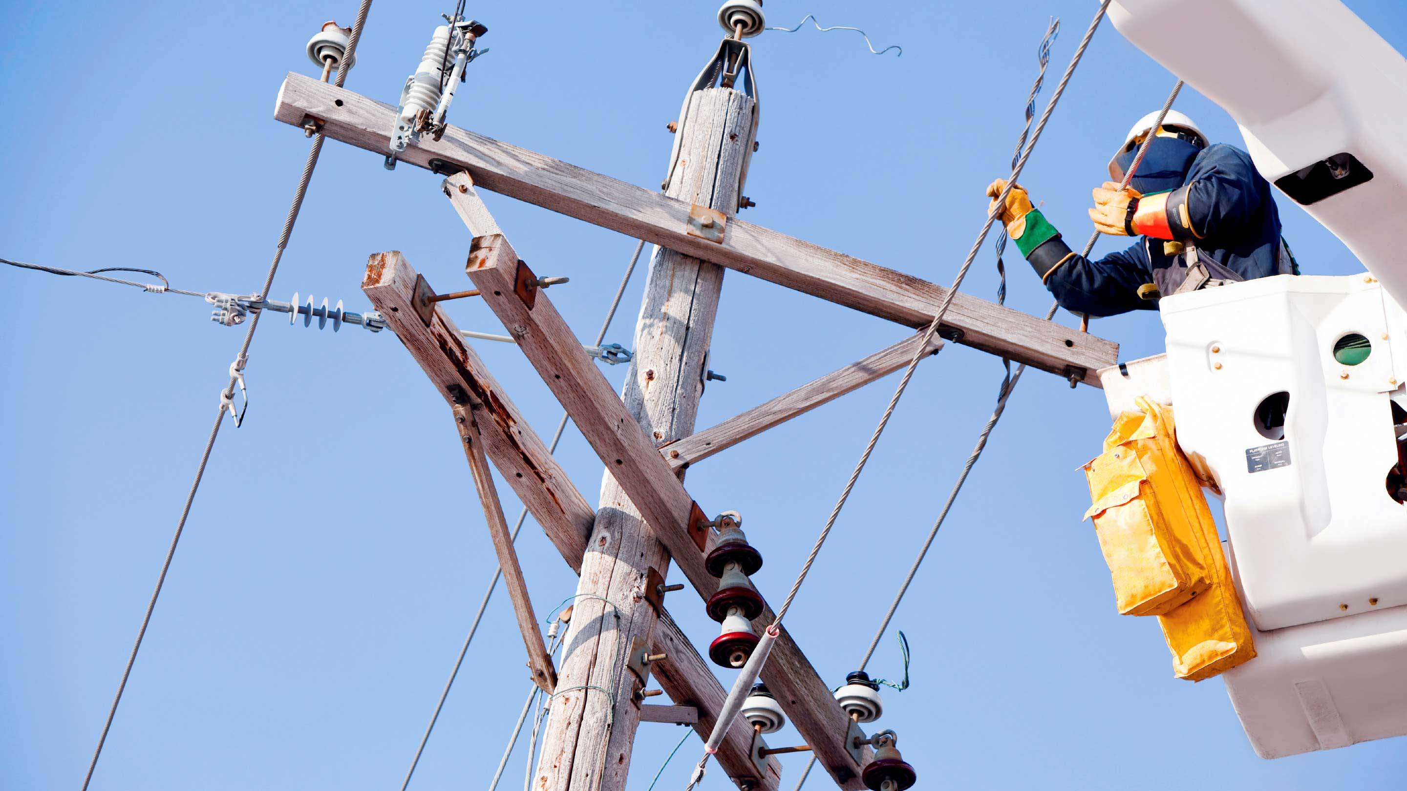
- Utilities
- Smart City