One platform for optimal fleet performance
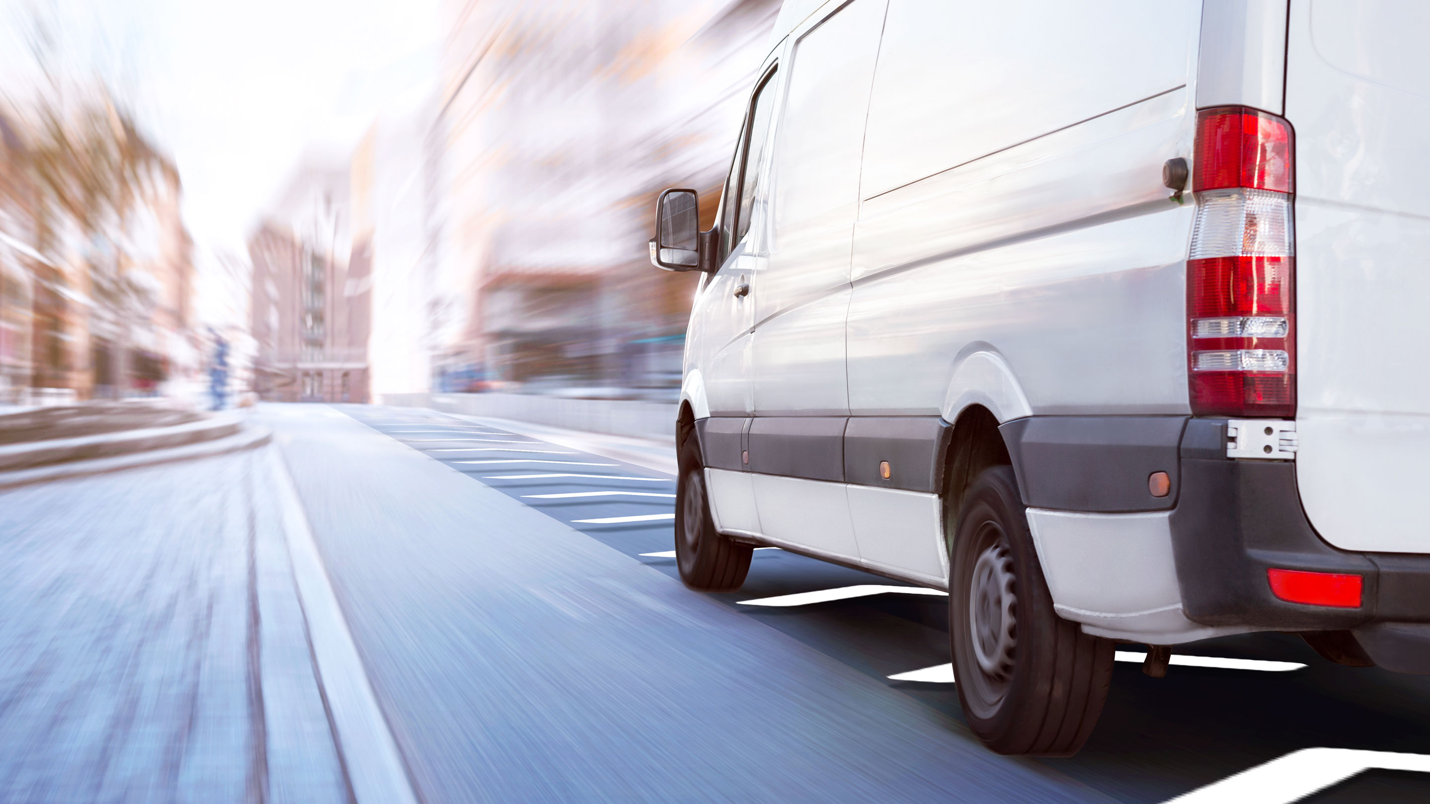
Connect your entire fleet, seamlessly
Unlock fleet potential with AI-powered insights
Drive safety, efficiency, and savings
.svg)
Product
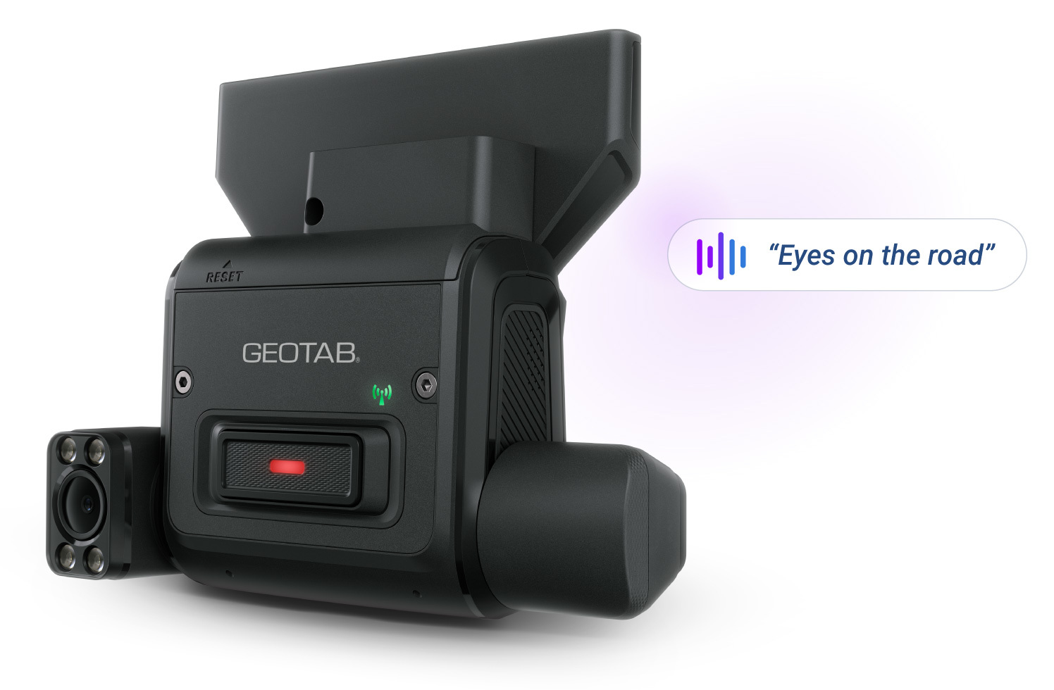
GO Focus Plus AI dash cam
Meet GO Focus Plus, the AI dash cam that calls out risks like distractions, tailgating and rolling stops the moment they happen. Drivers hear instant, in-cab voice feedback, turning critical seconds on the road into teachable moments before an incident occurs. Smart Sequence™ surfaces the most urgent events first, along with video and context, so managers can coach, review and take action without chasing footage or sorting through endless alerts. Focus on what demands your attention and change outcomes, all within Geotab's unified safety platform.
Put connected fleet intelligence to work to drive better outcomes
An open platform for safe, sustainable and cost-effective mobility powered by AI and data intelligence.
%20(1).svg)

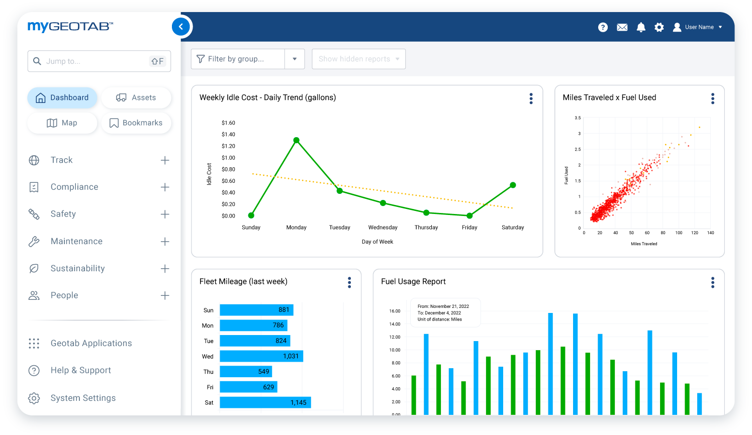
Automate processes and be proactively alerted to opportunities to lower costs, work smarter, and optimize productivity and uptime for a better bottom line.
We recognize your employees are your company’s greatest asset. Our driver-focused and fully customizable solutions prioritize their well-being while minimizing risk and improving safety – on both sides of the wheel.
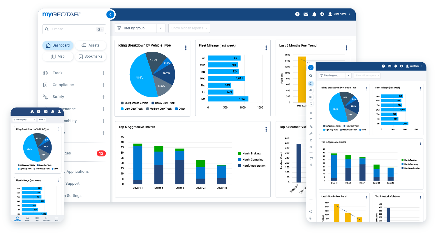
Unlock fleet potential with AI-powered insights from Geotab Ace, simplifying complex data for smarter decisions and empowering your entire team with easy, secure access to drive efficiency, safety, and sustainability.
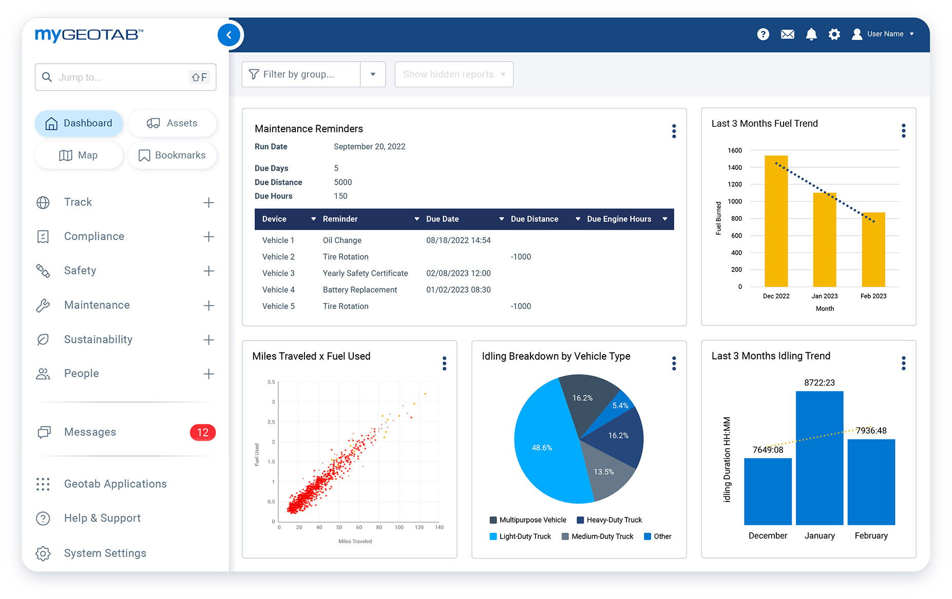
Stay ahead of the curve with automated reminders and integrated solutions for fleet performance and maintenance. Easily identify and prioritize maintenance tasks early on to help prevent vehicle wear and reduce downtime.
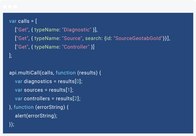
Extend MyGeotab's functionality with custom applications using the MyGeotab SDK. Developers can leverage sample code and projects to create custom Add-In buttons or pages, integrating MyGeotab data with external APIs for a unified data view.
Why businesses choose Geotab
25+ Years of fleet management excellence
Recognized as an industry leader
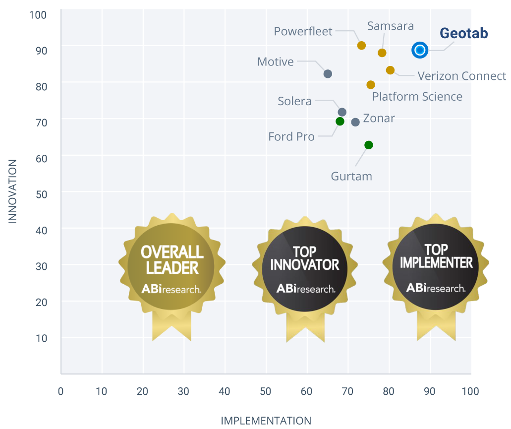
ABI Research #1 commercial telematics ranking
Download ABI Research’s independent telematics vendor comparison report. Compare Geotab to Samsara, Motive, and other platforms. Unbiased insights for informed decisions.
Connected fleet updates and latest product features
What's new at Geotab

MyGeotab product updates
MyGeotab is constantly evolving. See what's new in our monthly feature release blog post.

Fleet Newsletter
Get ready for the new Geotab fleet newsletter! Discover industry insights and product news with our revamped monthly newsletter.
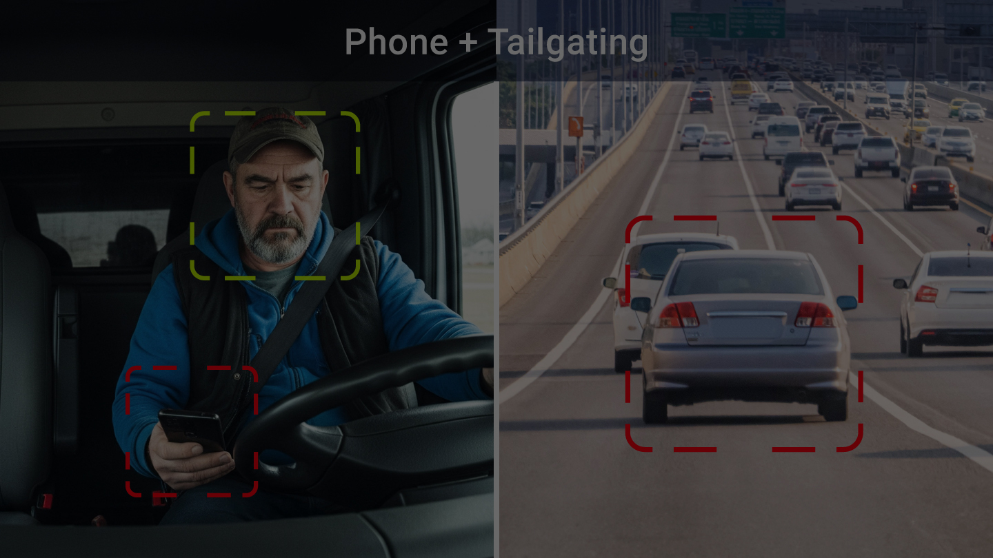
From risk to safer drive. Instantly
The second risk shows up, the coaching starts. Introducing the Geotab GO Focus Plus AI dash cam.

#1 Commercial telematics ranking
ABI Research’s independent telematics vendor comparison report has ranked Geotab #1 in commercial telematics.
Meet Geotab Ace
Your generative AI analytics assistant, with a simple prompt, get quick answers about your fleet and assets
Top fleet management solutions
Fleet operations powered by AI and data intelligence
Fleet dash cams
Take the guesswork out of collisions and other critical traffic events with our seamlessly integrated AI-powered dash camera solutions
ELD
Our FMCSA-certified ELD automates data collection and provides step-by-step workflows with pop-up reminders to minimize violations.
Routing and dispatching
Improve productivity and help lower costs by leading your fleet down the right path with our fleet routing and dispatching solutions.
Fuel management
Monitor and control your fleet’s fuel consumption. Use reports and driver training tools to develop fuel efficient driving behaviors.
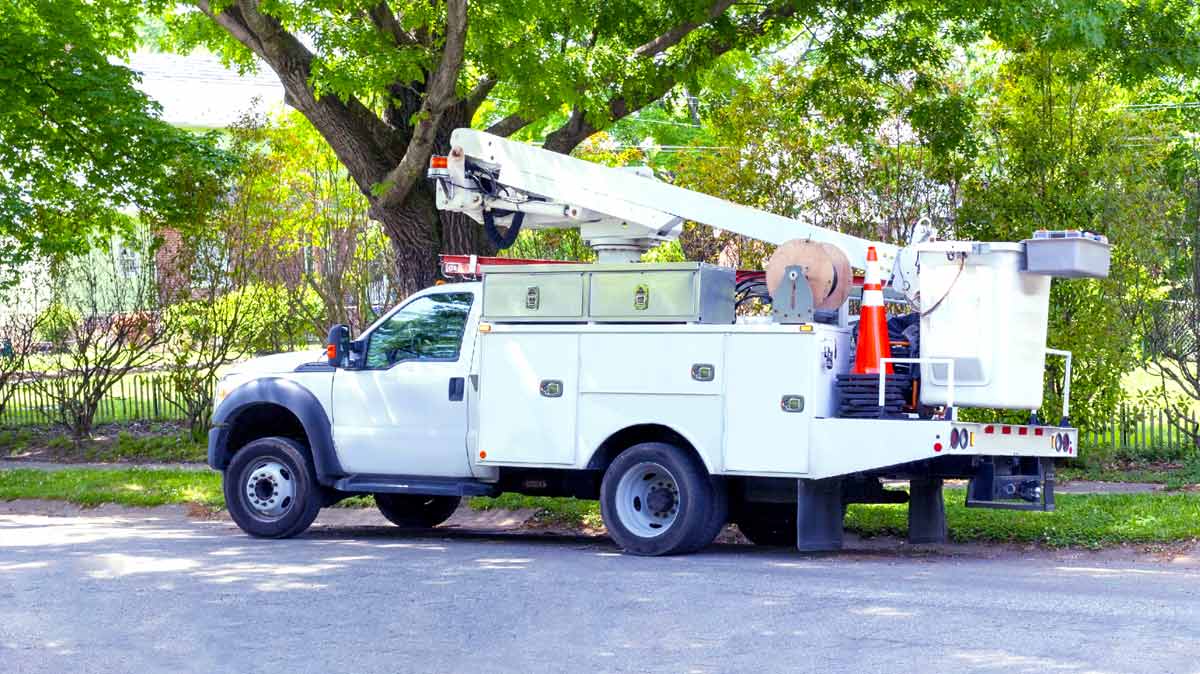
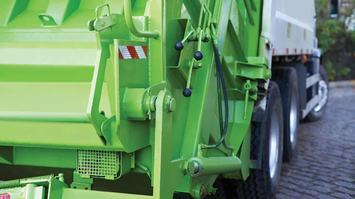
Industry-specific fleet expertise
Fleet management solutions tailored to your industry

@2x.jpg)


Extensive partner ecosystem
Working with the largest companies across the globe
Fleet Management Partners
Expert partners who sell, install, and support Geotab's fleet management solutions to businesses of all sizes.
- Continuous consulting and support
- Relationship management
Marketplace Partners
Partners offering a wide range of integrated solutions that extend the functionality of Geotab's platform, helping businesses customize their fleet management systems.
- Custom third party integrations
- Data integrations
OEM Partners
OEM's can integrate with Geotab's industry-leading telematics and provide their customer and Geotab fleet customers easy access to rich OEM data and analytics.
- Choose from four levels of OEM integration
- Expand your offerings and shorten time to market
Popular Marketplace solutions
Integrate the things that matter to your business. Take advantage of solutions and expertise from our diverse ecosystem and partner network to achieve your goals.
.png)
Need direct support?
We’ve got you covered. Connect with well-trained Geotab support experts 24 x 7 that are in-market - not off-shored or outsourced.
Customer success
“Support member was great, very knowledgeable and quickly diagnosed my problem and he also waited while i contacted drivers to ensure everything was working correctly.”
Andy C, Charlotte, North Carolina, USA
Get a demo
Fleet management demo
Boost your fleet's safety and efficiency with cutting-edge collisions avoidance technology. Empowered managers actively support drivers after incidents, minimizing downtime, reducing stress, and expediting claims.
Frequently asked questions
What does Geotab do?
Geotab is the world’s #1 commercial telematics provider. We connect vehicles to the internet and provide web-based analytics to help organizations manage their fleets. Our solutions help improve business operations in six areas. They include, productivity, fleet optimization, sustainability, safety, expandability and compliance.
What fleet management solutions does Geotab offer?
Geotab offers a variety of solutions for fleets of all sizes and industries from fuel management, driver coaching, routing and dispatching, and much more.
What are the advantages of using Geotab's fleet tracking solutions?
With Geotab’s fleet tracking solution, receive insights that will lead your fleet into the future. With features such as accurate vehicle tracking and in-vehicle coaching, improve efficiency and maximize your fleet’s profit. To learn more about the advantages, visit the Vehicle Tracking Device page.
What industries does Geotab work with?
Geotab works with a large number of industries, including: Construction, Courier and Delivery, Utilities, Oil, Gas and Mining, Food and Beverage, and Waste and Recycling. View the full list of our industry-specific offerings. Is your industry not listed? Reach out for a chat and we’ll be happy to show you the vast capabilities of our solutions.
What is fleet tracking?
GPS fleet tracking enables fleets to understand vehicle location and other fleet activities. For Geotab, fleet tracking includes much more than “dots on a map” and also includes many other focus areas such as driver safety, fleet compliance, vehicle emissions and vehicle health. To learn more, visit our Asset Tracking Solution page.
What is a fleet tracking system?
A fleet tracking system enables you to view detailed, real-time data on your vehicles. All of this data can be accessed remotely from a single platform. To learn more about Geotab’s fleet management software, visit our MyGeotab page.
What are the benefits of a fleet tracking system?
There are many benefits to using GPS tracking, including helping increase safety, improve customer service, streamlining vehicle maintenance and reducing downtime and strengthening fleet compliance. Discover how companies are using fleet tracking to improve business operations on our success stories page.
Does Geotab fleet tracking software use GPS?
The Geotab GO device is an industry leading, expandable telematics device. With its ability to use GPS fleet tracking, vehicle locations can be viewed in near real time along with a complete trips history. Our patented algorithms provide detailed and accurate information to help support your fleet.
What is the Geotab GO vehicle tracking device?
The Geotab GO device is a compact vehicle tracking device that plugs easily into a vehicle’s OBD II port with no additional mandatory antennas or wire-splicing required. Adapters are available for vehicles without an OBD II port and no special tools are required. As soon as you begin to drive, the GO device starts recording rich data on vehicle location, speed, engine idling, distance and much more, with end-to-end security. The latest iteration features a 32-bit processor, more memory and a gyroscope.
What are the benefits of choosing Geotab?
As the #1 commercial fleet telematics provider worldwide, Geotab serves businesses and public sector organizations of all sizes across the globe. Geotab’s secure open-platform technology gives you complete visibility over your vehicles’ movements, engine health, fuel usage and more. With this critical business intelligence, you can make data-driven decisions to improve a wide range of business operations. You also get access to over 200 third-party Add-Ons from Geotab’s Marketplace. Geotab puts data security first. For more information, visit our Security Center.
What is telematics?
Telematics is a method of monitoring cars, trucks, heavy-duty equipment and other assets by using GPS technology and on-board diagnostics (OBD) to plot the asset’s movements on a computerized map. Also known as fleet tracking or GPS vehicle tracking, telematics is now an essential management tool for any commercial and public sector fleet.
What is the purpose of fleet telematics?
Telematics devices are designed to retrieve data generated by the vehicle, like GPS position, speed, engine light information, engine faults and fuel usage. MyGeotab retrieves additional data for electric vehicles on real-time charge levels, charging locations and durations, and battery state of health, enabling fleet managers to effectively manage their EVs and compare their performance directly against the conventionally fueled vehicles in the fleet.. The telematics device sends the data up to the cloud, and it is then available for viewing and analysis in a fleet management platform.