Telematics Glossary: 100+ terms to know
Get up to speed with this ultimate telematics glossary.
By Geotab
Jan 2, 2025

Whether you’re new to the field or mastering advanced integration, this glossary is a handy reference for everything you need to know about telematics. We have now included terms for electric vehicle fleet management.
3
3G sunset
As with the previous 2G network shutdown, the 3G sunset refers to the period when major mobile network carriers began phasing out or “sunsetting” their 3G networks to allow for a transition to 4G LTE and 5G network use.
4
4G LTE network
4G LTE connectivity for telematics devices provides a greater level of speed and efficiency for cloud-based fleet management and solution integrations. The term “4G LTE” is an acronym for “fourth generation long-term evolution”.
5
5G network
The 5G network is the fifth generation of telecommunication technology used by mobile networks to transmit data around the world. This standard builds on 4G and allows increased capacity and faster speeds. There is a part of 5G called Category M which is optimised for IoT and devices like the Geotab GO.
A
Accelerometer
An accelerometer is an electronic device that can measure the position of the vehicle (up/down, left/right and forwards/backwards). Information from the accelerometer is used in collision reconstruction to understand driving behaviour leading up to the event.
AC charging
Level 1 is the slowest form of charging. Almost all electric cars come with a cable that connects to the vehicle’s onboard charger and a standard household (120v) outlet. This set-up provides between 2 and 5 miles per hour. While this does not sound at all impressive, it can work for vehicles that travel less than 40 miles a day and have all night to charge.
Active tracking
Active Tracking is a software feature in MyGeotab that provides faster location information at a more granular level, ideal for industries that need precise and immediate vehicle location, such as the emergency/medical services. Speed, turns and stops can be seen by a dispatcher in near real-time to ensure that a vehicle gets to its location safely.
Aggressive driving
This is a type of high-risk driving behaviour that can be tracked by a telematics device. Aggressive driving includes speeding, which has its obvious risks; sharp braking, which can indicate the driver was following too closely or was distracted; hard acceleration, which reduces the chances of reacting on time, not to mention being fuel-inefficient; and hard cornering, which can also indicate distracted driving or even drowsy driving. Telematics can help curb aggressive driving, through risk and safety monitoring, driver coaching tools and driver recognition/reward programmes.
Alternative fuels
Alternative fuels is a broad term used to encompass all non-petrol and non-diesel engine technology. Alternative fuels include fuels such as propane, compressed natural gas (CNG), biodiesel, ethanol and hydrogen fuel cells. It also includes electric vehicles (see separate glossary term for electric vehicles). With any of these technologies, using telematics can help not only to decide which fuel would be best suited to particular vehicles or applications, but also to help benchmark and track the benefits gained by switching all or part of a fleet to alternative fuels.
Application Programming Interface (API)
APIs are essential for integration of fleet management systems. An API, or application programming interface, is the language a computer uses to tell the system what data to retrieve. These languages must be able to talk to each other for an integration to occur. A good example of a successful integration is also seeing temperature tracking information on reefer units in your telematics dashboard.
Asset tracking
In addition to vehicles, companies have many other types of assets, such as heavy machinery, equipment, tools etc. All of these can be tracked like a vehicle. Using Bluetooth® technology, the location of assets can be shown on a map, geofences set up to reduce theft, alerts flagged when an asset reaches a certain location and so on.
Asset utilisation
Fleet asset utilisation is the understanding of what vehicles are in your fleet, who is driving them, where they are going, when they are arriving and how they will get there. By tracking these details, fleets managers can get a better picture of fleet performance and how to use each vehicle, driver and route to the company’s advantage.
Autonomous vehicles
With several “levels” of autonomous technology, the highest level is self-driving cars, lorries, buses etc. Using sensors, cameras and telematics data to detect other cars and conditions around the vehicle, autonomous vehicle technology allows the vehicle to run without an operator. Many companies have research and pilot programmes in progress now but it’s unlikely that autonomous vehicles will be considered mainstream for many years yet.
B
Battery electric vehicle (BEV)
A battery electric vehicle (BEV) is a fully electric vehicle that does not contain an internal combustion engine (ICE). Examples of BEVs include the Nissan Leaf and Chevrolet Bolt. All BEVs have a large onboard battery that powers all vehicle functions from driving mechanics to electric windows. BEVs are separated into two categories: short-range and long-range. Short-range BEVs have a battery size of less than 50 kWh while long-range BEVs have a battery size of over 50 kwh. For more information on how companies are adopting EVs into their fleets, see our white paper, here.
Battery voltage
Battery voltage is one of the many items that can be tracked by a telematics system. By tracking battery voltage, you can better monitor vehicle health.
Business intelligence and data analytics
Data analytics is the process of taking big data and turning it into Business Intelligence, meaning all the data collected is turned into palatable, understandable reports that lead to actionable insights. These data-driven decisions are considered to have a positive impact on operations by finding inefficiencies, or identifying good processes and replicating them.
C
Collision reconstruction
Fleets can use telematics data to help reconstruct the events of a vehicle collision.
Connected vehicles
Connected vehicle technology is used around the world to support productivity, efficiency, sustainability and compliance in business and government and is essential to safety, competitiveness and innovation. Wireless vehicle connection is made possible through vehicle-to-vehicle communication and vehicle-to-infrastructure communication. For example, a vehicle-to-infrastructure relationship could be a weather alert system sending a notification to drivers in the area.
Controller area network bus (CAN bus)
The controller area network bus or CAN bus system connects and facilitates communication between all engine computer units (ECUs) in vehicles today.
Cost of ignoring (COI)
As opposed to return on investment (ROI), the cost of ignoring (COI) is the loss of savings that occurs by not taking a specific action.
Curve logging algorithm
The Curve Logging Algorithm is a patented algorithm used by Geotab in processing large amounts of telematics data. The algorithm makes calculations to identify unnecessary points of data and discard them, while preserving the most important information.
Cybersecurity
With any type of data being transmitted, there is always the need for cybersecurity. The FBI, NHTSA and NAFA have all expressed the need for greater awareness and action on cybersecurity with regard to connected vehicles.
D
Dash cam
Dash cams (also known as dashboard cameras) are video recording devices mounted on the front dashboard of a vehicle to capture footage while a vehicle is in operation. These cameras can be installed to look out at the road, showing the vantage point of the driver, or pointed inwards to monitor driver behaviour. Dash cams are useful tools in verifying a driver’s account of events during a collision or for ensuring that drivers adhere to company driving standards when operating a vehicle.
Data feed
The Geotab Data Feed is the application that allows telematics data to flow from a fleet’s devices to MyGeotab for management.
Data privacy
Strong data governance in telematics is essential to protecting the privacy of personal and vehicle data. Read why every company should be thinking about digital responsibility and data privacy.
Data normalisation
Data normalisation is the process of standardising data to provide aggregated information on various vehicle features.
Data visualisation
Data visualisation is the process of translating telematics data into a visual representation or software dashboard on the computer, to make it easier for fleets to pinpoint actions and make decisions. It shows trends for different fleet metrics, such as daily idling averages, the safest drivers over the last month, average fleet MPG and others.
DC fast charging
A level 3 charger, also known as a DC fast charger, is a petrol pump-sized machine. There is no single standard for fast charging. Tesla has the Supercharger network while the Nissan Leaf along with Kia and Mitsubishi EVs get their quickest jolt using CHAdeMO. The Chevy Bolt as well as BMW and Volkswagen EVs use SAE Combo (a combined charging system also referred to as CCS). All of these fast chargers deliver about 80% charge in 30 minutes, and faster charging options are coming to market every year.
Digital transformation
Digital transformation is a global movement in the business economy, which includes the adoption of technology, automation and connection to real-time data for process optimisation and increased competitiveness. An example of digital transformation is the movement towards cloud data storage.
Distracted driving
Distracted driving is a serious and dangerous offence, punishable by law in many countries, and can be defined as driving and using a phone or texting, eating, or any other activity that takes a driver’s eyes off the road or hands off the wheel.
Driver feedback
Driver feedback refers to the use of technology to notify a driver of driving errors through audible beeps or spoken messages to help promote safety on the road. Feedback can be paired with driver management and training solutions to further improve behaviour and help reduce collisions.
Drowsy driving
Drowsy Driving, also called “fatigued driving”, increases the likelihood of crashing and causes many fatalities and injuries on the roads each year. The National Safety Council reports that driving after more than 20 hours with no sleep is equal to driving with a 0.08% blood-alcohol concentration (U.S. legal limit).
Duty of care
Duty of care is the responsibility of fleet managers to help keep drivers safe and healthy, through measures for assessing and reducing risk.
E
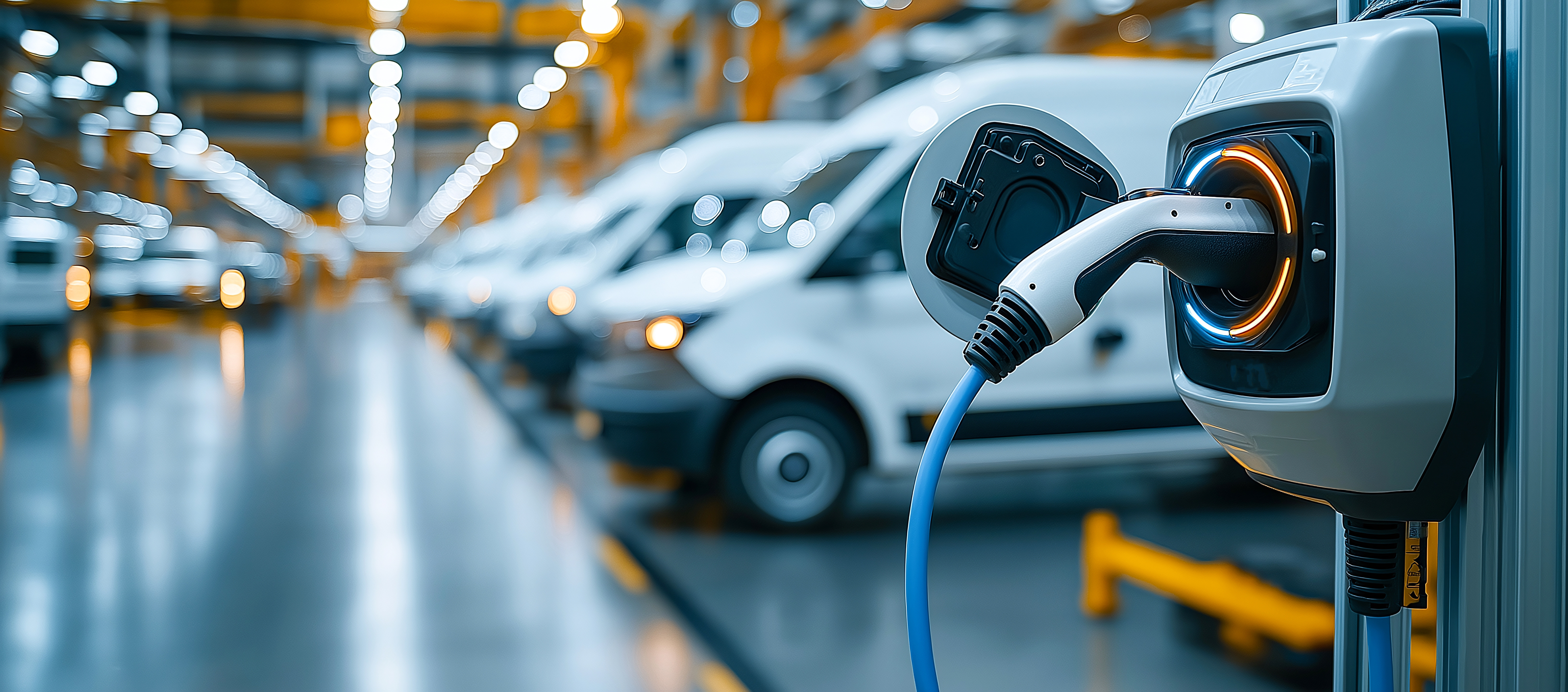
Electric vehicles (EV)
Electric vehicles (EV) are cars, lorries or other transportation vehicles that rely on full or partial battery power. There are several types of electric vehicles, including hybrid electric vehicles (HEV), battery electric vehicles (BEV) and plug-in hybrid vehicles (PHEV). Learn more about Geotab and EVs here.
Electric vehicle supply equipment (EVSE)
Electric vehicle supply equipment (EVSE) is the intermediary between a power source and the vehicle’s charging port. It is typically mounted on a wall or raised on a pedestal. Its role is to safely relay the alternating current (AC) power to the vehicle.
Electric vehicle service provider (EVSP)
An electric vehicle service provider (EVSP) provides connectivity across a network of charging stations. Connecting to a central server, it manages the software, database and communication interfaces that enable operation of the station.
Electric Vehicle Suitability Assessment (EVSA)
An Electric Vehicle Suitability Assessment (EVSA) is a customised, interactive tool from Geotab that provides EV make and model recommendations for fleets. The tool is powered by Geotab’s largest collected EV telematics dataset in the world and takes into consideration: EV availability in the local market, EV performance in extreme weather conditions, financials related to procuring the EVs and more.
Engine diagnostics
Engine status data for all major engine protocols, such as rpm, voltage, fuel usage, coolant temperature and fluid levels, can be communicated through the Geotab telematics device which plugs into the OBD II port. These onboard engine diagnostics come in the form of diagnostic trouble codes (DTCs) that can be specific to an OEM.
Engine hours
Engine hours tells you the actual hours an engine has run, which is different from what is tracked by the odometer, which is actual miles driven. For example, the odometer reading would not include time idling at a red traffic light. In high-idling applications, this measurement can help provide more accurate maintenance parameters. This is also how electronic logging devices (ELDs) are able to automatically log driver hours.
EVSE product manufacturer
An EVSE product manufacturer is a company that produces charging station hardware. Electric vehicle charging services are offered by EV charging network providers.
Expandability
Expandability refers to technology that supports additional integrations with other software or hardware to extend capabilities. To learn about specific expandability options for Geotab.
F
FIPS 140-3 validation
FIPS 140-3 validation is a benchmark for cryptographic modules which protects sensitive computer and telecommunication system data for the U.S. and Canadian government as well as for the military.
Fleet compliance
Keeping up with compliance standards is a key part of fleet management, especially during times of crisis. Fleet compliance refers to the adherence to regulations such as digital tachograph, tax reporting and driver vehicle inspection reporting (DVIR) to name but a few.
Fleet electrification
Fleet electrification refers to the switchover of fleets from internal combustion engines (ICE) to electric vehicles (EVs). Electrifying a fleet can help to maximise fleet efficiency and contribute to green initiatives within the transportation industry.
Fleet integration
Fleet integration is the process of connecting multiple software systems within a fleet to facilitate business automation and greater visibility, accuracy and efficiency.
Fleet optimisation
Through the use of telematics, fleets can improve — or optimise — many different areas of operations, such as fuel efficiency, idle time, vehicle maintenance and fleet utilisation. Learn more about fleet optimisation and benchmarking.
Fuel usage
This measurement indicates how much fuel is consumed by a vehicle.
G
Gamification
Gamification is the concept of turning safe driving habits into a game or competition. Using the MyGeotab software and an integrated gamification solution, managers can see the top safest drivers and then reward good driving behaviour, as well as create friendly competition among drivers.
Geofencing
Geofencing allows managers to create zones of various types such as an office or customer location. For example, if a certain vehicle shouldn’t leave a particular jobsite, a fleet manager could set up a geofence for that vehicle around the area it should stay in. With exception reporting, the manager can then receive alerts if that vehicle travels outside the geofence.
Geotab Drive
Geotab Drive is a Mobile App operated in conjunction with the Geotab GO telematics device, used for hours of service (HOS) logging, driver identification, driver vehicle inspection reports (DVIR) and driver messaging.
GO device
The Geotab GO is a telematics device for fleet management with state-of-the-art GPS technology, G-force monitoring, GEOTAB IOX expandability and engine and battery health assessments, with data security measures.
GO RUGGED
The GO RUGGED is a ruggedised telematics device by Geotab, designed for harsh environments and for use in off-road vehicles, mining equipment, heavy machinery and more. The protective covering on a GO RUGGED device shields the internal electronics from elements like dust and water.
GO TALK
Geotab’s GO TALK is a driver coaching solution that delivers spoken messages to the driver in near real-time to help improve fleet safety. It does this by tracking hard cornering, speeding and other risky behaviours and letting a driver know immediately that they should modify or change a particular behaviour.
G-force
Measured by an accelerometer, G-force is the movement of the vehicle and acceleration, whether left/right, up/down, forward/back. This information helps fleets to reconstruct accidents.
Global Alliance for Vehicle Data Access (GAVDA)
GAVDA stands for the Global Alliance for Vehicle Data Access, a group that works to preserve and enhance the open, secure, technology-neutral and direct access by vehicle owners to real-time data.
Global Positioning System (GPS)
GPS, or the global positioning system, is a navigation network of satellites, monitoring stations and receivers used to transmit global location data. GPS is used in devices like mobile phones and in-car navigation systems to help track location and provide directions from point A to point B.
GPS fleet tracking
GPS fleet tracking enables fleets to understand vehicle location and other fleet activities. For Geotab, GPS tracking is much more than “dots on a map” and also includes many other focus areas such as driver safety, fleet compliance, vehicle emissions and vehicle health.
Green fleet
“Green fleet” is a term used to reference fleets that are focused on sustainability, with goals to reduce environmental impact through initiatives such as decreasing greenhouse gas emissions and fuel consumption, and the adoption of electric vehicles.
H
Hybrid electric vehicle (HEV)
A hybrid electric vehicle (HEV) is a vehicle that contains both an onboard battery and an internal combustion engine (ICE). An example of an HEV is the Toyota Prius. HEVs contain small onboard batteries that are charged via regenerative braking and cannot be charged externally. The included battery is only used when idling or when the car moves off from a stopped position.
I
Internal combustion engine (ICE)
An internal combustion engine (ICE) is a traditional engine powered by petrol, diesel or organic material-based fuels. It is the most commonly used type of engine on the road, even with the rise of electric vehicles (EV). Vehicles that have an ICE generally require substantially more maintenance than EVs as they are made up of multiple moving parts that work to power the vehicle. ICEs are much more efficient now than when they were first invented, but are still nowhere near as efficient as EVs.
Internet of Things (IoT)
The Internet of Things (IoT) is the trend toward “smart” products, from smart products in your home such as refrigerators and lights, to products used in transportation such as smart traffic signals that can modify signal timing based on traffic flows throughout the day. Other examples of IoT in the automotive industry are car sharing companies, where a user can reserve, unlock and rent a vehicle through an app on their phone.
In-vehicle coaching
In-vehicle coaching is when a device inside the front of the vehicle is able to alert drivers about their driving through audible and/or visual alerts.
IOX technology
IOX technology allows Geotab GO input/output device expansion. It allows you to connect other hardware to the device and further its capabilities using other Add-Ons. Geotab GO TALK is an example of IOX technology, in which the GO TALK device is connected to the Geotab GO device, sending driving tips and behaviour alerts to the vehicle operator in real-time.
J
J1939
The J1939 standard was developed by SAE International to create consistency in how different components in a vehicle communicate with each other. The standard is used in conjunction with the controller area network bus (CAN bus) system for medium and heavy-duty commercial vehicles to send and receive signals within a vehicle. Included within J1939 is the digital annexe (DA), which defines thousands of signals used on a CAN bus.
K
Kilowatt-hours per mile (kWh per mile)
Kilowatt-hours per mile (kWh per mile) represent how much electricity an EV uses in one mile driven, indicating its fuel efficiency.
M
Machine learning
Machine learning is what makes modern predictive modelling possible, meaning that through historical data, a computer/artificial intelligence can learn about what’s most likely to happen next. Machine learning is one aspect to autonomous vehicle technology that makes it more than just sensors and cameras. It can continue to learn more and more about the roads it travels on and use that for subsequent trips when the vehicle is on that road again.
Management by measurement
“Management by measurement” is a phrase used in business referring to the practice of making decisions based on data. Vehicle telematics is one method by which business or government fleets can gather intelligence to help inform future decisions about operations.
Marketplace
The Geotab Marketplace is an online solutions centre where fleets can browse for business-specific Add-Ons and software Add-Ins and Apps to integrate with their Geotab telematics system, such as a fuel tracker, driver scorecard or collision reconstruction.
Maximum range
The total number of miles an EV can be driven before it needs to stop and recharge. The maximum range is determined by a number of different factors including temperature, operating climate and vehicle age. The older a vehicle is, the more susceptible it is to battery degradation, which can lessen the maximum range over time.
Miles per gallon of petrol-equivalent (MPGe)
Miles per gallon of petrol-equivalent (MPGe) is a metric used by the Environmental Protection Agency (EPA) to compare the fuel economy of EVs and other alternative fuel vehicles with that of vehicles running on petrol.
MyGeotab
MyGeotab is the fleet management software that pairs with the Geotab GO telematics device (though the software is device-agnostic and can be used with other telematics devices). The web-based, scalable software provides dashboards to actually view the data and trends about a fleet, and to view and export reports and benchmarking data. MyGeotab is at the heart of what makes the system friendly for the end user and brings value to fleet operations.
MyGeotab rules engine
A feature of the Geotab telematics platform that allows users to set fleet management rules for drivers such as for maximum speed limit, idling time or EV charging, then monitor compliance in MyGeotab.
N
Nearest vehicle
Using telematics, fleets can improve dispatching through a feature that makes it possible to locate the nearest vehicle to a particular customer stop on a map. For example, when a service or a emergency service fleet gets an emergency call, instead of calling each mobile worker to check if they can respond to the job and find out exactly where they are, a dispatcher can easily see which vehicle and worker are closest to the job and dispatch and route them straight from where they are.
Near-field communication (NFC)
Near-field communication (NFC) is a collection of communication protocols that enables communication between two nearby devices. In fleet management, it can be used in conjunction with telematics devices to verify driver identity and allow sign-in to specific vehicles.
O
OBD II
Onboard diagnostics port (OBD-II) is an automotive electronic system for vehicle self-diagnosis and reporting capabilities.
Odometer
An odometer in a vehicle depicts the actual miles driven. This is not to be confused with a vehicle’s actual engine hours (see separate glossary entry).
OEM (original equipment manufacturer)
The term “original equipment manufacturer”, abbreviated to “OEM”, refers to companies that produce cars and lorries and also those that manufacture parts and equipment for vehicles.
OEM embedded telematics
OEM embedded telematics refers to vehicle manufacturers (OEMs) that provide factory-fit, built-in modems to record and process telematics and other connected vehicle data. These embedded telematics systems require no installation and can be integrated with select cloud-based telematics, like Geotab, for management of multiple vehicle makes on one platform.
Onboard charger
An onboard charger is a factory-installed charging device used in conjunction with AC charging EVs. It works by converting alternating current (AC) power from an outlet to direct current (DC) power to charge the battery in an EV. The charging speed may vary but the most common onboard chargers are 6.6 kW on battery electric vehicles (BEVs) and 3.3kW on plug-in hybrid electric vehicles (PHEVs).
Open platform
Open platform means a telematics system which provides open or free access to the data through a software development kit (SDK) and application programming interfaces (APIs) — see separate glossary entries for both. In contrast, a closed platform may have vehicle manufacturer-specific hardware and the access to data is limited or filtered. Open platform users have flexibility for integrating telematics with their other business systems and using partner vendor devices or third-party applications and solutions such as those from the Geotab Marketplace.
Over the air (OTA)
Over the Air (OTA) testing evaluates the performance of the integrated aerial on a telematics device (and many others) to understand the safety and risks behind using a particular type of device — consider all the safety labels seen on electronics in general. This particular test makes sure that the device meets the minimum levels of radiation (total radiated power) and sensitivity (total isotropic power) and is only one of three main aspects of testing these types of devices.
P
Plug-in hybrid electric vehicle (PHEV)
A plug-in hybrid electric vehicle (PHEV) has a two-part drive system, including an electric drive and a small internal combustion engine running on fuel. The other two main types of EVs are hybrid electric vehicles (HEV) and battery electric vehicles (BEV).
Preventive maintenance
Preventive maintenance is the scheduled maintenance to regularly check a vehicle for potential problems. Getting the oil changed is just one part of a preventive maintenance check. Other tasks include checking all fluid levels, brakes, tyres and so on. Telematics goes hand in hand with preventive maintenance because fleets can keep track of maintenance scheduling and even get alerts when the engine triggers a diagnostic trouble code, which means there could be something wrong with the vehicle. The fleet can then get the vehicle into the garage while a technician can diagnose the problem before the vehicle even gets there.
Productivity
Fleet productivity is an understanding of employee work output, which can be measured by dividing hours worked by breaks and downtime.
ProPlus
ProPlus is a fleet management rate plan from Geotab.
R
Range anxiety
Range anxiety refers to an EV driver’s fear of running out of electricity before the end of a trip.
Remote diagnostics
Remote diagnostics is a solution that fleets can use to set up automatic alerts on diagnostic trouble codes (DTCs) generated by the engine’s computer, along with severity, fault description and recommendations for action. The benefits of remote diagnostics include helping to prepare technicians in advance so they have the right parts, and decreasing vehicle downtime.
S
Scalability
Scalability means being able to increase in size and strength as a business evolves and grows.
Scorecard
A driver scorecard is a useful tool that allows fleet managers to measure and rank driver performance, with the goal of improving safety, productivity, efficiency or even compliance. Fleets can customise scorecards to focus on speeding, sharp braking, engine light on, idling, fuel consumption or other metrics.
Software development kit (SDK)
A software development kit (SDK) is the set of tools, information and examples given to other software developers on how to work with the data. The SDK along with APIs (see separate glossary entry on APIs) enable what’s called open platform telematics (see separate entry).
Seat belt usage
Seat belt usage can actually be tracked by a telematics system such as the Geotab seat belt report, which lets managers know which drivers aren’t using their seat belt. It can also be used as part of the Geotab GO TALK in-vehicle coaching add-on (see separate glossary entry).
Smart city
Smart cities leverage connected infrastructure, sensors and IoT devices to help solve urban challenges like traffic congestion, service delivery for growing populations, and public health and safety. Telematics and urban analytics are the building blocks of smart cities, providing local regions with a real-time view on city operations and conditions.
State of charge (SOC)
State of charge (SOC) refers to the amount of battery power left in an EV, as measured in percentage.
Sustainability
Sustainable fleet management is the practice of focusing on and reducing environmental impact by making fleet enhancements and using management tools for fuel and CO2 emissions tracking, route optimisation, and the adoption of electric vehicles.
T
Tachograph
A tachograph is a device affixed to a vehicle weighing at least 3.5 tonnes that automatically records data on speed and distance together with the driver's activity selected from a choice of modes. To learn more about driving hour regulations in Europe see, EU-regulation (EC) No 561/2006.
Telematics
Telematics is the monitoring of a car, lorry or other type of equipment or asset with a device to track GPS location, vehicle speed, driving behaviour and other engine data for fleet management and optimisation.
Third-party device integration
The ability to connect partner devices to the Geotab platform so the data can be viewed alongside Geotab telematics data in MyGeotab, to allow common rules and reporting.
Trips
Vehicle trips from point A to point B can be tracked by telematics and viewed from a fleet management software portal or app. In Geotab, a trip is defined from when the vehicle starts moving to when the vehicle starts moving again after a stop (when the vehicle ignition is turned off or when the vehicle has a speed of less than 1 km/h [less than 1 mph] for more than 200 seconds).
U
Urban analytics
Urban analytics is the collection and analysis of data on smart city processes and environments. Hazardous driving areas, junction metrics, areas of idling and hyper-local precipitation are examples of datasets that smart cities can use to support traffic optimisation and improve safety and the environment.
Ultra Low Emission Zone (ULEZ)
The Ultra Low Emission Zone (ULEZ) is an area in Central London where drivers must pay a daily fee for driving within the zone. The initiative was put in place to improve air quality in this heavily populated area and encourage the use of more environmentally friendly vehicles. For more information on how the UK is encouraging green fleets, read this white paper.
V
Vehicle dwell
Vehicle dwell is where a fleet vehicle resides when not in use. For most vehicles this would be a garage, driveway or fleet yard.
Vehicle Identification Number (VIN)
The Vehicle Identification Number (VIN) assigned to every vehicle is what tracks the vehicle throughout its life, no matter who owns it. For large fleets, keeping track of these can be a pain. VINs are important since they can also tell you if there have been any recalls on the vehicle, for example. MyGeotab has a VIN lookup tool to help manage VINs.
W
Watchdog Report
The Watchdog Report in MyGeotab tracks the status of all Geotab GO devices within your fleet and shows whether a device has been used recently, is installed correctly or is working properly. For more information on using the Watchdog
Z
Zero-emissions
Zero-emissions refers to a global movement towards sustainability based on EVs generating lower or zero greenhouse gas emissions and the use of other clean, sustainable technology. For more information on the road to zero-emissions, see here.
Zones
Creating a zone is a key functionality in telematics software and allows fleet managers to track metrics on productivity, such as how long a vehicle stopped at a customer location for a drop-off.
Subscribe to the Geotab Blog
Geotab
Table of contents
- 3
- 3G sunset
- 4G LTE network
- 5G network
- Accelerometer
- AC charging
- Active tracking
- Aggressive driving
- Alternative fuels
- Application Programming Interface (API)
- Asset tracking
- Asset utilisation
- Autonomous vehicles
- Battery electric vehicle (BEV)
- Battery voltage
- Business intelligence and data analytics
- Collision reconstruction
- Connected vehicles
- Controller area network bus (CAN bus)
- Cost of ignoring (COI)
- Curve logging algorithm
- Cybersecurity
- Dash cam
- Data feed
- Data privacy
- Data normalisation
- Data visualisation
- DC fast charging
- Digital transformation
- Distracted driving
- Driver feedback
- Drowsy driving
- Duty of care
- Electric vehicles (EV)
- Electric vehicle supply equipment (EVSE)
- Electric vehicle service provider (EVSP)
- Electric Vehicle Suitability Assessment (EVSA)
- Engine diagnostics
- Engine hours
- EVSE product manufacturer
- Expandability
- FIPS 140-3 validation
- Fleet compliance
- Fleet electrification
- Fleet integration
- Fleet optimisation
- Fuel usage
- Gamification
- Geofencing
- Geotab Drive
- GO device
- GO RUGGED
- GO TALK
- G-force
- Global Alliance for Vehicle Data Access (GAVDA)
- Global Positioning System (GPS)
- GPS fleet tracking
- Green fleet
- Hybrid electric vehicle (HEV)
- Internal combustion engine (ICE)
- Internet of Things (IoT)
- In-vehicle coaching
- IOX technology
- J1939
- Kilowatt-hours per mile (kWh per mile)
- Machine learning
- Management by measurement
- Marketplace
- Maximum range
- Miles per gallon of petrol-equivalent (MPGe)
- MyGeotab
- MyGeotab rules engine
- Nearest vehicle
- Near-field communication (NFC)
- OBD II
- Odometer
- OEM (original equipment manufacturer)
- OEM embedded telematics
- Onboard charger
- Open platform
- Over the air (OTA)
- Plug-in hybrid electric vehicle (PHEV)
- Preventive maintenance
- Productivity
- ProPlus
- Range anxiety
- Remote diagnostics
- Scalability
- Scorecard
- Software development kit (SDK)
- Seat belt usage
- Smart city
- State of charge (SOC)
- Sustainability
- Tachograph
- Telematics
- Third-party device integration
- Trips
- Urban analytics
- Ultra Low Emission Zone (ULEZ)
- Vehicle dwell
- Vehicle Identification Number (VIN)
- Watchdog Report
- Zero-emissions
- Zones
Subscribe to the Geotab Blog
Related posts
Fleet management tools for SMEs: scale and stay UK compliant
July 15, 2026
2 minute read
2026 Sustainability roadmap: fleet electrification & European CO2 rules
July 15, 2026
3 minute read