%20(1).jpg)
Aggregate movement intelligence from Altitude by Geotab
Get a complete, anonymized view of commercial vehicle movement—delivered in a privacy-first format to support infrastructure, planning, and sustainability decisions across industries.
Plan with confidence. Grounded in observed movement
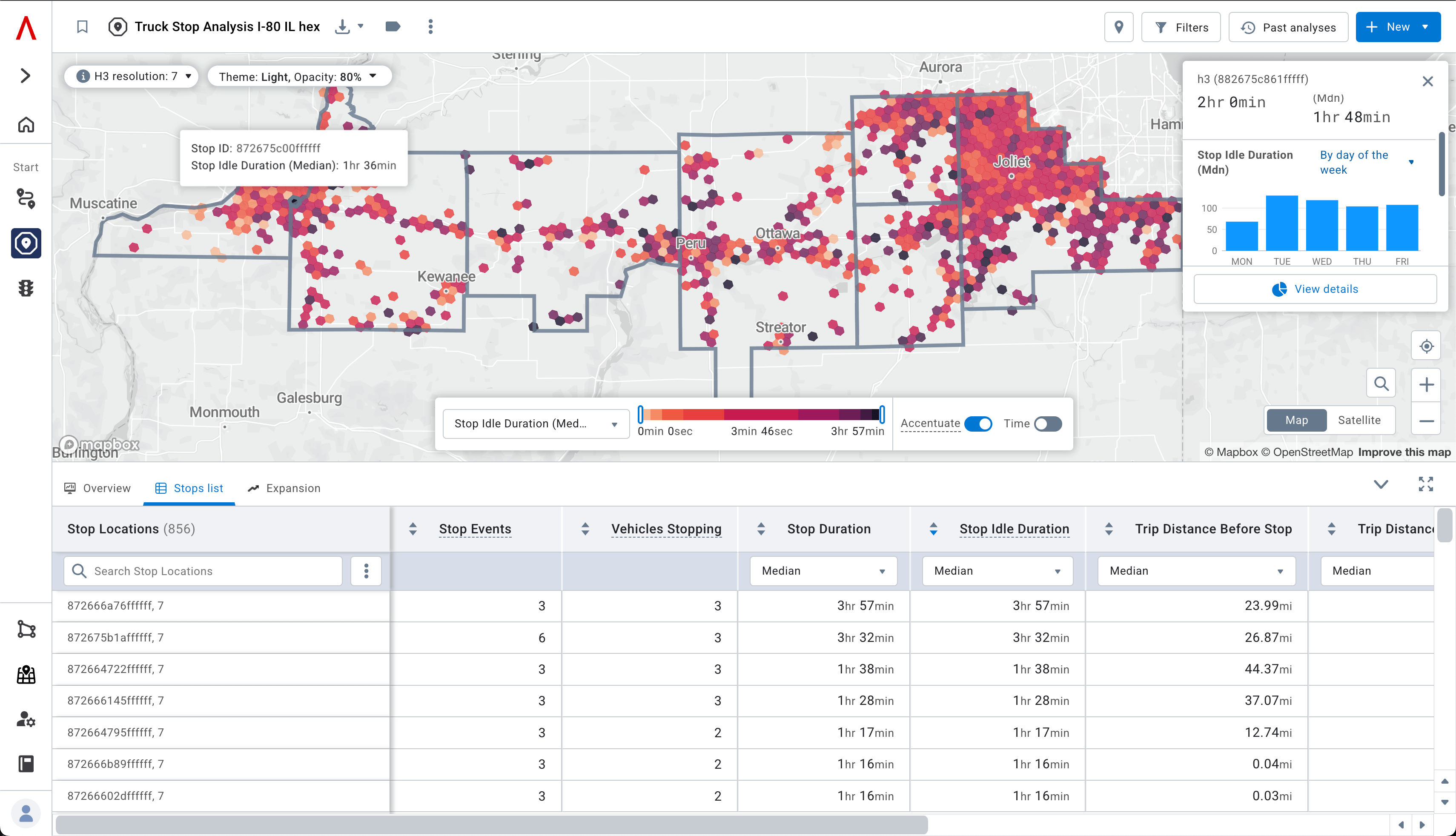
Altitude by Geotab provides historical, aggregate insights into commercial vehicle movement across North America. Used by state agencies, infrastructure planners, utilities, and data platforms, Altitude transforms billions of anonymized trips into actionable intelligence — without relying on real-time tracking.
Whether you're modeling regional traffic demand, validating EV infrastructure plans, or optimizing site selection, Altitude adds the movement context your solution needs.

Purpose-built for modern infrastructure and mobility planners
Altitude by Geotab delivers reliable, contextualized movement intelligence to support smarter infrastructure decisions. Designed for transportation agencies, utilities, consultants, and commercial strategists, Altitude equips your team with planning-grade insights that drive results:
- DOTs and MPOs prioritize freight corridors and investments using real-world movement patterns.
- Utilities and energy planners model EV charging demand with VMT, trip density, and idling data.
- Site selection teams and developers evaluate location potential based on commercial traffic flows.
- Consultants and analytics platforms quantify bottlenecks, parking demand, and long-term trends.
- Traffic engineers and public works teams assess congestion and pavement stress from heavy vehicle volumes.
- Mobility and GIS platforms enrich tools and dashboards with integrated, spatially contextualized data.
Plan with confidence using trusted movement insights
- Planning-grade quality
Built specifically for long-term decision-making — not dispatch or real-time routing. - Contextualized & aggregated
Insights are anonymized, de-identified, and presented at the right geographic and temporal resolution. - Trusted by planners
Used by leading transportation agencies and infrastructure partners across North America. - Backed by Geotab
Powered by one of the world’s largest commercial vehicle networks.
.jpg)
Who we help: Success Stories

CIMA+ optimizes EV infrastructure planning
How CIMA+ uses Altitude’s transportation insights to identify strategic EV charging locations.

WSP powers next-gen state freight plans
WSP integrates Altitude into DOT freight planning to prioritize high-impact corridor upgrades.

SCAG accelerates regional transportation strategy
Southern California Association of Governments uses Altitude to coordinate cross-jurisdiction planning.

NYC DOT uses movement insights to improve mobility
New York City DOT turns commercial movement data into safer, more efficient road projects.

The Ray and Altitude partner for sustainable highways
How Altitude supports The Ray in building data-driven sustainable freight corridors.
Commonly asked questions
What is Altitude by Geotab?
A Geotab business line offering mobility insights for infrastructure and site planning—not fleet telematics.
How is it different from Geotab telematics?
Geotab helps fleets; Altitude helps planners. It uses aggregated data to improve roads, corridors, and mobility.
Is the data safe?
Yes. Altitude uses a PII-safe layer to anonymize all vehicle data before analysis. No driver or fleet can be identified.
What data does Altitude use?
Anonymized, aggregated commercial vehicle movement data, validated with public benchmarks like HPMS.
Who uses Altitude?
Public sector planners, MPOs, DOTs, consultants, utilities, and petroleum strategists.
Is it available by API?
Yes. Use Altitude via UI or integrate directly into GIS tools and planning workflows with our API.
Does Altitude sell emissions or compliance data?
No. We don’t sell fleet data. We provide road-level mobility insights for planning, not for compliance enforcement.
Is Altitude available globally?
Currently, Altitude is available in the U.S. and Canada.
Gain perspective with Altitude
Explore how aggregate movement data can enhance your platform or planning process.