What’s new in MyGeotab — Version 6.0
Welcome to our latest summary of updates in MyGeotab.
Dec 23, 2022
Geotab Users: To verify your version: go to MyGeotab > Administration > About, and check the build number, (e.g. 6.0.xxx release).
Partners: Review this post for important changes affecting your customers and note any recommendations. If you have suggestions for improvement, please leave a comment below.
Sign up for Geotab news
Stay up to date on what’s new. Please subscribe to the Geotab newsletter to get these update posts emailed to you.
✱ NOTE: The images shown here are for illustration purposes only, and may appear different in the software as we approach the final release
Release naming convention: We have changed our software version naming convention from “YY+release number” (e.g. 2104) to X.X (e.g. 6.0.0). Instead of 5.7.2104, the notation of this version is 6.0.0. The release that follows will be 7.0.0, and so on.
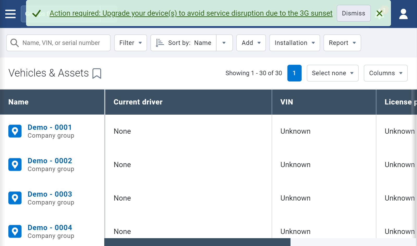
3G sunset
Urgent action required
Major wireless network carriers in the U.S. are in the process of phasing out their 3G networks. Commonly referred to as the 3G sunset, this is the period when wireless carriers shut off their 3G services to make room for new technology. When this occurs, devices that are not compatible with 4G (LTE) or higher, may no longer receive cellular service. Depending on your region or your carrier, some 3G devices may fall back to 2G.
To make sure that you and your Customers are aware that there are devices in your databases that will be affected by the sunset, an urgent reminder will display directly in your database, starting in 2022. Only Administrators will see these messages.
✱ NOTE: The 3G sunset reminder will display in versions 2103, 2104 and the current release, 6.0.0.
Users
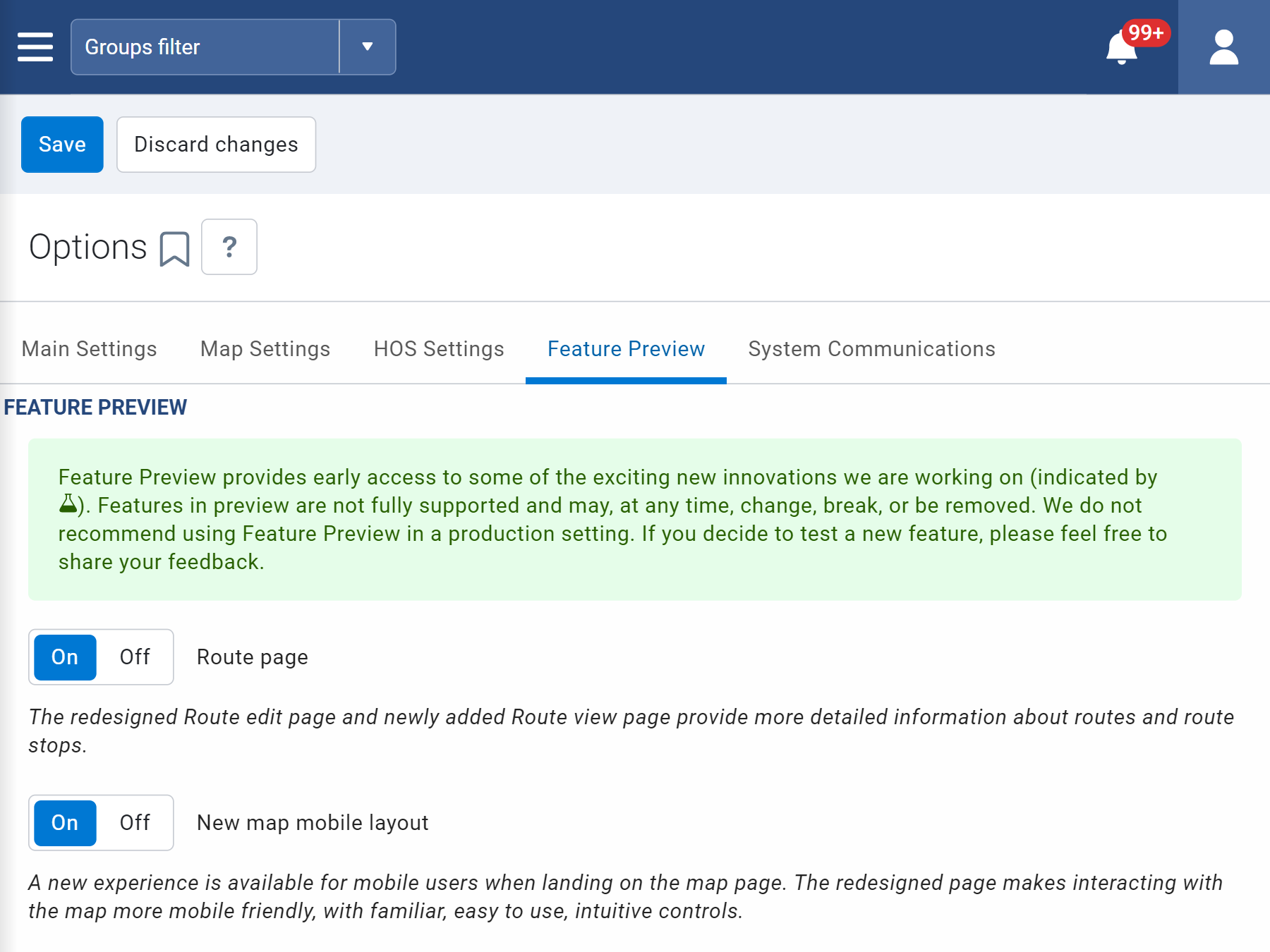
A new way to use Feature Preview
Feature Preview provides early insight into upcoming releases, as well as the opportunity to help shape the products that work for you. Choose which features to preview with easy-to-use toggles that turn features on and off as you explore them. You can preview all features, or just the ones that make sense for your fleet. You can now find Feature Preview under its own tab on the User Edit page, or in your Options window.
Routing
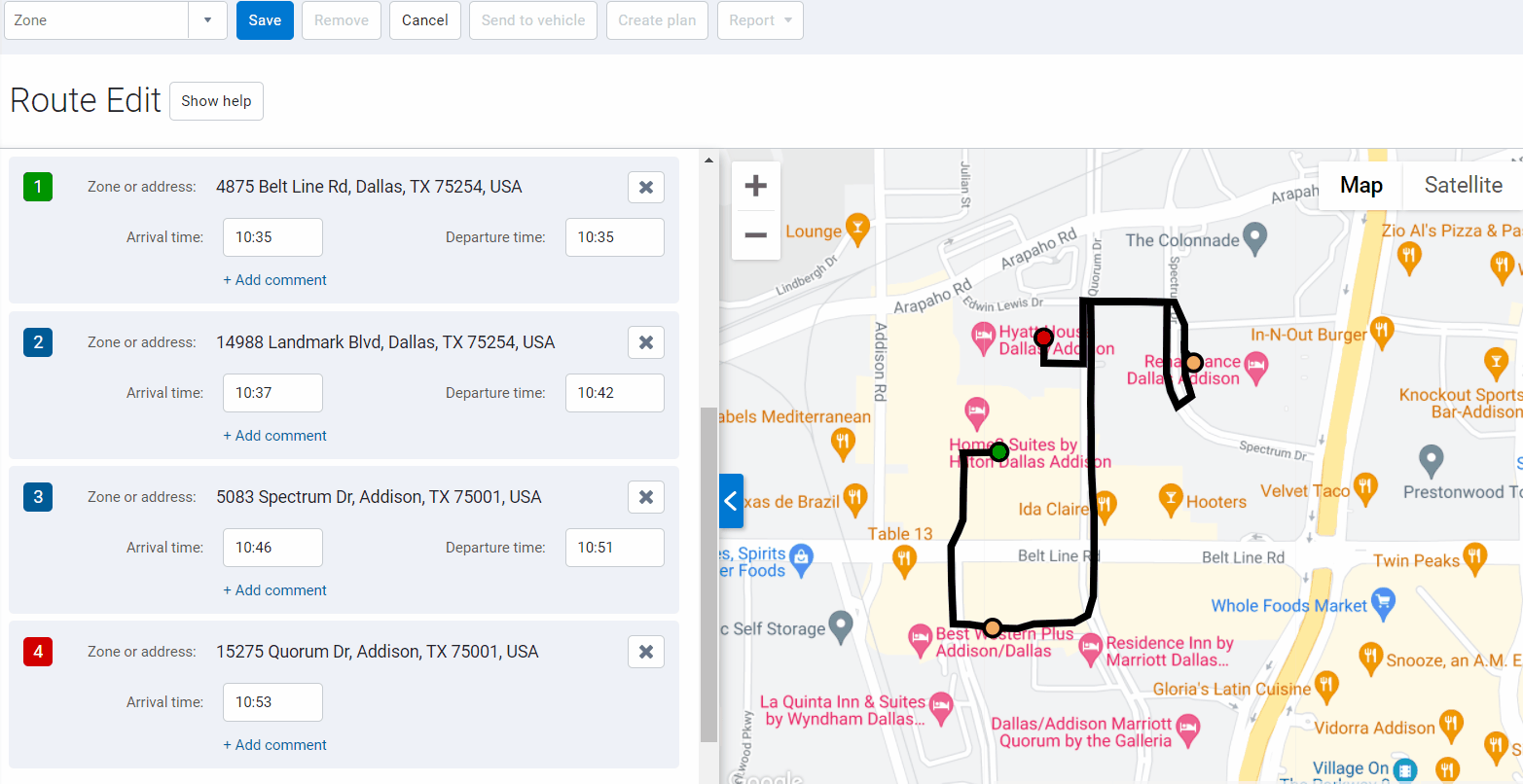
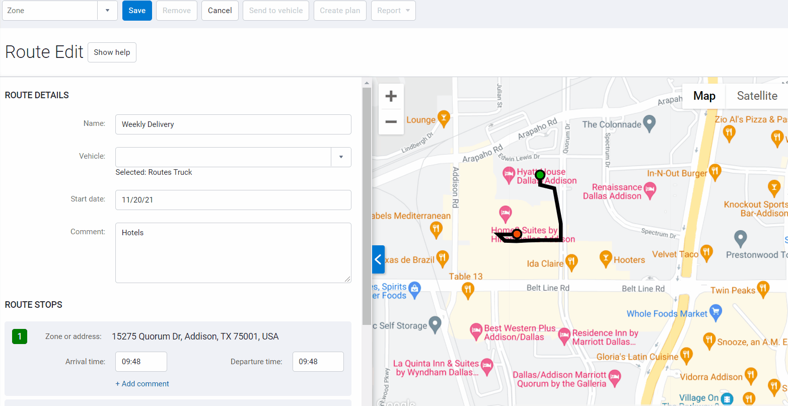
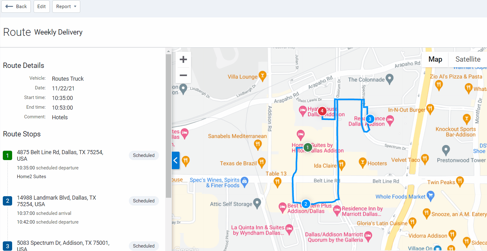
Redesigned Route Edit page (Feature Preview)
We continue our work to provide meaningful design and improved usability for fleets of all sizes. For this release, we have updated the Route Edit and new Route View pages with interactive, side-by-side views of the Map, and related activity.
Key updates include:
- Ability to add notes to each route stop.
- Progressive route status including Scheduled, Missed, Completed.
- Improved design with added colors for better contrast between stops.
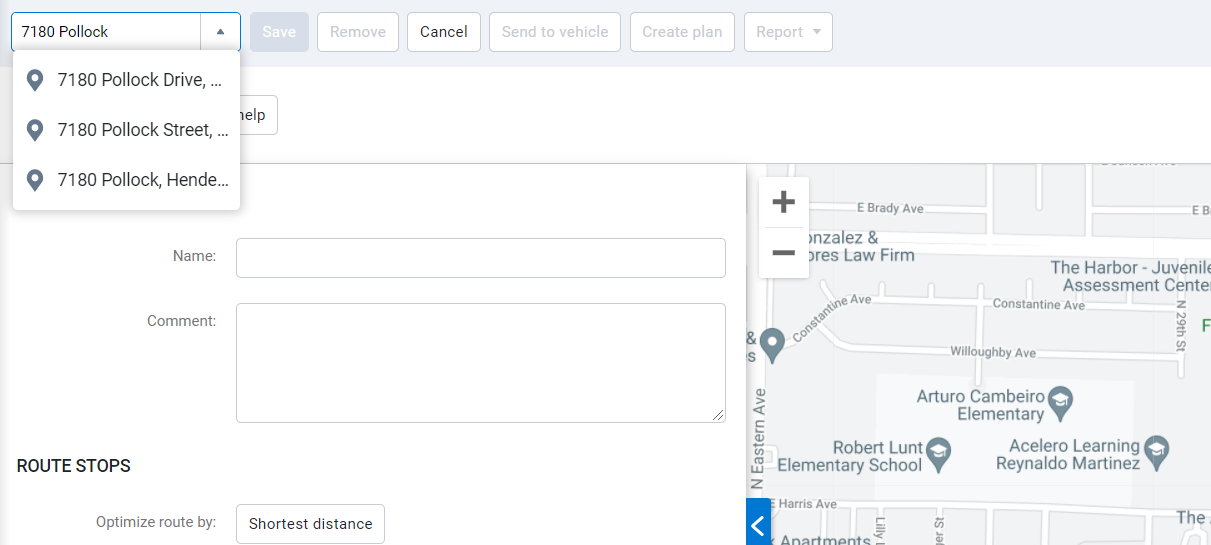
Predictive text for addresses and waypoints (Feature Preview)
For faster searches, we added predictive text capability to the Search field. Users can now enter a partial address or waypoint, then choose from three suggestions based on current proximity on the Map.
Route name in vehicle balloon (Feature Preview)
The name of the route assigned to a vehicle is now visible in the vehicle balloon on the Map.
Rules
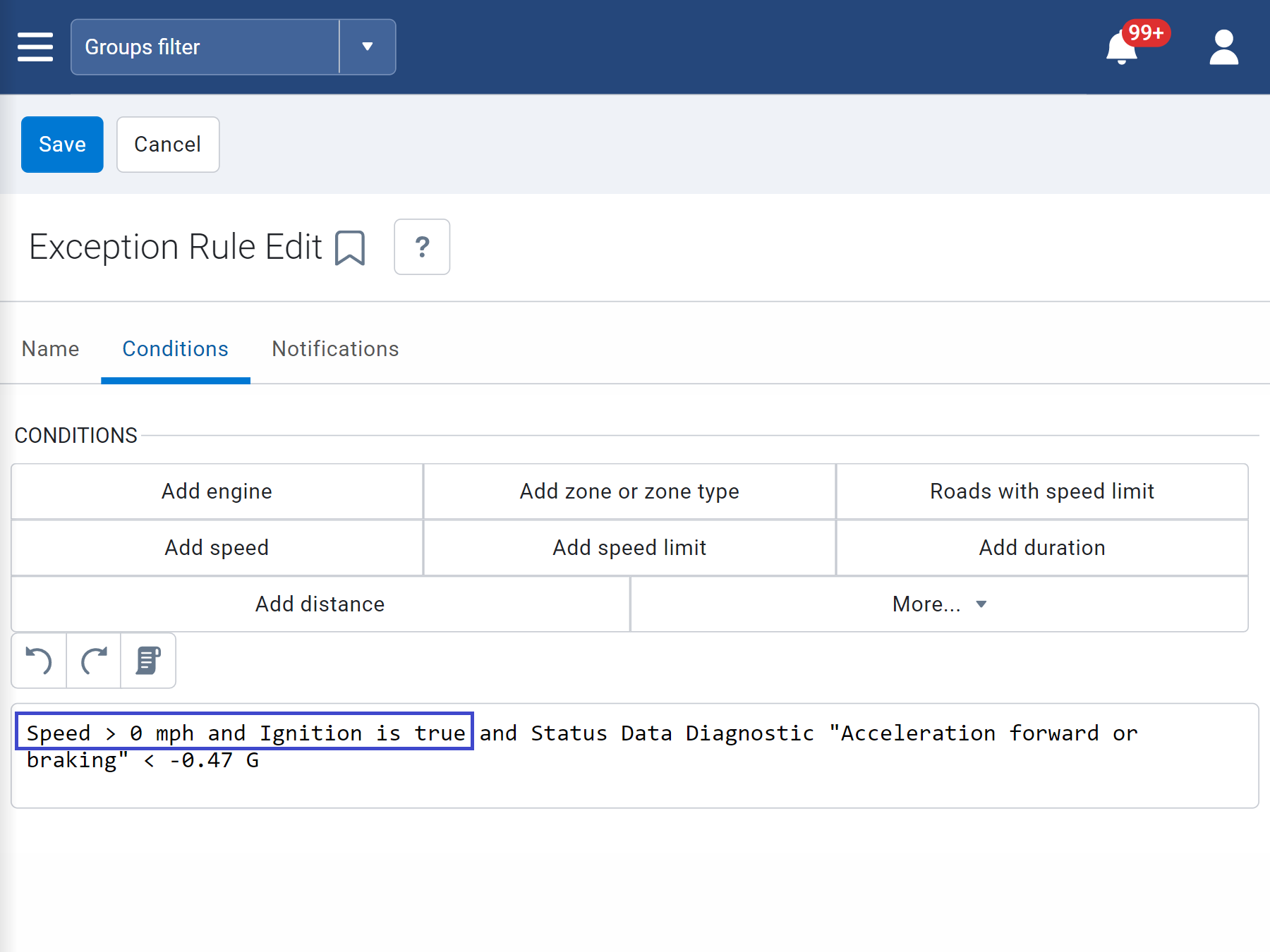
New conditions for Accelerometer rules
To better report accelerometer-based events such as harsh braking, harsh cornering, and hard acceleration, we have added Ignition ON and Speed greater than zero conditions to the rules. Users with harsh braking, harsh cornering, and hard acceleration rules enabled will notice improvements after upgrading to the 6.0.0 release. However, historical data will not change unless reprocessed to re-calculate the events.
✱ NOTE: The new conditions apply to default harsh braking, harsh cornering, and hard acceleration rules only. They do not apply to custom rules. We do, however, suggest that users with custom rules add ignition and speed to their conditions.
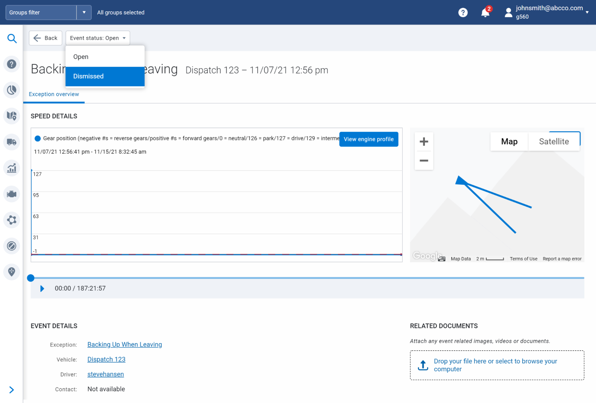
More flexibility for Exception Events (Feature Preview)
For additional context, users can now add comments, links and attachments to the Exceptions Events page.
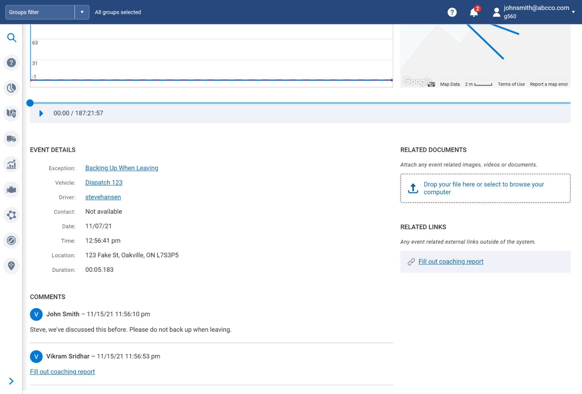
In scenarios where discretion is required, supervisors can dismiss exceptions that are outside the driver's control, such as harsh braking events caused by defensive driving maneuvers (for example, a vehicle cut off by another driver on the road).
✱ NOTE: To prevent dismissed events from impacting driver scorecards, the option to hide them in reports will be available in an upcoming release.
Mobile App
New Bookmarks menu
We have added a new, conveniently-located Bookmarks menu at the bottom of the screen. The Bookmarks menu displays four features, starting with the Map, Trips History, Assets, and Dashboard — but can be customized by bookmarking other must-have features, such as Zones & Messages. In case they are all your favorites, the main menu is still available through the hamburger icon.
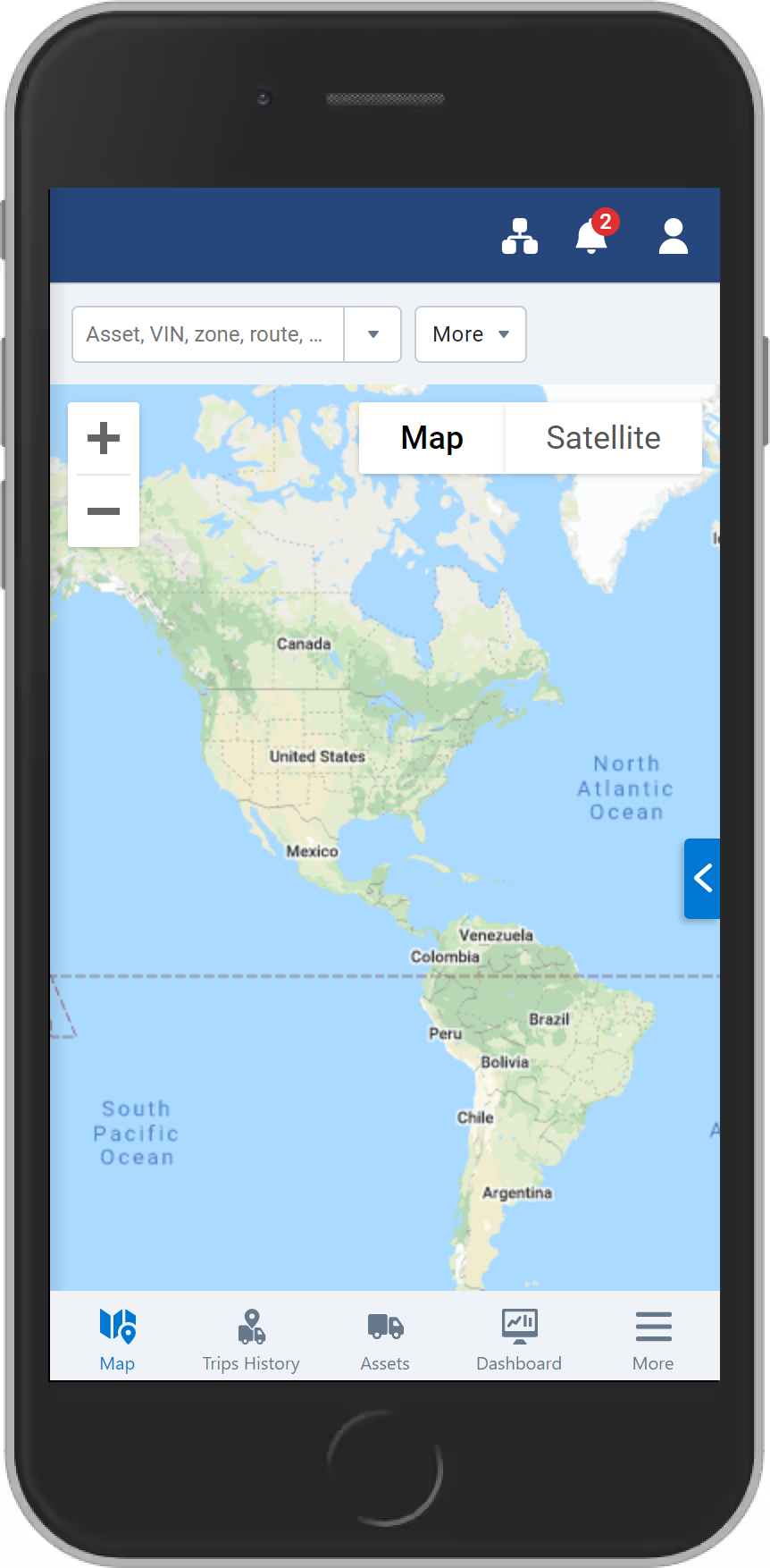
New mobile Map layout (Feature Preview)
We redesigned the mobile Map to place our top features into a compact navigation drawer that only displays content when accessed by users. Using the drawer tool, users can open and close select features from Assets or Add-ins, while maintaining visibility of the Map. Trips are also accessible from the drawer, and can be traced with your finger to display speed and other information along the way. We have also created space by hovering the address bar over the Map along with the Options menu, which can now be opened in full screen.
Live Map Trips History
.png)
Map
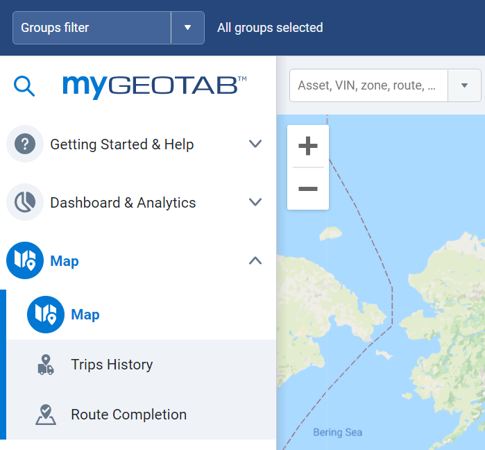
New Map menu
For better navigation between pages, Trips History and Route Completion are now submenus under the main Map menu.
Dashboard & Analytics
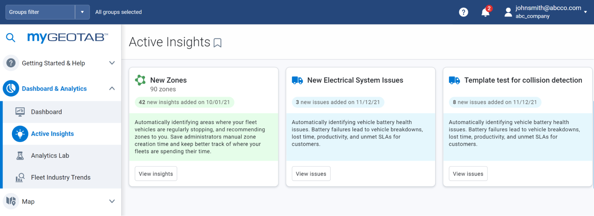
Active insights now out of Feature Preview
In our 2103 release, we introduced Active Insights in Feature Preview. We are excited to announce that Active Insights is out of Feature Preview, and now available to all by default. Thank you to all users who provided valuable feedback. We work hard to create simple and effective solutions, and your participation is an essential part of that process.
For fleet managers with limited resources, Active Insights provides clear and compelling insights into your business by using data analysis and AI models. Active Insights helps turn your data into measurable cost savings, with recommendations on what you can do to optimize your fleet. Visit the Active Insights page to begin your data story today!
Reports
Updated Debug Log Report
We have removed the DebugLocation column from the built-in Debug Log Report. This column displayed the address of individual records. Users with customized Debug Log Reports are not affected by this change.
Engine & Maintenance
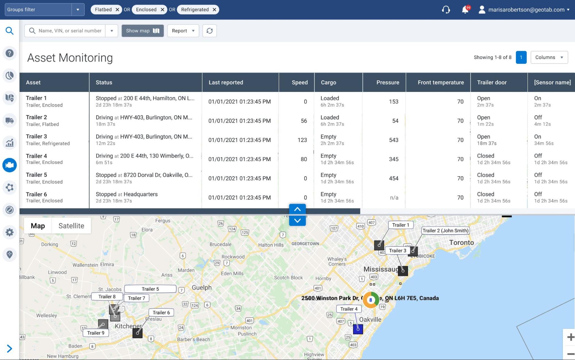
New Asset Monitoring page for asset tracker live data (Feature Preview)
For better asset tracking, we moved asset sensors from Advanced options on the Map page, to a dedicated page of its own under Engine & Maintenance. Live sensor data now displays in a table view with configurable columns that populate the nearby Map for side-by-side analysis. Options to view the Asset Monitoring page as a full-screen table, a full-screen map, or a split screen with both, are also available. We will continue our redesign in subsequent phases, with a focus on improved data display for any sensor that has been mapped in MyGeotab.
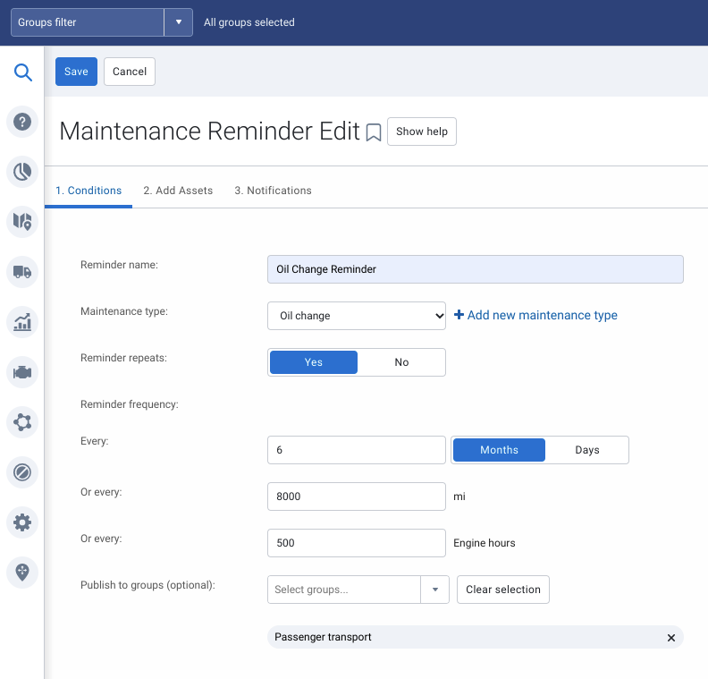
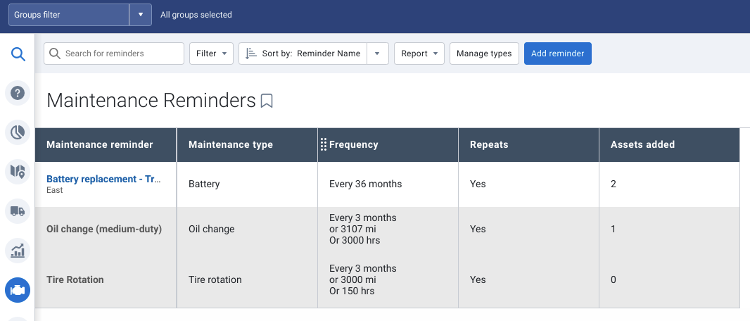
New Publish to groups feature for Maintenance Reminders
For better visibility into Maintenance Reminders, members of a parent group can now publish their reminders to members of a subgroup. Members of the subgroup can then edit the reminder to add assets or modify rule conditions, based on what’s best for their operations. If the subgroup also has subgroups, they too can view the published reminder, but cannot modify it (including those with Additionally allow reporting by enabled). Only the subgroup, with whom the reminder is shared, can modify it. If the parent group is a company group, the same applies. All subgroups under the company group can view the reminder, but only the subgroup, with whom the reminder is shared, can modify it.
The Publish to groups feature is highly flexible, and useful for companies who want to promote transparency, and share data with all users without having to provide access to modify it.
✱ NOTE: When modifying published maintenance reminders, assets must be added one at a time. Since asset types can vary, maintenance schedules can also vary, and may require review by a field supervisor.
Other improvements
- Added “Geotab” to submenus under Getting Started & Help to better identify the contact source for Live Chat, Support tickets, and training tickets.
- Updated “Exceptions report” on the Security clearance page to “View exceptions”, and prevent users without this clearance from viewing them on the Map.
- Updated the sorting order on the Install Logs page to display oldest to newest, show changes in bold, and improve "empty" states (Feature Preview).
- Updated Replace selected devices feature to include a reason, and a field for shipping address.
- Renamed “segment” to “zone” in Public Works route completion when importing to a spreadsheet. Also added a statement indicating the default pass count is two.
- Public Works Route Completion routes can now be imported in Excel file format
MyGeotab/Geotab Drive SDK and Add-In updates
General SDK updates
- Changed the software version naming convention to use three parts (e.g. 6.0.0) from four parts (e.g. 2104). To learn more, click here.
- Fixed an issue in which the NuGet package API.SessionId property generates an InvalidOperationException, if accessed before it is assigned.
- The MyGeotab NuGet package no longer includes a reference to Newtonsoft.json.
- Increased media file size limits to 50 MB for video and 10 MB for images.—
- Added CanadaNorthOf60CycleOneTeam and CanadaNorthOf60CycleTwoTeam to the rulesets.
- The MyAdmin SDK is now available fromhttps://developers.geotab.com/ All pages are in the process of being converted to Markdown format.
- Added Wifi hotspot capability, with Interface to configure hotspot settings on telematics devices.
Contributors:
Vik Sridhar, Product Engineering Manager, MyGeotab, Sarah Kerr, Senior EV Product Manager, Heather Holmes, Technical Writing Manager, Inshaal Badar, Content Manager
Subscribe to get industry tips and insights
The MyGeotab and Technical Writing Teams write about MyGeotab updates for Geotab.
Table of Contents
Subscribe to get industry tips and insights
Related posts

The plug-and-play rental fleet: Upgrade your technology without missing a single booking
April 27, 2026
5 minute read

The Evolution of Product Updates: Welcome to Your New Centralized Hub
December 15, 2025
2 minute read