Marine tracking, or how I spent my summer vacation
Last updated on December 27, 2023 in Driver Safety by John Day | 3 minute read
Table of contents
Learn about how to track your summer vacation on the water with Geotab GO7 Fleet management device.
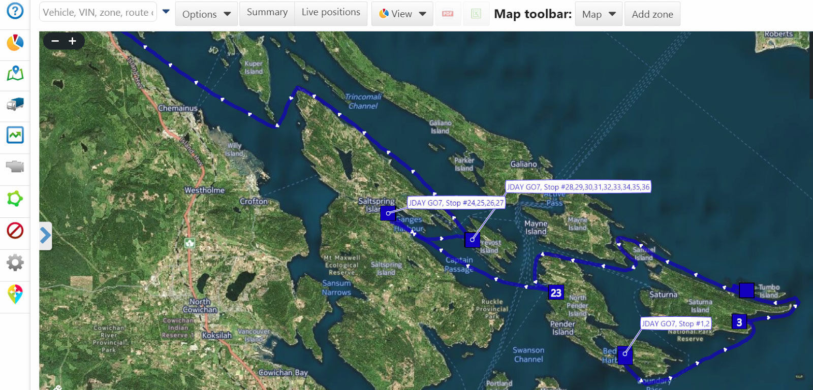
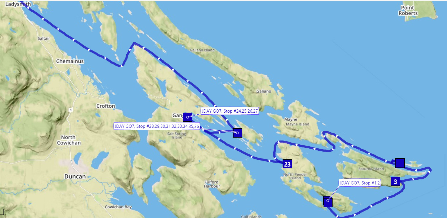
Summer vacations are fantastic. The classic summer vacation involves a road trip, maybe a bit of camping in the wilderness, and kids frolicking in the water. So when I stuck a GO7 in my sailboat (which is really a floating camper van) and showed some folks at work where I went they thought it was pretty cool. But I think it was primarily because they are geeks. They weren't really interested in where I went, just that I could show people - so accurately, and in such detail - where I went. Because in my experience, when you show people where you went on your summer vacation, much like a slide show, their eyes gloss over, they start noticing shiny objects, and they expect you will show the same level of patience when they talk about their equally fascinating summer vacation...
But it got me thinking (again) of using the Geotab platform for Marine Tracking as a marketable solution. Clearly, just showing somebody where you went is not enough - in fact it's pretty boring and you can download free apps on your smartphone to do that if that is all you want. A solution that somebody would pay for needs to add value around safety and security over and above something that makes it easy for people to participate in the Blogosphere.
Now don’t get me wrong - Geotab is not in the business of providing a Marine Tracking solution, and no such solution is offered by Geotab. I’m just pointing out the possibilities of using the Geotab platform for it. A Geotab Partner would need to step up to provide all the services and support mentioned below to have a fully functioning Marine Tracking system.
Safety
For safety, boaters use a VHF when in local waters to call the Coast Guard for help. Like 911 on land, no system would ever replace that. But having a system online that tells the Coast Guard what your track was, what lead up to the mishap, and what direction the current might be flowing could certainly help in times of emergency. Working with the Coast Guard wouldn’t be easy and would involve relationship building - but technically, it’s a piece of cake. Adding a Panic Button to the mix, as long as somebody paying attention gets the notifications, adds to the solution from a Safety perspective.
Offshore, boaters use an EPIRB. Adding an IOX-IRIDIUM would help both in the safety factor and tracking offshore. Hitting the Panic Button could tell family or friends, or the partner providing the service, that there is a problem. Not that help is easy to come by offshore...
Security
For security hook up an IOX-AUX to your bilge pump or a door sensor to wake the device up and send you an email or text message. Nobody wants to be woken up in at 3 in the morning with a phone call - unless it is somebody asking if it is okay that your boat hatch has just been opened... And as a boater I want to know if my bilge pump starts coming on frequently or somebody is opening my hatch. It could even lower my insurance rates!
Tracking
What is really great about the Geotab platform is our patented curve based algorithms which give new meaning to lay lines and tacking. As a sailor it is cool, albeit a little disheartening, to see wind shifts (noticeable by slight changes in the direction of the boat while sailing) and the actual angles between tacks - normally around 90 degrees. The less the angle, the higher you point.
The MyGeotab address look-up system proved to be remarkably accurate. Who knew so many bays resolved to addresses that made sense. But there will be more remote areas with no address information - you are on the sea after all.
Offshore, or at least outside of cell coverage, an IOX-IRIDIUM will go a long way. On a long passage, it would certainly give loved ones peace of mind that you are making it, albeit more slowly than planned, when you are two days late in getting to your destination.
Installation
I installed my GO7 using a 3-wire harness (no vehicle diagnostics on my boat…). I also used an IOX-AUX to identify when I was sailing or not. I wired the ignition wire to my depth sounder at the panel (as I always turn it on before I leave and off after I’ve anchored) and wired an input on the IOX-AUX to the ignition to show when the engine was on or off. I then created a rule on MyGeotab to show when I was sailing or motoring. Unfortunately, there is a lot of motoring in British Columbia in the summer...
The future of Marine Tracking
Adding in weather maps, wind charts, and local weather conditions using an Add-In would be great to see your current conditions for those following you from the comforts of their warm, dry homes. And perhaps one could use an IOX-RS232 or IOX-CAN to transmit anemometer data to show current wind speed - what the boat is actually experiencing. Or boat speed through the water (which you don't get from GPS unless there is zero current).
Ah, as a boater the platform is ripe for exploitation... But as a Marketer - is there a market??
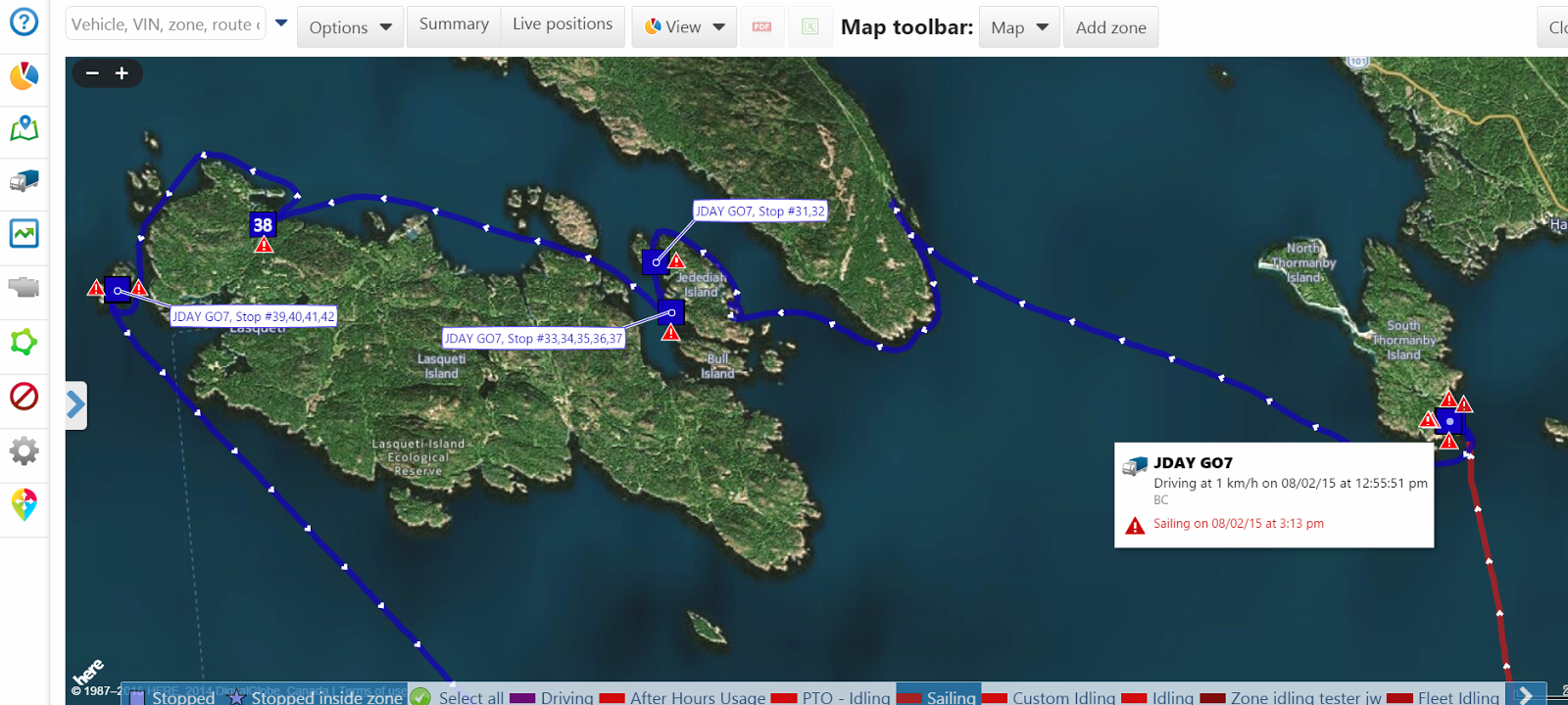
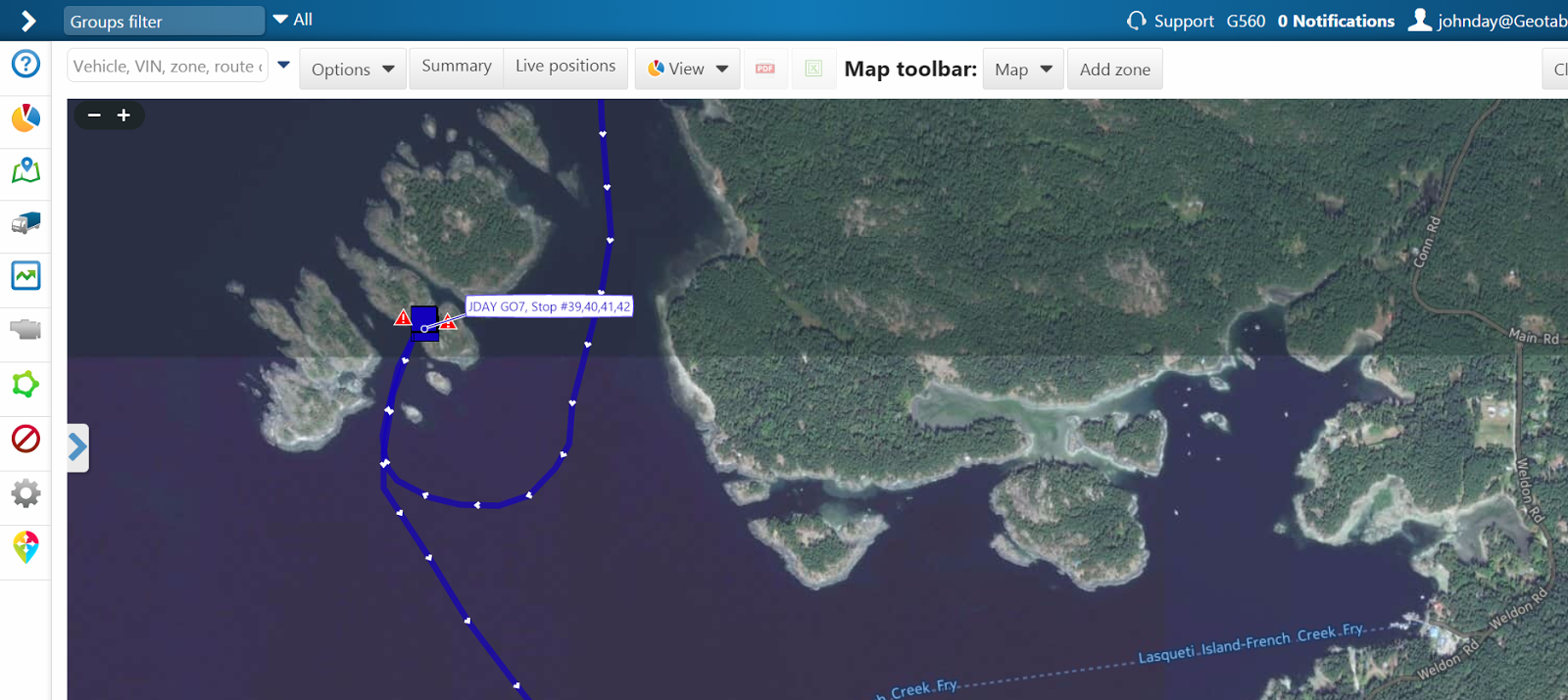
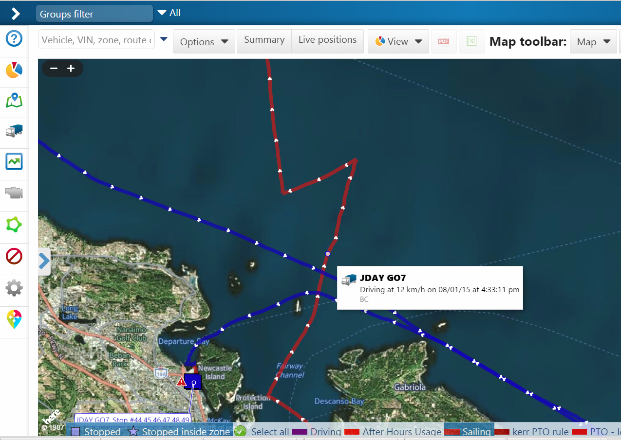
Anchoring woes. Or rather, lifting the anchor woes...
If you liked this post, let us know!
Disclaimer
Geotab's blog posts are intended to provide information and encourage discussion on topics of interest to the telematics community at large. Geotab is not providing technical, professional or legal advice through these blog posts. While every effort has been made to ensure the information in this blog post is timely and accurate, errors and omissions may occur, and the information presented here may become out-of-date with the passage of time.
Get industry tips and insights
Sign up for monthly news and tips from our award-winning fleet management blog. You can unsubscribe at any time.
Republish this article for free
Other posts you might like

How to build a fleet safety program – A step-by-step guide
May 3, 2024

Boosting public safety operations through integrated technology solutions
April 26, 2024

A fleet’s guide to multi-stop route planners
April 24, 2024
.jpg)
Working Together to Raise Distracted Driving Awareness: Driving Safely in a Connected World
April 23, 2024

