What’s new in MyGeotab — Version 9.0
Welcome to our latest summary of updates in MyGeotab.
Apr 27, 2023

Geotab users: To verify your version, go to MyGeotab > Administration > About, and check the build number, (e.g. 9.0.0-release).
Partners: Review this post for important changes affecting your Customers and note any recommendations.
Early feature access
If you would like to test out new features before they are widely available, you can register a database on the preview servers to gain early access.
If you would like to submit feedback regarding new features, you can do so at any time via the Community or your Partner.
Sign up for Geotab news
Stay up to date on what’s new and subscribe to the Geotab newsletter to get these update posts emailed to you.
What’s new in Geotab Drive
Refer to 9.0 — What’s New in Geotab Drive for information on new ELD/HOS features for this release.
✱ NOTE: The images shown here are for illustration purposes only, and may appear different in the software as we approach the final release.
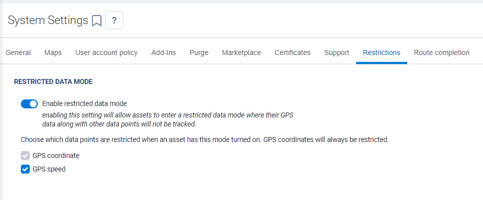
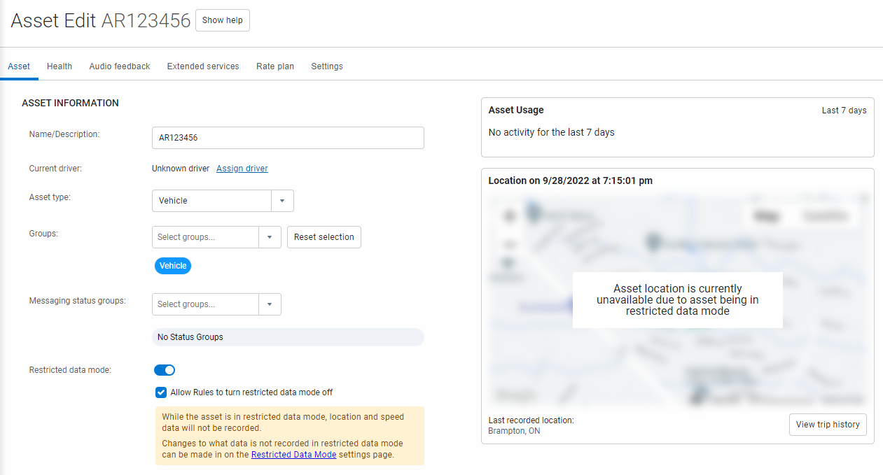
Restricted Data Mode
Restricted Data Mode (Feature Preview)
Geotab has been working hard on improving the functionality of Personal Mode, and is happy to announce the next iteration of this feature, now known as Restricted Data Mode!
Restricted Data Mode allows drivers and fleet managers to temporarily forego recording GPS coordinates and/or GPS speed on their vehicles. When Restricted Data Mode is enabled, location features in MyGeotab that use GPS such as position, trips, speed profiles, and GPS based exceptions, are not available. The key difference between the Personal Mode and the new Restricted Data Mode is that the GPS record is not stored in the database during that time period.
Features that do not use GPS and other restricted data points will continue to be available without any interruptions and displayed as normal. Since GPS data is not accessible in Restricted Data Mode, other features such as reports or Add-Ins will function differently when Restricted Data Mode is enabled.
Restricted Data Mode is intended for Customer use cases such as:
- Leasing companies, where the leasing company does not need to see where the vehicles are, but requires maintenance data to automate vehicle maintenance. For example, data can be shared with the Customer database, where full access to GPS data is maintained.
- Employee perks, where drivers are allowed to drive company vehicles outside of work hours for personal use and do not require vehicle tracking during these hours.
- Contractor vehicle use, where contractors drive their personal vehicle for business use and require vehicle tracking for business use but not personal use.
- Law enforcement, where some operations may require location-based services to be disabled.
Stay tuned for a dedicated announcement about Restricted Data Mode, along with a new user guide!
✱ NOTE: Restricting GPS speed will affect safety and other rules that use GPS speed to not create events (for example, collision detection, harsh braking, harsh cornering, speeding, and so on). Additionally, reporting that makes use of GPS speed will also not function. For these reasons, we recommend not restricting GPS speed unless you absolutely need to do so.
Assets
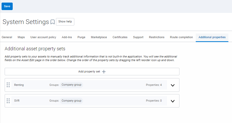
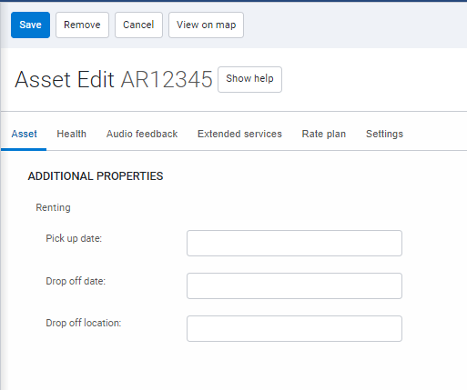
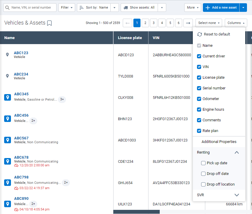
Additional property sets for assets
You can now add additional properties for your assets based on the Group the asset is a part of.
From the menu, navigate to Administration > System … > System Settings, and then select the Additional properties tab to configure additional property sets for your assets.
Following configuration, these additional properties are displayed in the Additional Properties area on the Asset Edit page. These properties can also be displayed on the Vehicles & Assets page by enabling the new columns you would like to see.
✱ NOTE: You can (as always) rearrange the columns on the Vehicles & Assets page as you would like to see them.
Lastly, you can also add these additional properties into a Device excel report by adding a custom header into the datasheet with the format: [CustomProperty].Property. For example, [CustomProperty].Pick up date.
Rules
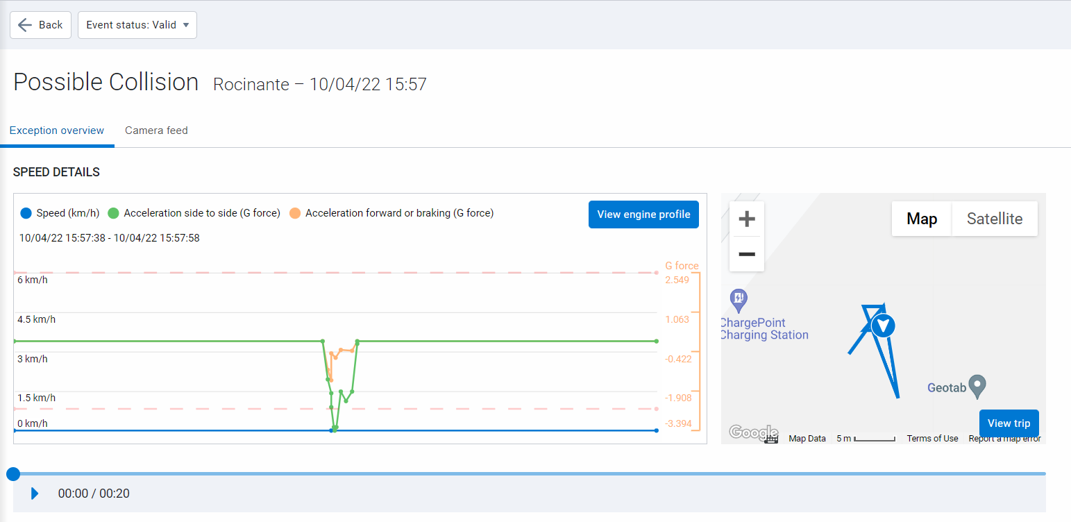
Exception Events page for Possible Collisions (Feature Preview)
By enabling Exception details you can review possible collisions in an improved format that includes the following:
- Relevant data points to be viewed on the graph that include speed, acceleration side-to-side and acceleration forward, or braking.
- A 10-second window before and after the event to have a full overview.
- An adjusted trip history graph showing you the relevant location of the event.
Try it out by clicking on a Possible Collision exception on the Exceptions page.
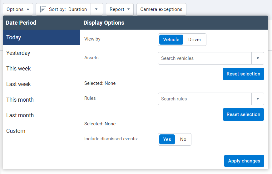
New exception filter
We’ve made it easier for you to either include or exclude dismissed events using the Include dismissed events toggle in the Options menu under Exceptions.
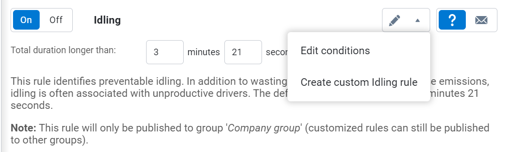
Stock Idling rule conditions can now be modified
The Idling stock rule’s conditions can now be modified to suit your needs. Select Edit conditions to modify the conditions of the rule to suit your definition of idling. You can raise or lower the default value, or incorporate power take-off (PTO) usage into the rule. For example, you can specify if an asset has PTO engaged while the ignition is on, the idling rule will not trigger, but if the PTO is not engaged and ignition is on over the default time value, MyGeotab will log an idling exception.
Reports
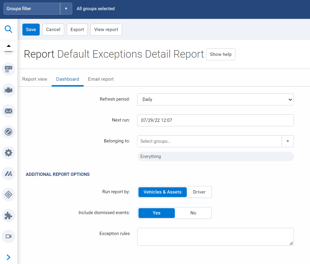
Option to exclude or include dismissed events
The Exceptions Detail, Exceptions Summary, and Risk Management reports have now the option to include or exclude dismissed events using the Include dismissed events toggle.
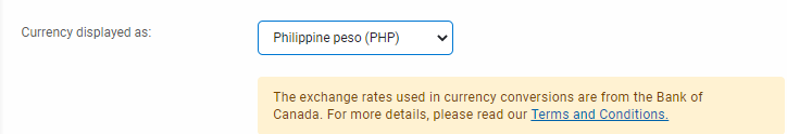
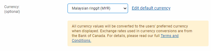
Malaysia ringgit (MYR) and Philippine peso (PHP) currencies available in MyGeotab
As a result of expanding our coverage of Customers around the world, we’ve added the Malaysia ringgit (MYR) and Philippine peso (PHP) currencies to MyGeotab to help with understanding currency costs amongst Customers who span multiple countries. These currencies are available for MyGeotab users on the Options page and the Maintenance Records page.
Map
Latitude/Longitude displayed in Share Asset Location
Street addresses are not always useful or applicable for off-road assets. To improve location sharing, the Share Asset Location feature now displays assets’ last known latitude and longitude when a conventional address is not available to allow users with the shared link to reference its approximate location.
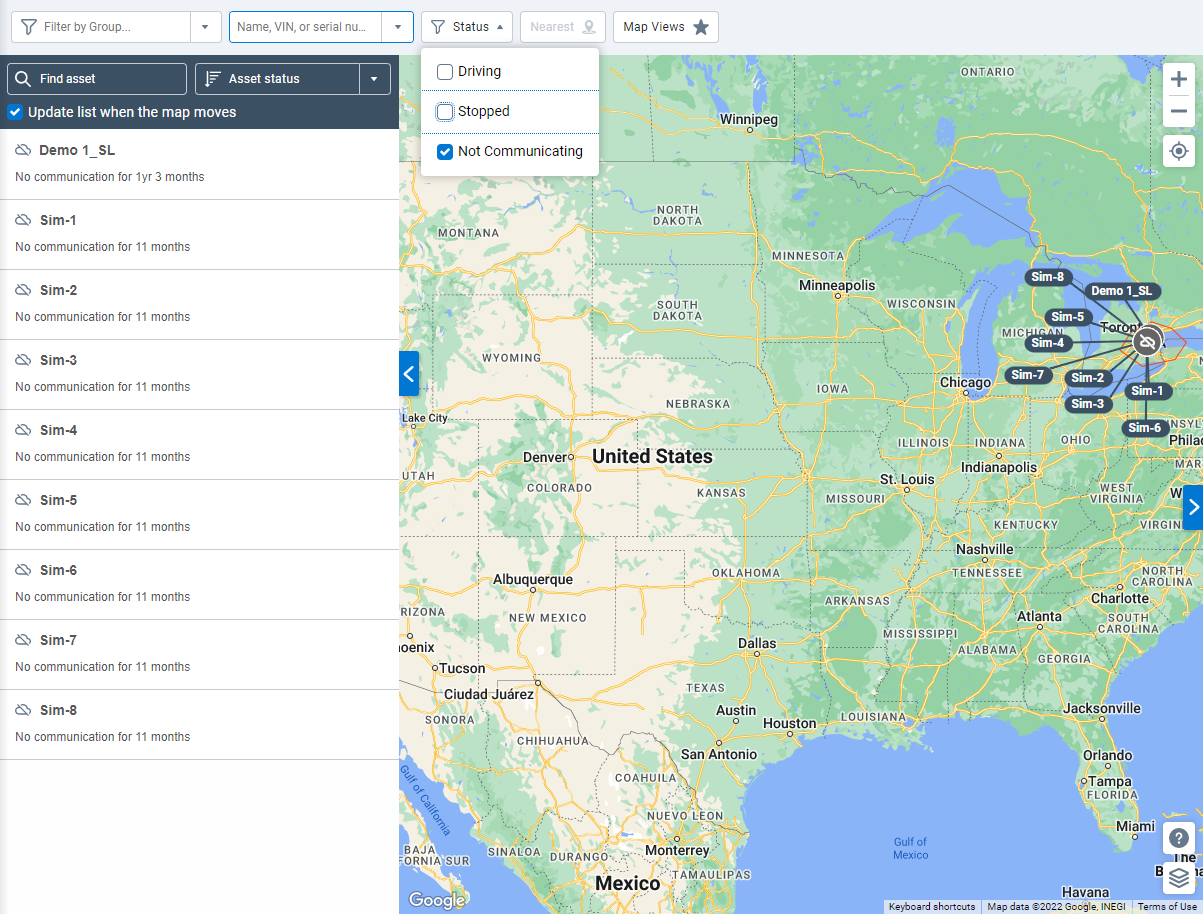
Asset Status filter
We’ve added a new Status filter to quickly filter assets of interest. The filter has three options enabled by default. These options are as follows:
- Driving
- Stopped
- Not Communicating
Only those assets meeting the Status filter criteria are displayed on the Map and asset list for quick reference.
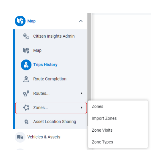
Zones moved under Maps in the navigation menu
To improve ease of navigation, the Zones, Import Zones, Zone Visits, and Zone Types pages are now available under Maps > Zones.
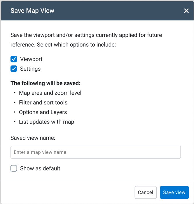
Save map views
You can now save map views for quick access in the future. You can do the following:
- Select the Map viewport checkbox to save the area of the map currently displayed.
- Select the Map settings checkbox to save all related Map settings.
With both options selected, the following details are saved with the map view:
- Group, Assets, and Asset status
- Map Provider, Show routes, and Show Traffic options
- Labels, Zones, and Weather layers
- Update list when map moves and List Sorting options
Saved map views can be uniquely named for easy recall and future access using the Map Views button above the map. Furthermore, saved map views can be edited and deleted when no longer needed.
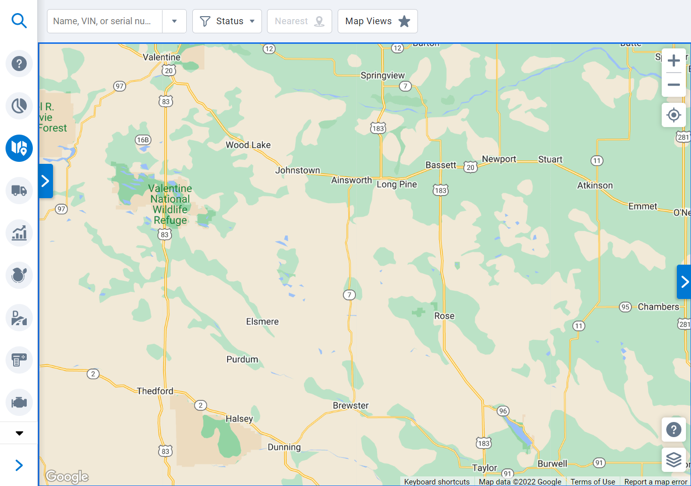
Zoom controls and My Location button relocated on the map
We’ve moved the Zoom controls and My Location buttons to the top-right of the map.
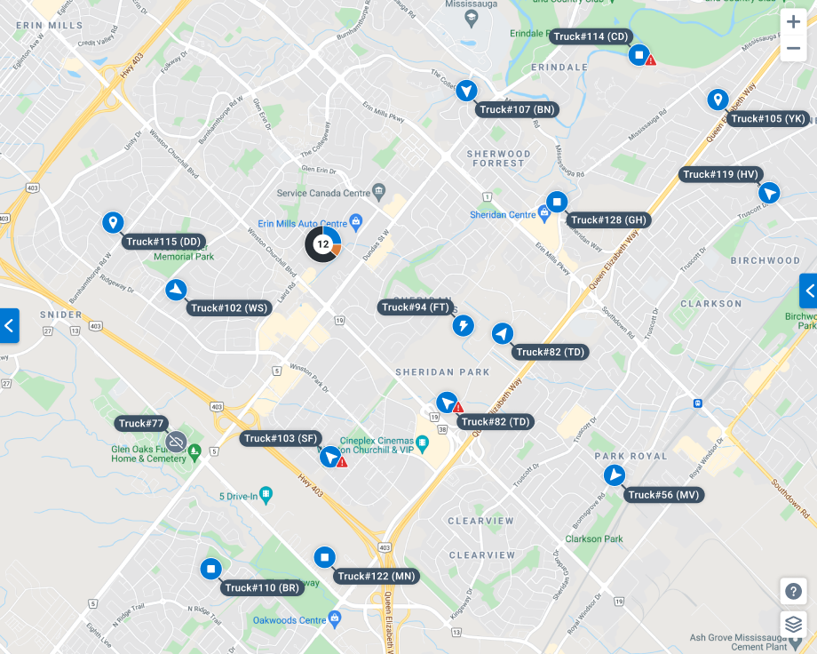
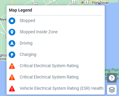
New asset icons on the map
We’ve introduced new vehicle icons to improve readability of the map. New icons include new status icons (for Driving, Stopped, Stopped inside Zone, and Charging statuses), as well as a new Exception icon (for vehicles with active exceptions). The map legend has been revised to include these new icons and their meanings.
If the number of assets in a particular area is too large to be displayed with individual icons at the selected zoom level, they are now clustered together with a new circular icon showing the total number of vehicles present in the area. Hovering over the circular icon provides a breakdown of the number of vehicles in each of the indicated states (Driving, Stopped, Stopped Inside Zone, and Charging).
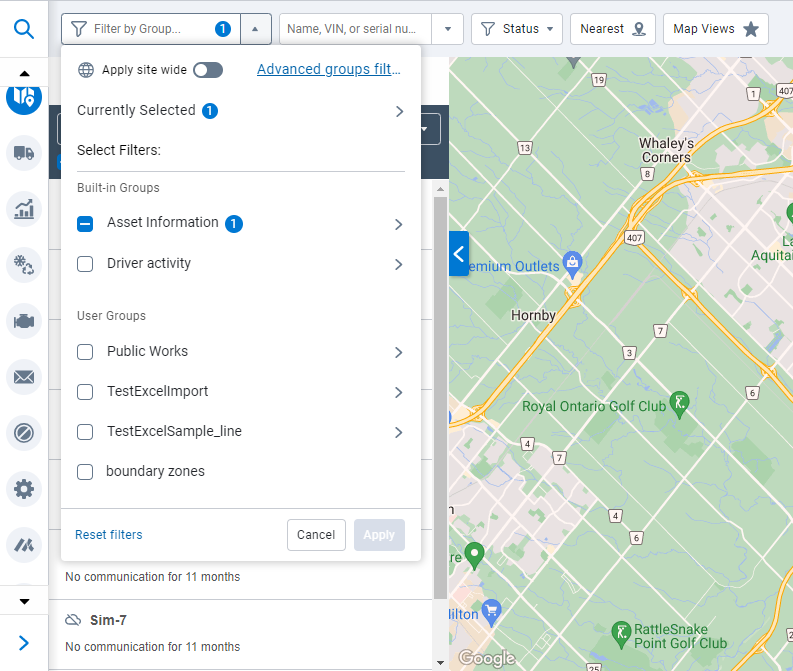
Groups filter enabled in Map (Feature Preview)
With the New Groups Filter enabled in Feature Preview, you can now filter which assets are displayed on the map according to selected Groups. Both Built-in and User groups can be used, with the option to create advanced group filters using AND and OR operations.
Additionally, filtering for particular groups on the map also colors the displayed assets with the color of the group the asset is associated with. For example, you may want to differentiate assets displayed on the map by asset type. You can use the Groups filter to select individual asset type groups, and then you will see your assets displayed on the map with colors associated with their asset type group.
Trips History
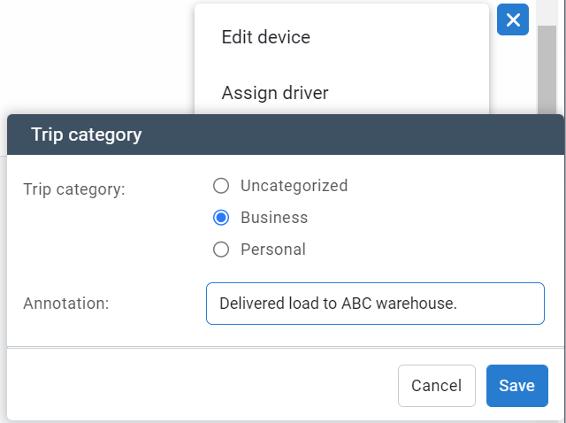
Trip categories on the Trips History page (Feature Preview)
We’ve added new trip categorization columns to the Trips History page so you can quickly filter trips by Business, Personal, or Uncategorized. These categories can be enabled in the Options menu at the top of the page by setting the Trip categories option to Show. All trips are shown by default but can be filtered by selecting the desired category.
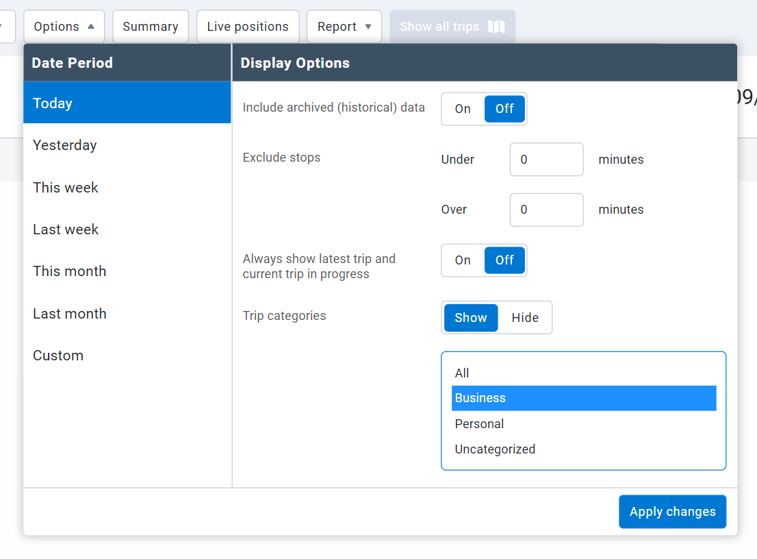
Trips without an assigned driver have no trip categorization information. If a driver is assigned to the asset, the category is displayed along with a hover icon that can be moused over for the annotation text.
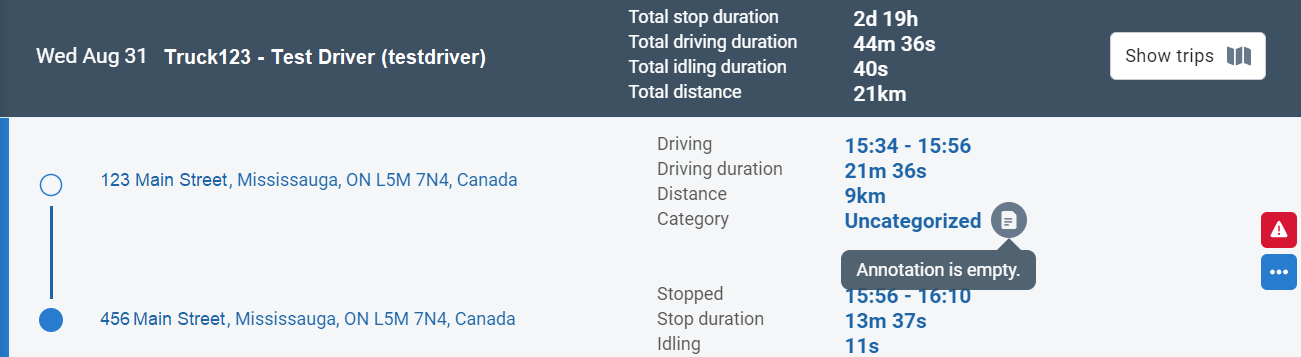
You can edit trip categories and annotations by clicking the blue More Options icon and selecting Change category.
Refer to What’s New in Geotab Drive - Version 6.0 for more information on trip categorization.
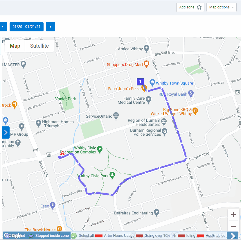
Trip Replay out of Feature Preview
The Trip Replay feature is now out of Feature Preview. You can replay trips for single or multiple vehicles to better understand how the driver’s trip progressed.
To see a Trip Replay, navigate to the Trips History page, select the trips you want to replay, and choose Show replay from the Map options dropdown. While watching the animated trip history, you can click play or pause at any time. You can also change the replay speed and use the timestamp button to jump to a desired section of the trip.
Additionally, new replay speed options of 0.5x, 1x, 3x, and 5x speed have been added.
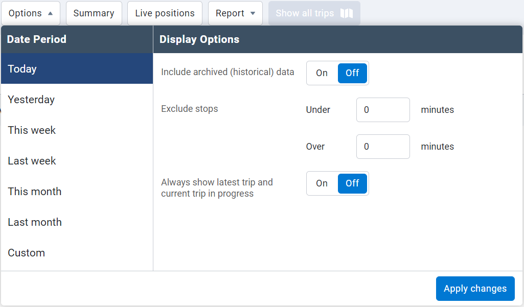
Historical data not displayed by default when viewing trips
When a trip is selected for display from the Map or from an Asset Card, the Include archived (historical) data option is now set to Off by default. This change is meant to reduce potential confusion with trips taken by past vehicles with similar names.
Trip Categorization report
A number of bugs that prevented the Trip Categorization report from successfully generating are fixed. These fixes are added to MyGeotab versions 6.0, 7.0 and 8.0 as well.
Include assets with no distance in Trip Summary report
Asset utilization is an important data point for understanding which assets in your fleet may be over or under utilized. The Trips Summary report now includes assets which have not reported any distance for the specified time frame, allowing you to get a better picture of your least utilized assets.
New exclude “stops under” option
We’ve added a new Exclude stops under filtering option to the Additional Report Options for our Trips History page and Trips Detail reports, so you can exclude stops under a particular threshold. This can be useful when a vehicle makes a lot of short trips, such as within a depot. You can now clear this from your view, and see only the longer trips you are interested in.
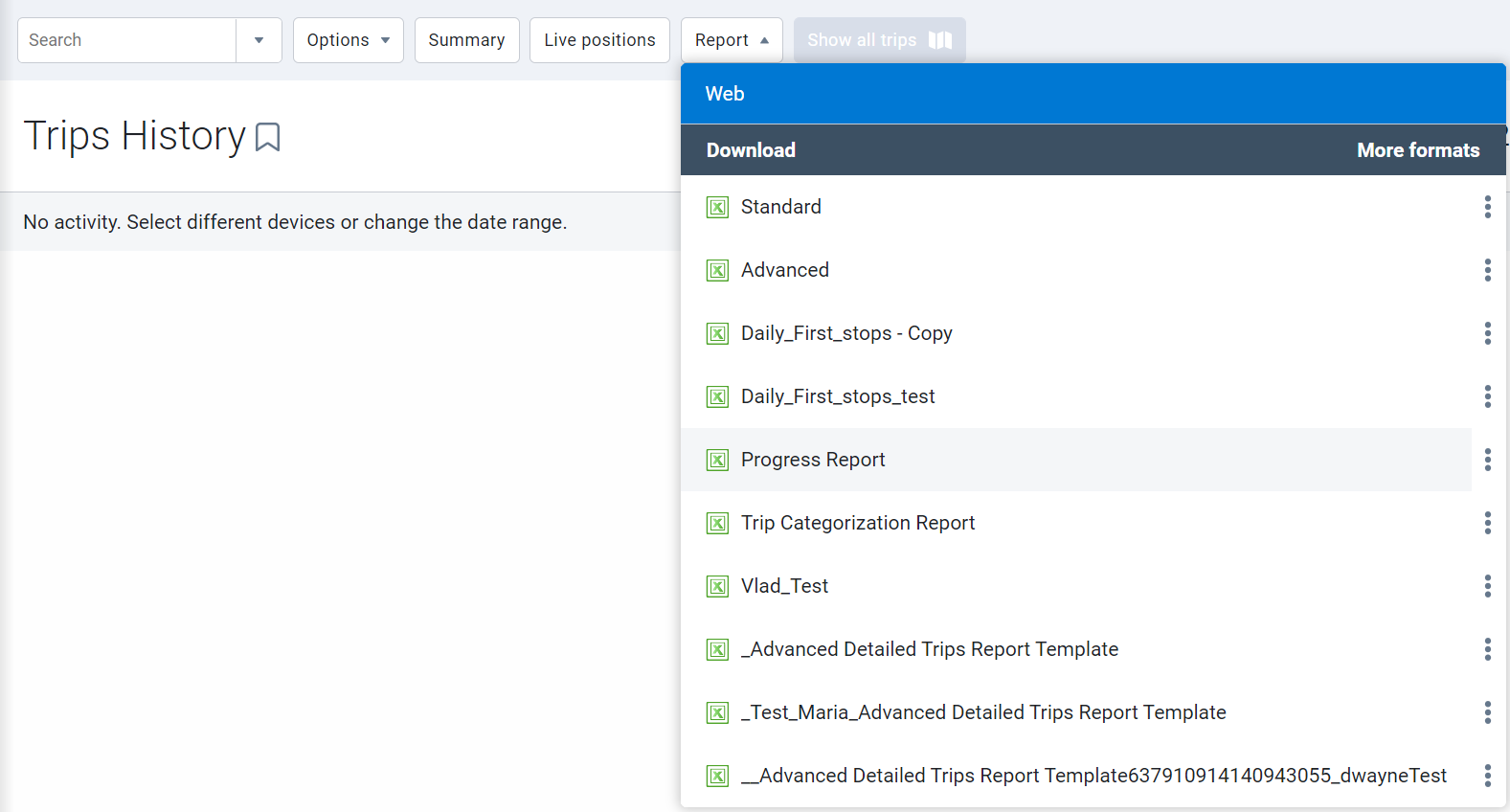
New Progress report
We’ve added a new Progress report to MyGeotab under Map > Trips History > Report. This report is intended to streamline downloading start and stop locations and timestamps for assets with extensive trip histories in the given time period. This helps create meaningful reports that filter unnecessary data points to deliver the data you need.
Engine and Maintenance
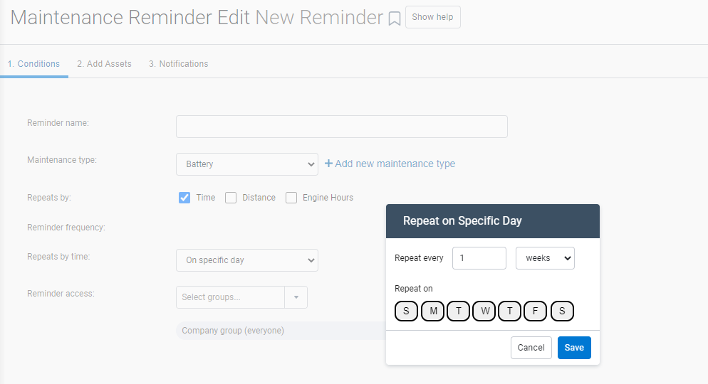
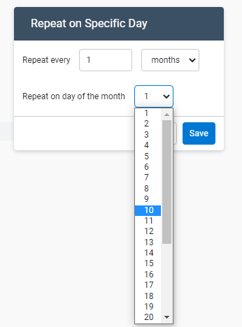
Maintenance Reminder Rule setup – Day of month selection
To further simplify maintenance reminders, you can now set Maintenance Reminder rules to occur on recurring days of the week or month. For example, you can set maintenance reminders for assets in your database to repeat on your preferred day of the week at a custom interval, such as every fourth Monday, or biweekly on Tuesdays.
Pagination support for Maintenance Records page
The Maintenance Records page now supports pagination to benefit Customers with a lot of maintenance records. Records will load faster, and you can review their data with ease by going through the records page by page.
Localization
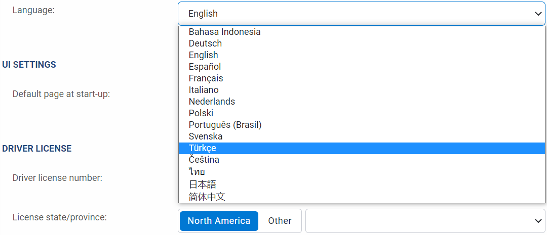
Turkish language support
The MyGeotab user interface (UI) is now available in Turkish. You can modify your UI language using the Language dropdown in the Regional Settings area on the Options page.
Built-in Groups
Support for Internal Combustion Engine fuel types
We’ve added a new built-in group structure that automatically classifies Internal Combustion Engine (ICE) vehicles based on their unique fuel types. MyGeotab now reviews the fuel type signal communicated from the vehicle based on its engine diagnostics (if available), and automatically enters the respective asset into one of these built-in groups: Gasoline, Diesel, Compressed Natural Gas, or Propane/Liquified Petroleum Gas.
In addition to these automatically assigned groups, there are three additional groups that do not have automatic group assignments: Biodiesel, Ethanol, and Other Fuel Type. Vehicles can be manually classified into any of these groups at any time.
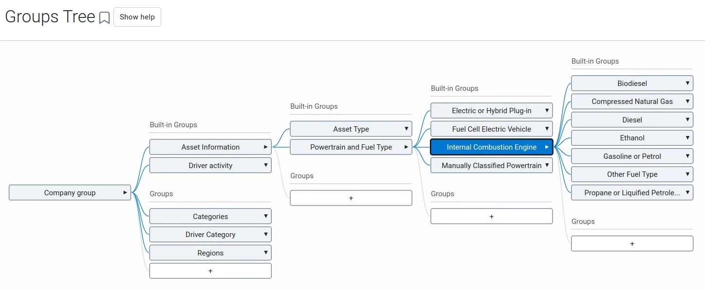
If an asset is manually assigned to any of these groups, that asset will be tagged under the Manually Classified Powertrain group. Once an asset is manually classified, the Manually Classified Powertrain group must be removed in order for the asset to be automatically classified again. If you are removing the Manually Classified Powertrain group to re-enable automatic classification, we recommend removing any existing powertrain or fuel type groups for the asset at the same time.
An asset can be part of multiple groups if it is manually classified. When an asset is automatically classified, however, it may only be part of one built-in group. The exception to this rule is any asset that is classified as a Plug-in Hybrid vehicle, in which case it may be classified as both Plug-in Hybrid Vehicle along with a Gasoline or Diesel classification.
Please note that the added support for ICE fuel types is an extension to the feature Electric Vehicle Powertrain and Fuel Type Groups announced in What’s New in MyGeotab 8.0. All other details regarding automated Electric Vehicle (EV) powertrain assignment remain the same.
MyGeotab/Geotab Drive SDK and Add-in updates
MyGeotab Add-ins
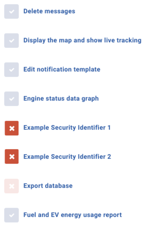
Custom security identifiers for Add-ins
Custom security identifiers for MyGeotab Add-ins are now available. Identifiers can be defined in the configuration.json file of Add-ins, which will then add them to the list of permissions available when editing clearances. These definitions can support multiple languages.
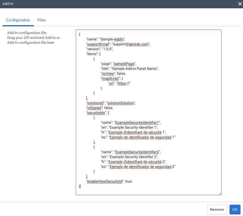
Administrator clearance will remain non-editable and have all custom clearances enabled by default. All other default/system clearance levels only allow editing of custom security identifiers, while keeping the system defined default identifiers non-editable.
✱ NOTE: By default, once the enableViewSecurityId property in the configuration.json for an Add-in is set to True, a View “Add-in name” add-in identifier is created that must be enabled for users to be able to view the Add-in. More granular control needs to be set within the Add-in code for any custom identifiers added to the configuration.json.

SDK
- Added new rate limits for API requests for endpoints that do not require authentication.
- Removed the DatabaseExists API that was originally used for database registration purposes. If the database name exists, CreateDatabase throws a RegistrationException.
- Removed the RouteSearchGroups property and replaced it with the ServiceGroups property.
- Added the optional PropertySelector parameter that is used with the Get and GetFeed methods to include or exclude specific properties for entity types requested. Detailed information can be found here.
- Removed the DriverWhiteListContent object and replaced it with the DriverAuthListContent object.
- Improved system group objects to be returned with an English Name field.
- Added RequestPending as an acceptable value of DeviceShareStatus. This value indicates when an outgoing device share request has been created by a user on the source database, and is waiting for confirmation it has been created successfully.
- Added the ResetPassword security identifier.
- Added the EditStockRules security identifier.
- Added the following security identifiers:
- ManageTachographInspection
- ViewTachographInspection
- ManageTachographCompanyCards
- ViewTachographCompanyCards,
- TachographDownloadAndUploadFiles
- ViewTachographRemoteDownloadData
- ViewTachographDrivingTimeData
- ViewTachographInfringementData
- SendColdChainCommand
- Added the ContinuousConnectClearance security identifier.
- Added the ViewShipments and ManageShipments security identifiers.
MyGeotab Release Notes – Version 9.0
Restricted Data Mode
- Added Restricted Data Mode to the Personal Mode feature, allowing drivers and fleet managers to temporarily skip recording GPS coordinates and/or GPS speed on their vehicles. When enabled, location features that use GPS are not available.
Rules
- Added ability to review possible collisions that describe relevant data points on the graph, a ten-second window before and after the collision event, and an adjusted trip history graph on the Exceptions page.
- Added an Include dismissed events toggle to include or exclude dismissed events on the Exceptions page.
- Updated the Idling stock rule’s conditions to raise or lower the default value, or add power take-off (PTO) usage into the rule.
Reports
- Added the option to include or exclude dismissed events using the Include dismissed events toggle for the Exceptions Detail, Exceptions Summary, and Risk Management reports.
- Added support for Malaysia ringgit (MYR) and Philippine peso (PHP) currencies on the Maintenance Records page.
Map
- Added the Shared Asset Location feature to display assets’ last known latitude and longitude location.
- Added a Status filter to filter assets based on whether they are driving, stopped, or not communicating.
- Moved the Zones, Import Zones, Zone Visits, and Zone Types pages under Maps > Zones.
- Updated the Map Views feature to save related Map settings and added Map view buttons to recall saved Map Views.
- Moved Zoom controls and My Locations buttons to the top-right of the Map.
- The following vehicle icon improvements are made to the Map:
- Updated asset icons for assets that are driving, stopped, stopped inside zones, and charging, and for assets with active exceptions.
- Updated icons displayed on the Map legend.
- Updated the asset cluster icon.
- Hover over circular icons to view a breakdown of the number of assets in each state.
- Added a new Groups Filter to filter which assets display on the Map according to the selected Groups. Assets are displayed with the color of the group the asset is associated with (Feature Preview).
Trips History
- Added Trip categorization columns to the Trips History page. All trips are shown by default and can be filtered by a specific category.
- Removed the Trip Replay feature from Feature Preview and new replay speed options are available.
- Updated the Include archived (historical) data display option to be set to Off by default.
- Improved a number of errors that prevented the Trip Categorization report from successfully generating. These are also added to versions 6.0 and 7.0.
- Improved the Trips Summary report to include assets that have not reported any distance for a specified time frame.
- Added Exclude stops under filter to exclude stops under a particular threshold. Clear this from your view to see longer trips only.
- Added a new Progress report under Map > Trip History > Report to help download Start/Stop locations with timestamps.
Engine and Maintenance
- Added the ability for Maintenance Reminder Rules to select specific days of the week or day of the month, as well as how many weeks or months this rule should reoccur on.
- Updated the Maintenance Records to support pagination for Customers with a lot of maintenance records.
Localization
- Added the Turkish language option to the Fleet Management Application user interface.
Built-in Groups
- Added built-in group structure to classify Internal Combustion Engine (ICE) vehicles based on the fuel types.
Fleet Management Application SDK and Add-ins
- Added custom security identifiers for Fleet Management Application Add-ins.
- Added a new rate limit for API requests for endpoints that do not require authentication.
- Removed the DatabaseExists parameter that was originally used for database registration purposes. If the database name exists, CreateDatabase throws a RegistrationException.
- Removed the RouteSearchGroups property and replaced it with the ServiceGroups property.
- Added the optional PropertySelector parameter that is used with the Get and GetFeed methods to include or exclude specific properties for entity types requested.
- Removed the DriverWhiteListContent object and replaced it with the DriverAuthListContent object.
- Improved system group objects to be returned with an English Name field.
- Added RequestPending as an acceptable value of DeviceShareStatus. This value indicates when an outgoing device share request has been created by a user on the source database, and is waiting for confirmation it has been created successfully.
- Added the IncludeDismissedEvents property. When enabled, this includes dismissed exception events.
- Added the ResetPassword security identifier.
- Added the EditStockRules clearance.
- Added the following clearances:
- ManageTachographInspection
- ViewTachographInspection
- ManageTachographCompanyCards
- ViewTachographCompanyCards,
- TachographDownloadAndUploadFiles
- ViewTachographRemoteDownloadData
- ViewTachographDrivingTimeData
- ViewTachographInfringementData
- SendColdChainCommand
- Added the ContinuousConnectClearance security identifier.
- Added the ViewShipments and ManageShipments security identifiers.
Subscribe to get industry tips and insights
The MyGeotab and Technical Writing Teams write about MyGeotab updates for Geotab.