Advancing the use of technology in telematics
Learn how telematics is evolving and how it will continue to change in the future. Neil Cawse discusses the influence of technology in telematics.

By Neil Cawse
Founder and CEO
Jun 25, 2015

Note: This article is available in Spanish and German.
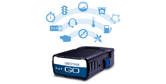
Your company is using MyGeotab and Geotab GO7 to manage your fleet, improve productivity, safety, and integrate that data into your internal applications. It’s interesting, though, to reflect on how telematics has changed because of technology’s influence and how it will continue to change in the future.
Telematics of the Past
If we wind back the clock to look at how fleet management worked 10 years ago, we see a simple product with a GPS and position recorder. That device had to have an external antenna because the GPS’s of the day required direct view of the sky. This external antenna was an obvious failure point. It had a connector, a long wire, was subject to interference, and was often a cause of having installers return to vehicles. Back then nobody was connecting into the vehicle’s OBD port. This meant that special wiring had to be done to power the tracking device – another source of failure. Any time a wire was cut or a connection made, that wire could break down. There was also no engine data and there was no way to know whether the driver was wearing his seatbelt. The vehicle’s fuel consumption was unknown and any engine fault lights and statuses were unavailable to the system.
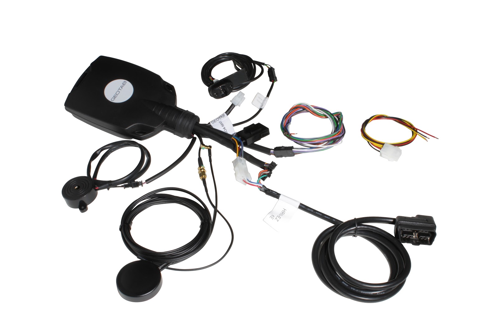
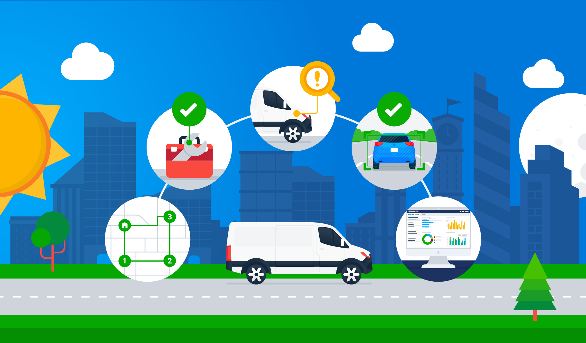
The old devices had very limited expansion capabilities. They had dedicated I/O wires and maybe a serial port. Today on the other hand, we have IOX expansion – there are more than 30 different IOX’s that can be plugged into the Geotab GO7. The variety of add-ons turns a tracking device into a very specialized data gathering computer. For example, a module that connects to the Iridium satellite network so that the device will work anywhere in the world, can be added at the same time as a driver ID add-on, Mobileye integration, and possibly a unit that measures reefer temperature.
These old devices also did not have an accelerometer. The accelerometer is a very sensitive micro machine (MEMS) that measures when you accelerate or brake too hard. It can reconstruct what happened in an accident.
In the old days, software and databases had to be installed in your own IT infrastructure. You had to have an expert on staff to manage the systems and install the end user software. Today, we are all cloud-based through the web.
There were initially no API’s for MyGeotab. Today, the data is completely open. Through the SDK, hundreds of partners are integrating data from MyGeotab into other systems like maintenance, invoicing, route planning, risk management and safety systems. There is a whole ecosystem of partners that are value adding to the Geotab solutions, in order to help customers solve business problems that are very specific to their industry and could never be solved before.
It’s clear that new technology has brought incredible improvements to fleet management:
- Reliability (no more cutting wires, mounting antennas and unreliable installs)
- Simplicity (installs in the OBD port, Web-based services, emailed reports, server rules and driver feedback)
- New Engine Info (valuable measurements that come directly from the vehicle like seatbelt, odo, fuel consumption and fault codes)
- Expansion (new IOX’s that address virtually every use case, from weight scales to temperature monitors to driver identification)
- API’s and Integration (automating data and connecting customers’ systems to solve new tricky business problems)
It’s amazing how technology has already changed fleet management and it is certain that new ongoing technology improvements will continue to add value to how customers measure and manage their fleets.
The future of telematics holds lots of exciting opportunities, including:
- Big Data
- Customer benchmarking
- Connected Vehicle
Geotab is your partner at the FOREFRONT of changing fleet management.
To learn more, please comment in the box below, or let us know what you think on social media by tagging us @GEOTAB.
Subscribe to get industry tips and insights
Founder and CEO
Neil Cawse is the Founder and CEO of Geotab, a global leader in connected vehicle and asset solutions, data intelligence and AI.
Table of Contents
Subscribe to get industry tips and insights
Related posts
Beyond consumer apps: 5 ways integrated navigation protects your fleet
July 23, 2026
6 minute read

From video archives to active prevention: The case for AI dash cams
July 22, 2026
4 minute read
Closing blind spots in cargo security with a 360 fleet camera system
July 22, 2026
3 minute read
The safest mile in field service is the one nobody drives
July 22, 2026
2 minute read

Crafting a fleet incident management plan that helps your municipality get ahead of claims
July 16, 2026
5 minute read