Your tour of the Geotab Data Science Package for fleets
Geotab's AVP of Data Engineering describes how the new Data Science Package for fleets provides instant access to all your big data sets.
By Geotab Team
Oct 15, 2019
Updated: Aug 21, 2024

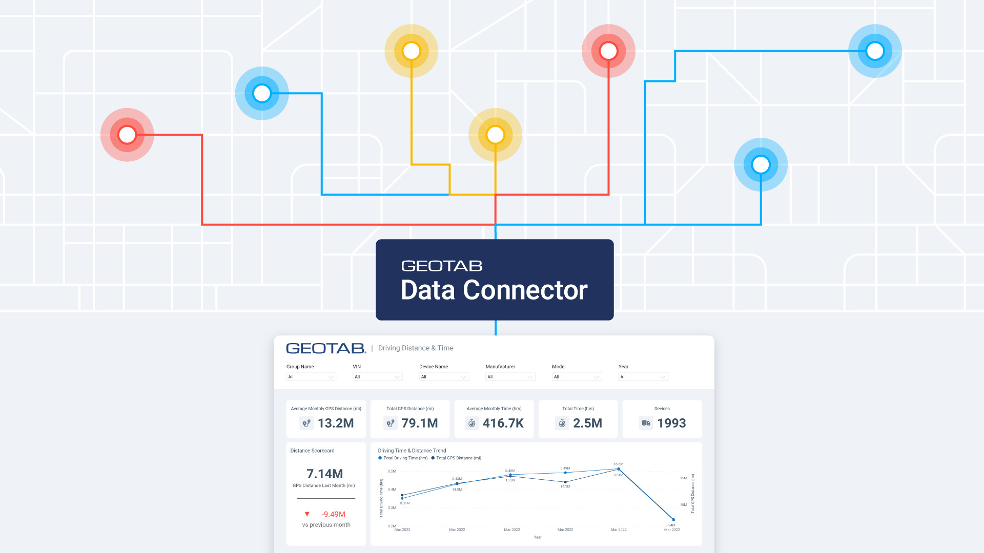
Looking for ways to make data analysis easier? Introducing the Geotab Data Science Package — a turnkey, ready-to-use software that allows you to access your data from a single platform. With the Data Science Package, you have access to all your datasets from an organized data pool.
Draw insights from your fleet data, and also bring in data from other areas of business, such as point of sales data, store locations or planned routes, to name a few.
In this video, Dan Dodgson, Associate Vice President, Data Engineering at Geotab gives you a quick tour and overview of the Data Science Package for fleets.
Related:
Geotab Data Bootcamp recap 2019
Subscribe to get industry tips and insights
Geotab Team
The Geotab Team write about company news.
Table of Contents
Subscribe to get industry tips and insights
Related posts

Small Steps, Big Impact: The Transformative Power of AI in Field Service
June 11, 2025
2 minute read

.jpg)
Harnessing AI to Drive Innovation, Responsibility, and Human Potential at Scale
May 23, 2025
2 minute read

Dash cams that protect driver privacy without missing key events
April 24, 2025
4 minute read
Smarter government fleet management with Geotab Data Connector
April 22, 2025
2 minute read

What is government fleet management software and how is it used?
April 10, 2025
3 minute read