Fleet management in the Outback
Managing fleets in the Australian Outback requires businesses to withstand a harsh climate, poor connectivity and other hazards.
By Geotab Team
Dec 3, 2021

Fleets in regional and remote Australia face some of the toughest conditions in the world. Despite this, the lure of rich mineral deposits in the Australian Outback make the mining and oil & gas sectors some of Geotab’s largest Customers in the country. To ensure worker safety and productivity, these fleets need a robust telematics platform to support their work.
See also:
• How to manage fuel consumption
• Driver ID in the connected fleet
• Managing fleet costs and finding savings with telematics (AU)
Australia’s size and scale
For international audiences, the sheer size and scale of Australia can be difficult to fully appreciate. As the world’s largest island, and a continental landmass of its own, the country covers more area then the contiguous United States.
As the driest inhabited continent, excluding Antarctica, the population is almost entirely coastal. This means that inland population centres are small and few and far between. This puts workers out of range of support services, and adds layers of complexity to fleet management.
Mining, and oil & gas industries in Australia
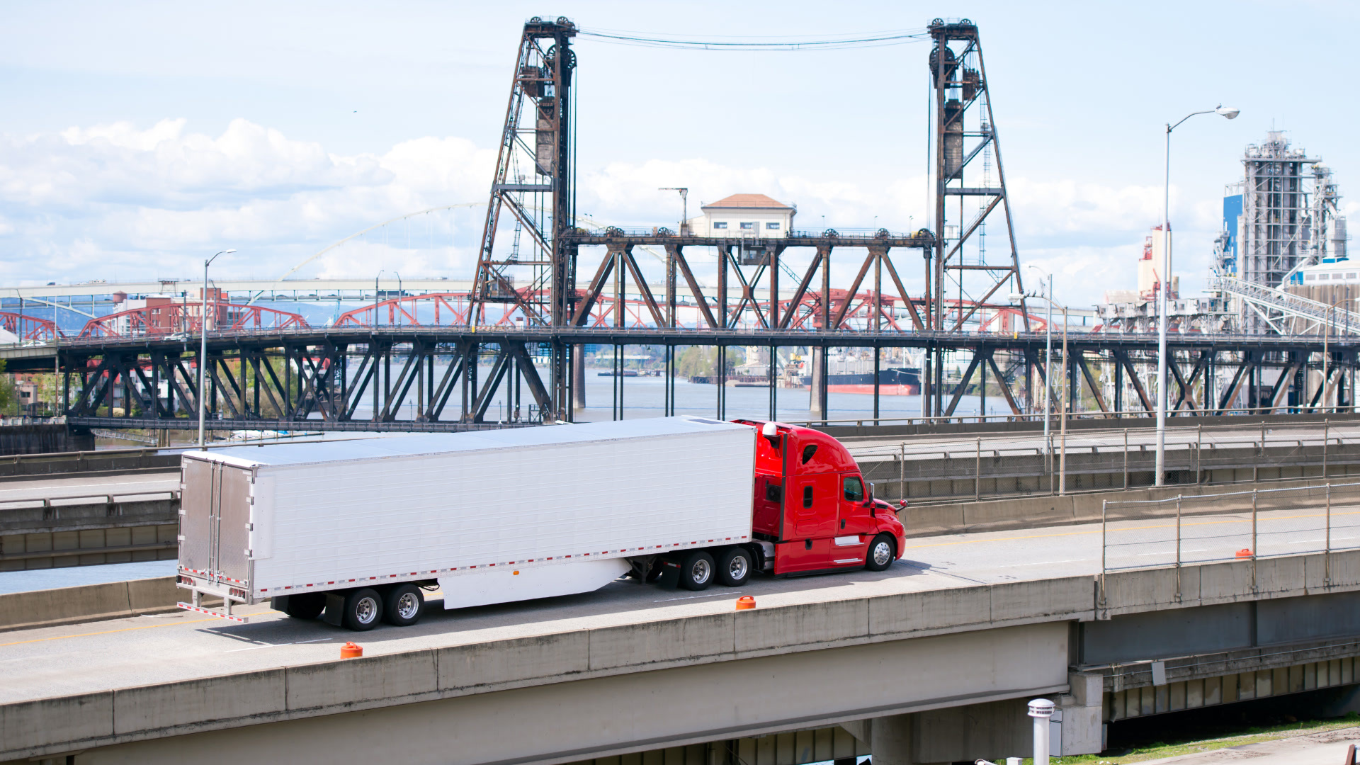
The resource sector accounts for 60% of Australia’s exports. Iron ore alone is worth as much as AU$74bn to the national GDP. Getting these minerals out of the ground in central Australia, to its export markets, requires personnel to cover great distances in exploration of deposits, building mine site infrastructure, extraction operations, and then the freight task of transporting ores.
Understanding the challenges for these fleets
For each of these activities in the sector, our Customers face significant difficulties managing their fleets. Most notably, many of these areas are outside cellular coverage, requiring an advanced solution for managing vehicles. This is all in the context of increasing demands for productivity.
Fleet managers or health & safety managers in regional Australia must:
- Manage worker safety in harsh conditions,
- Ensure remote workers are safe, so far from communication range, and
- Coordinate the needs of an often subcontracted workforce.
Harsh conditions
The Australian Outback includes both arid and desert regions. Workers will frequently be operating vehicles in locations that rarely see rainfall, and often reach more than 40°C (104°F) through summer. This creates dry, dusty conditions. The sparsely distributed population also results in more unsealed roads. These combine to put more stress on vehicle maintenance, and increase risk to personnel.
Remote worker safety
Workers in these regions will either be operating alone or in very small teams. They are also necessarily working far from cellular coverage. Should safety incidents occur or in the case of vehicle breakdown, help might be some hours away.
Because Australian WHS regulations state that the vehicle and any site are deemed a workplace — just as any fixed premises would be — the business has a duty of care to manage worker safety, including solutions that immediately notify those responsible in the event of a critical incident.
Subcontracted workers
Changes in the makeup of the workforce mean increasing numbers of subcontractors. As the resources sector moves from exploration, through construction, and then to production, mining work forces cycle through a number of types of workers. The specialization often leads resources organizations to contract out these works; however, they are also required by WHS law to manage safety for all, including contractors, despite the lack of direct employer relationship.
How Geotab supports fleet management in Australia
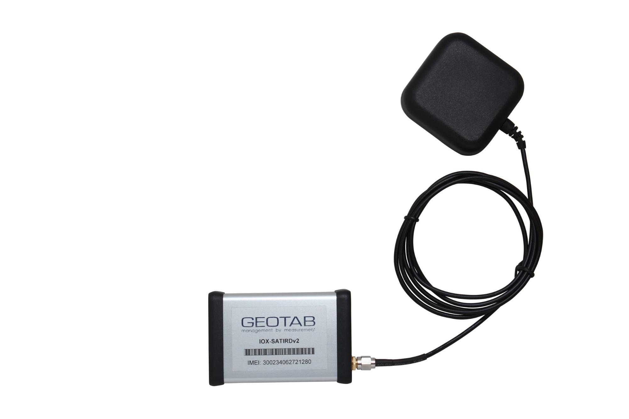
Managing fleets in the complex Australian Outback environment requires a comprehensive service. Geotab’s platform allows fleets to rely on unique expandability to meet these specific needs. First, to overcome the remote connectivity concern, we can offer IOX expansion to an Iridium satellite modem. Vehicles continue to send location information when outside cellular coverage, and upload the complete information when the vehicle returns to cellular networks. This minimizes expensive satellite data transfer, while maintaining complete visibility of fleet movements for safety reporting.
This kind of solution can also be expanded to include in-vehicle duress buttons and external man-down pendants. The former is a push-click emergency button fitted to the vehicle’s dash, and the latter is a device worn by the worker when away from the vehicle. Both of these aid workers experience critical incidents in alerting base at the push of a button, allowing swift support responses, such as informing search and rescue.
By creating zones around worksites, Geotab users can be alerted when workers might be at risk. Reporting worker movements through zones also helps to drive productivity through customized reporting of progress through geographical areas, such as in minerals exploration.
Geotab’s GO device can also register vehicle use information, to ensure the use of seat belts or 4WD functionality, for additional layers of safety compliance. The device can also be expanded to include driver identification, so the organization knows which driver is where, a vital topic when vehicles are pooled for use.
Finally, through Geotab’s solution, fleet managers can analyze their vehicle data to assist in maintenance planning. A broken down vehicle in the remote Outback can be a critical safety incident, as well as a significant loss of productivity.
To find out more about supporting your fleet in complex environments, request a demonstration today.
Subscribe to get industry tips and insights
The Geotab Team write about company news.
Table of Contents
Subscribe to get industry tips and insights
Related posts
Beyond consumer apps: 5 ways integrated navigation protects your fleet
July 23, 2026
6 minute read

From video archives to active prevention: The case for AI dash cams
July 22, 2026
4 minute read

Crafting a fleet incident management plan that helps your municipality get ahead of claims
July 16, 2026
5 minute read

Best small fleet management software providers and how to choose one for your business
July 16, 2026
8 minute read
.jpg)
Marketplace Spotlight: Redefining Fleet Security with Matrix iQ
July 15, 2026
2 minute read