Connected cars detect Mexico earthquake
Data from our telematics devices provide useful and sometimes unexpected information in times of crisis or natural disaster.

By Mike Branch
Vice President, Data and Analytics at Geotab
Apr 18, 2023

Mexico City and surrounding areas underwent a significant earthquake registering 7.1 on the Richter scale on September 19 at around 1:15 PM CT. As hurricanes have swept through the Caribbean and southern U.S. in the last few weeks, this was yet another natural disaster that left a mark on 2017. With more than 25,000 Geotab GO telematics in-vehicle devices in Mexico, we wanted to examine the impact of the historic earthquake to understand if early warning indicators could be used in the form of sensors on wheels to anticipate quakes prior to their arrival.
See also: Are connected car regulations up to date?
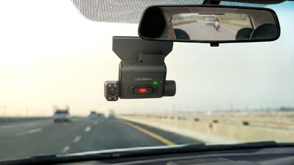
Geotab GO devices are equipped with accelerometers that track acceleration in the X, Y, and Z axes. While these readings are typically used to help fleets meet their safety goals by reducing erratic driving events and in accident reconstruction, they can also be used to monitor the effects of other forces that are acting on the vehicle while the vehicle is parked. In this case, we wanted to see if there was sufficient G-force applied to the vehicle that would result in a trigger on the GO device’s accelerometer.
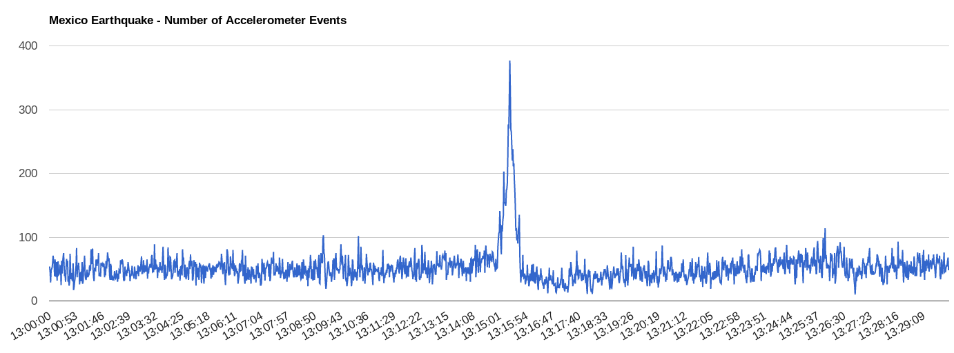
The results from our data analysis were compelling. There was a significant increase in the number of vehicles that reported accelerometer activity at the exact time of the earthquake, however there was not a noticeable distinction in the average G-force amongst vehicles in the Mexico City area during the earthquake.
The chart below illustrates that from 1:15 PM for about 40 seconds there was up to a five-fold increase in the number of vehicles reporting accelerometer activity in Mexico City and surrounding areas (with a peak 21 seconds after 1:15 PM).
Seismometers have been used for years to detect and measure the severity of earthquakes and a significant amount of research and development has been put into these early detection systems. Perhaps someday connected car sensors could be correlated with existing methodologies to enrich what is already being done. Our data science team continues to investigate these signals and compares them with historic trends and earthquakes to learn more about the potential of using this data to enrich early warning systems from connected vehicles on the road.
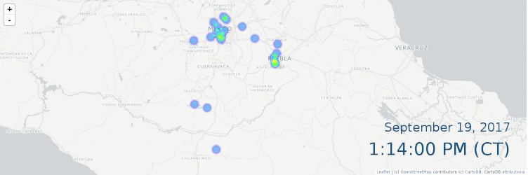
For a more visual representation of the acceleration chart above, Geotab developed a timelapse map that runs from one minute before to one minute after the earthquake hits. Just after 1:15 p.m. Mexico City lights up indicating the increase in the number of accelerometer events in vehicles in the area.
Data from our telematics devices provide useful and sometimes unexpected information in times of crisis or natural disaster.
Analysis of this type of data on the macro scale may provide a tool for smart cities to better understand disaster ramifications and intelligently deploy resources for aid.
Related:
Geotab data shows massive increase in fleet activity as Florida prepares for Hurricane Irma
Geotab data shows impact of Hurricane Harvey on driving and commercial fleet activity
Subscribe to get industry tips and insights
Vice President, Data and Analytics at Geotab
As Geotab’s Vice President of Data and Analytics Mike Branch leads the development for solutions that enable insight from over 5.8 million connected vehicles and 100 billion telematics records that Geotab processes daily.
Subscribe to get industry tips and insights
Related posts
B.C.'s Dashcam Mandate Creates an Opportunity for Safer Roads Across Canada
June 5, 2026
2 minute read
B.C.'s new dash cam law: A six-month clock is about to start for commercial fleets
June 2, 2026
5 minute read
Reefer trailer temperature monitoring: How it works, systems, and fleet benefits
May 26, 2026
4 minute read
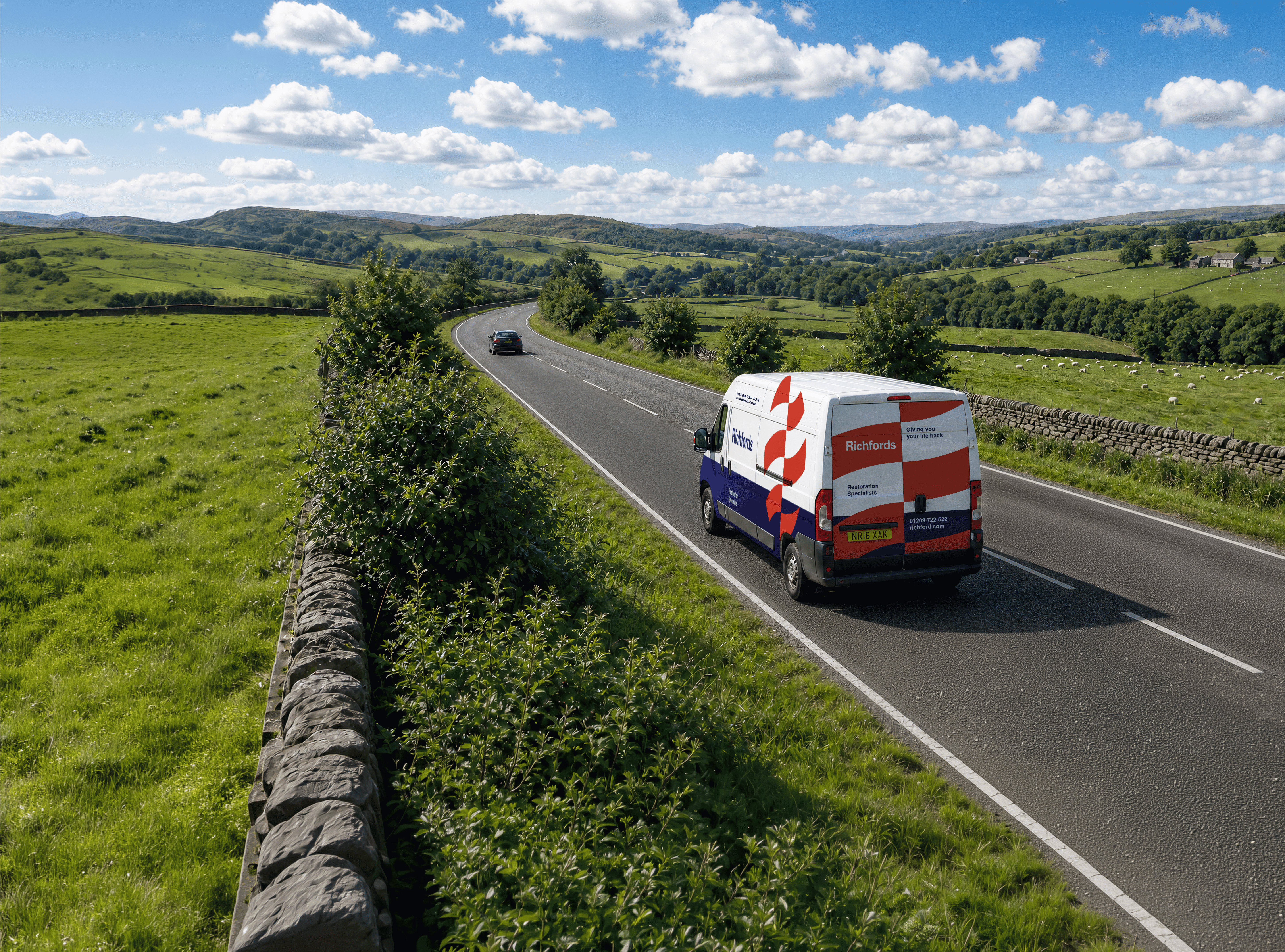
Fleet Safety Results: Richfords Cuts Speeding and Harsh Driving with Geotab Vitality
May 11, 2026
3 minute read